Functional temporarily unavailable
General information about Nazarivka
Village Nazarivka is located on the territory of Donetsk region and is administratively part of Mariupol district of this region. According to the Codifier of Administrative Territorial Units and Territories of Territorial Communities of Ukraine, the settlement Nazarivka has the code UA14140070100093562.
The district center of Mariupol of the district is a city Mariupol. The distance from the district center to the settlement Nazarivka is 42 kilometers in a straight line (the length of the road route may be longer).
A detailed description of Nazarivka, including geographical location, date of foundation, history of the settlement of Nazarivka with main historical events and persons, main sights and interesting places of Nazarivka, not yet available.
Село Назарівка розташоване на території Донецької області та адміністративно входить до складу Маріупольського району цієї області. Згідно з Кодифікатором адміністративно-територіальних одиниць та територій територіальних громад України, населений пункт Назарівка має код UA14140070100093562.
Районним центром Маріупольського району є місто Маріуполь. Відстань від райцентру до населеного пункта Назарівка становить 42 кілометрів по прямій (довжина маршруту автомобільними дорогами може бути більшою).
Детальний опис Назарівки, що включає географічне розташування, дату заснування, історію населеного пункта Назарівка з основними історичними подіями та персонами, основні пам'ятки та цікаві місця Назарівки, поки що відсутній.
Сплануй своє перебування у Nazarivka
What to see and where to go in Nazarivka
Tourist attractions and museums of Nazarivka

"Stone Graves" Reserve
Reserve
The "Stone Graves" Reserve is located near the village of Nazarivka in the Donetsk region. It was founded in 1927 as a special nature reserve and is part of the Ukrainian State Steppe Nature Reserve, which is located on the territory of Donetsk and Zaporizhzhia regions. It is a unique geological, historical and cultural object. The area of the "Stone Graves" Reserve is about 400 hectares.
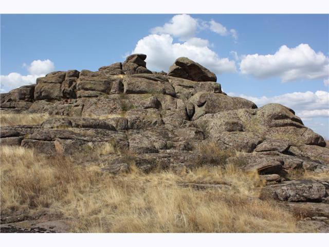
The "Stone Graves" tract is a small mountainous country among the steppes of the Azov region. Volcanic rocks about 2 billion years old formed a series of peaks here, which as a result of weathering turned into many expressive natural sculptures.
The rocky island was a cult place of ancient peoples and gave rise to many interesting legends. The ancient name of the area "Beshtash" is translated from the Turkic "five mountains". Today, these peaks are called Panorama, Vityaz, Hostra, Zhaba and Pivdenna. Their height is 200 and a little meters, in the past they rose up to 3 kilometers.
The picturesque landscapes of the "Stone Graves" Reserve, the combination of steppe and alpine vegetation, and the historical events of these places have inspired many artists and poets.
The Karatysh River – the left tributary of Berda – washes the ridge of rocks on the eastern side. According to Academician Kudryashov's version, during the battle of Kalka, the fortified camp of Prince Mstyslav of Kyiv was located near the Stone Graves (a chapel and a large stone cross were built).
RUSSIAN-UKRAINIAN WAR
During the full-scale military invasion of Ukraine, Russian occupation forces set up camps on the territory of the "Stone Graves" nature reserve, turning it into a military training ground. As a result of Russian military activity in this area, the unique nature reserve was virtually destroyed.
Reviews Nazarivka
Geographical information about Nazarivka
| {{itemKey}} | {{itemValue}} |
|---|---|
| Region |
Donetsk |


