Functional temporarily unavailable
Perevalne
Travel guide online Perevalne
General information about Perevalne
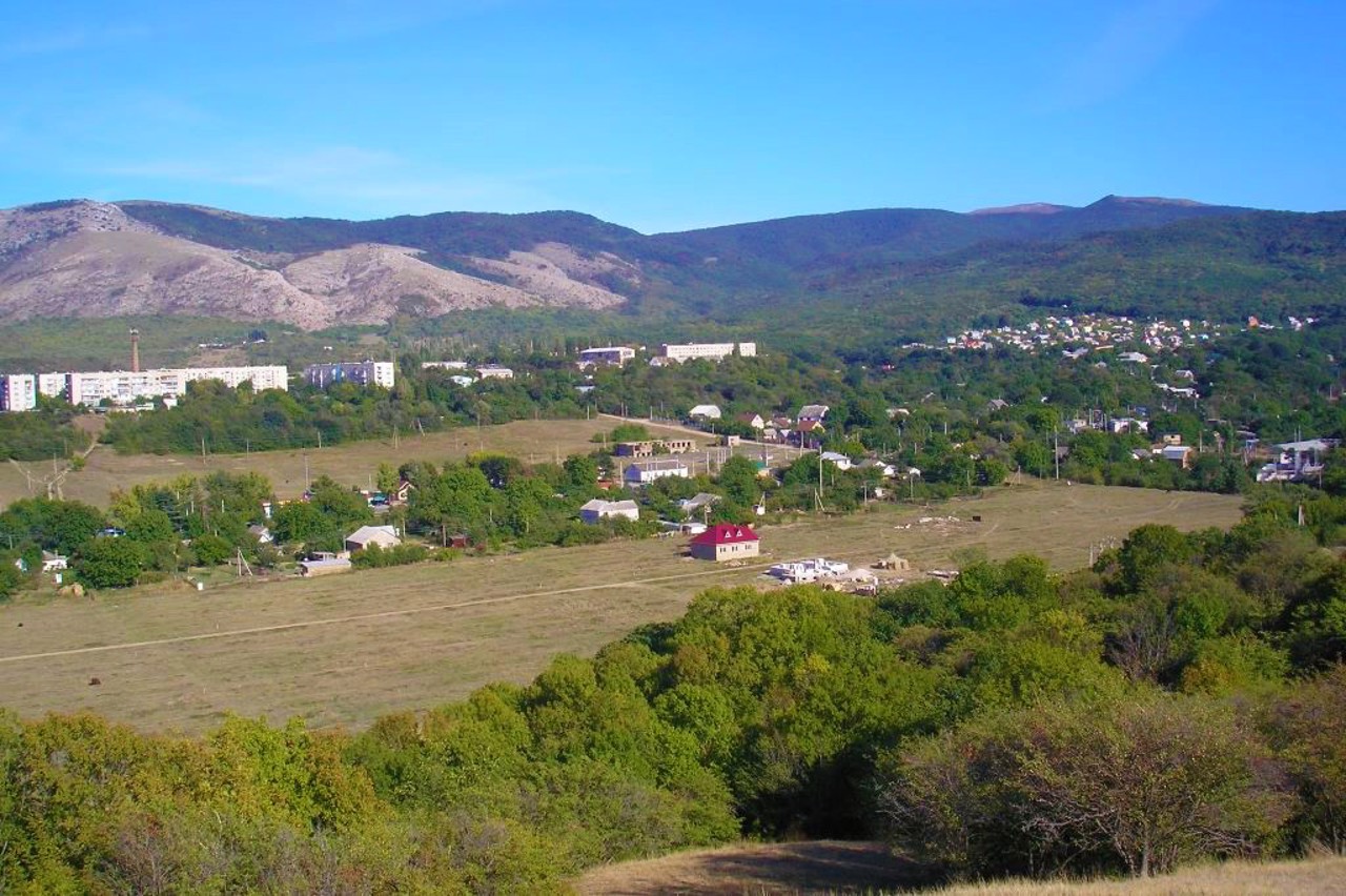
The village Perevalne is located between Simferopol and Alushta near the confluence of the Salgyr and Angara rivers.
The former Tatar village Angara received its name Perevalne in 1948 after the forced deportation of Crimean Tatars by the Soviet occupiers from Crimea to Central Asia.
Not far from Perevalne is the Angarskiy Pass - the highest point of the "Simferopol - Yalta" route (752 meters), a popular starting point for many tourist routes on Chatyr-Dag.
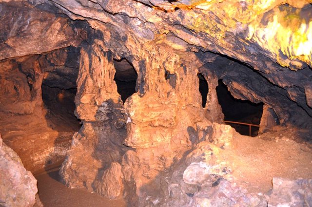
There are several caves nearby, the most famous of which are the "Kyzil-Koba Red Caves".
In winter, the "Angarskiy Pass" ski complex is ...
The village Perevalne is located between Simferopol and Alushta near the confluence of the Salgyr and Angara rivers.
The former Tatar village Angara received its name Perevalne in 1948 after the forced deportation of Crimean Tatars by the Soviet occupiers from Crimea to Central Asia.
Not far from Perevalne is the Angarskiy Pass - the highest point of the "Simferopol - Yalta" route (752 meters), a popular starting point for many tourist routes on Chatyr-Dag.
There are several caves nearby, the most famous of which are the "Kyzil-Koba Red Caves".
In winter, the "Angarskiy Pass" ski complex is open.
Село Перевальне розташоване між Сімферополем і Алуштою біля злиття річки Салгир та річки Ангара.
Назву Перевальне колишнє татарське село Ангара отримало у 1948 році після примусової депортації кримських татар радянськими окупантами з Криму до Середньої Азії.
Неподалік від Перевального знаходиться Ангарський перевал - найвища точка траси "Сімферополь - Ялта" (752 метрів), популярне місце початку багатьох туристичних маршрутів на Чатир-Даг.
Поблизу розташовано декілька печер, найбільш відомими з яких є "Червоні печери Кизил-Коба".
Взимку працює гірськолижний комплекс "Ангарський перевал".
Сплануй своє перебування у Perevalne
What to see and where to go in Perevalne
Tourist attractions and museums of Perevalne

Angarsky Pass
Natural object
Angarsky Pass is the highest point on the M-18 (E-105) "Simferopol - Yalta" route (752 meters).
This is one of the oldest routes for crossing the Crimean Mountains on the way from continental Crimea to the sea. The first road was laid in 1826.
Many tourist routes to Chatyr-Dag start from Angarsky Pass. In winter, the "Angarsky Pass" ski complex operates here.
In 2012, a monument to the Crimean trolleybus was installed on the pass - a unique long-distance transport, the route of which has been passing through the Angarsky Pass since 1959.

Kizil-Koba Cave
Natural object
Kizil-Koba Cave in Crimea (from Crimean Tatar - Red Cave) is one of the largest limestone cave complexes in Europe (17.6 kilometers, 6 levels of labyrinths).
The research was started in 1914. Traces of primitive people were found, an ancient sanctuary. In the 3rd-4th centuries, wine was stored in the cave, and there was a Scythian manor house on the lawn near the entrance.
The underground river Su-Ukhan flows through the bottom of the Kizil-Koba cave, divided by six karst siphons. The vault of the Red Cave is decorated with carbonate drips, stalactites, stalagmites, columns, draperies, and carlites.
Improvement works of the Kizil-Koba cave have been carried out since 1990. Excursion time 1 hour, route length 500 meters. Extreme tours of the underground river are available by prior arrangement.
Reviews Perevalne
Geographical information about Perevalne
| {{itemKey}} | {{itemValue}} |
|---|---|
| Region |
Autonomous Republic of Crimea |


