Functional temporarily unavailable
Zakharivka
Travel guide online Zakharivka
General information about Zakharivka
The village of Zakharivka is located in the upper reaches of the Berezivka River, 25 kilometers north of Oleksandriia. Administratively, it is a part of Velyka Andrusivka hromada of Oleksandriia district of Kirovohrad region.
During the time of the Hetmanship, the Cossack villages of Buhalka and Makrahovo existed at this place, which were first marked on the map of the famous French military engineer Danyil de Bosket in 1775. Later, lieutenant Pavlo Furman became the owner of Makrahovo farm, renaming it Furmanivka, and his son Zakhariy Furman gave the village its modern name.
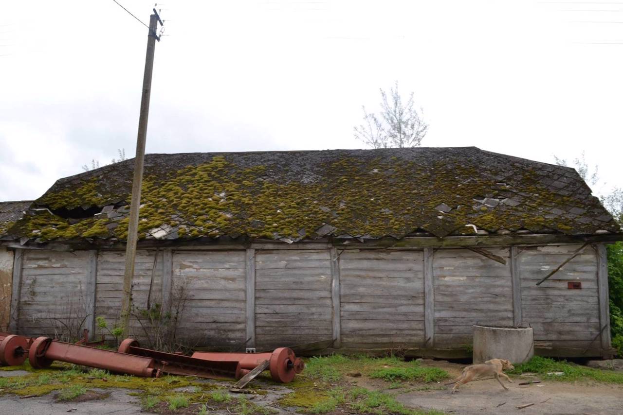
A wooden pantry from 1869 has been preserved, which could be moved from place to place on oak logs.
During the Holodomor, 428 people died in Zakharivka. A monument to the soldiers of the 116t ...
The village of Zakharivka is located in the upper reaches of the Berezivka River, 25 kilometers north of Oleksandriia. Administratively, it is a part of Velyka Andrusivka hromada of Oleksandriia district of Kirovohrad region.
During the time of the Hetmanship, the Cossack villages of Buhalka and Makrahovo existed at this place, which were first marked on the map of the famous French military engineer Danyil de Bosket in 1775. Later, lieutenant Pavlo Furman became the owner of Makrahovo farm, renaming it Furmanivka, and his son Zakhariy Furman gave the village its modern name.
A wooden pantry from 1869 has been preserved, which could be moved from place to place on oak logs.
During the Holodomor, 428 people died in Zakharivka. A monument to the soldiers of the 116th Kharkiv Rifle Division, who died during the liberation of Zakharivka from the German occupiers in 1943, was erected.
On the eve of the creation of the Kremenchuk HPP in the late 1950s, residents of several villages of the Novogeorgiiv district, which were flooded by the waters of the Kremenchuk Reservoir, were relocated to Zakharivka.
Село Захарівка розташоване у верхів'ях річки Березівки за 25 кілометрів на північ від Олександрії. Адміністративно входить до складу Великоандрусівської громади Олександрійського району Кіровоградської області.
За часів Гетьманщини на цьому місці існували козацькі хутори Бугалка і Макрагово, які вперше позначені на карті відомого французького військового інженера Даниїла де Боскета у 1775 році. Згодом власником хутора Макрагово став поручик Павло Фурман, перейменувавши його на Фурманівку, а його син Захарій Фурман дав селу сучасну назву.
Збереглася дерев'яна комора 1869 року, яку можна було переміщати з місця на місце на дубових колодах.
В роки Голодомору в Захарівці загинуло 428 осіб. Встановлено пам'ятник бійцям 116-ї Харківської стрілецької дивізії, які ...
Село Захарівка розташоване у верхів'ях річки Березівки за 25 кілометрів на північ від Олександрії. Адміністративно входить до складу Великоандрусівської громади Олександрійського району Кіровоградської області.
За часів Гетьманщини на цьому місці існували козацькі хутори Бугалка і Макрагово, які вперше позначені на карті відомого французького військового інженера Даниїла де Боскета у 1775 році. Згодом власником хутора Макрагово став поручик Павло Фурман, перейменувавши його на Фурманівку, а його син Захарій Фурман дав селу сучасну назву.
Збереглася дерев'яна комора 1869 року, яку можна було переміщати з місця на місце на дубових колодах.
В роки Голодомору в Захарівці загинуло 428 осіб. Встановлено пам'ятник бійцям 116-ї Харківської стрілецької дивізії, які загинули під час звільнення Захарівки від німецьких окупантів у 1943 році.
Напередодні створення Кременчуцької ГЕС наприкінці 1950-х років до Захарівки були переселені мешканці кількох сіл Новогеоргіївського району, які були затоплені водами Кременчуцького водосховища.
Сплануй своє перебування у Zakharivka
What to see and where to go in Zakharivka
Tourist attractions and museums of Zakharivka

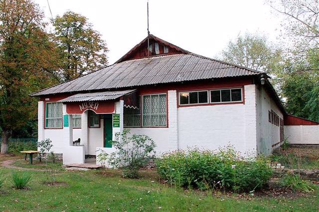
Zakharivka History Museum
Museum / gallery
The History Museum in Zakharivka is considered one of the largest rural museums in the Kirovohrad Region - its holdings include more than 13,000 objects from the main holding alone. The exhibition is housed in 15 rooms of the former kindergarten.
The basis of the museum's collection is the materials about the 116th Kharkiv Rifle Division, which liberated Zakharivka from the German occupiers in 1943. Searchers managed to establish the names of about a hundred fallen heroes buried in a mass grave on the territory of the village. Fragments of weapons and military equipment are presented.
The ethnographic section exhibits things preserved by the inhabitants of the villages of the Novoheorhiyvka district, which were flooded in the 1960s by the waters of the Kremenchuk Reservoir during the construction of the Kremenchuk HPP. Among them are furniture, household items, work tools, photos, toys, postcards. A collection of embroidered fabrics and antique towels is presented, including a wedding towel embroidered in 1813.
Impressive collections of ancient musical instruments, as well as hand, pocket and wall clocks, which are presented about 1.5 thousand copies.
Reviews Zakharivka
Geographical information about Zakharivka
| {{itemKey}} | {{itemValue}} |
|---|---|
| Region |
Kirovohrad |


