Functional temporarily unavailable
Kamyanets
Travel guide online Kamyanets
General information about Kamyanets
The town Kamyanets on the rocky banks of the Kamianka River is located 35 kilometers southeast of Kropyvnytskyi, on the road to Kryvyi Rih. It is administratively part of the Kropyvnytskyi district.
The historical chronology of the village begins in 1770, when the Kutsivka hamlet, founded by Cossack colonels Panas Kutsyi, was located on this site. In 1821, Kutsivka became a military settlement, the Novhorod cuirassier regiment was quartered here, the village was renamed Novhorodka in his honor. In 1860, Novhorodka received the status of a small town and became th ...
The town Kamyanets on the rocky banks of the Kamianka River is located 35 kilometers southeast of Kropyvnytskyi, on the road to Kryvyi Rih. It is administratively part of the Kropyvnytskyi district.
The historical chronology of the village begins in 1770, when the Kutsivka hamlet, founded by Cossack colonels Panas Kutsyi, was located on this site. In 1821, Kutsivka became a military settlement, the Novhorod cuirassier regiment was quartered here, the village was renamed Novhorodka in his honor. In 1860, Novhorodka received the status of a small town and became the parish center of the Oleksandriya District of the Kherson Province. In 2024, in accordance with the requirements of the law of Ukraine "On condemnation and prohibition of propaganda of Russian imperial policy in Ukraine and decolonization of toponymy", the town was renamed Kamyanets.
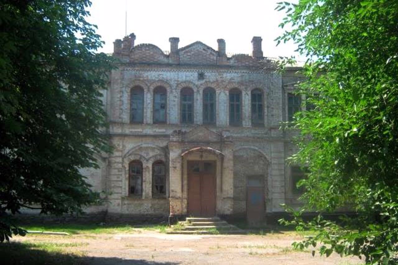
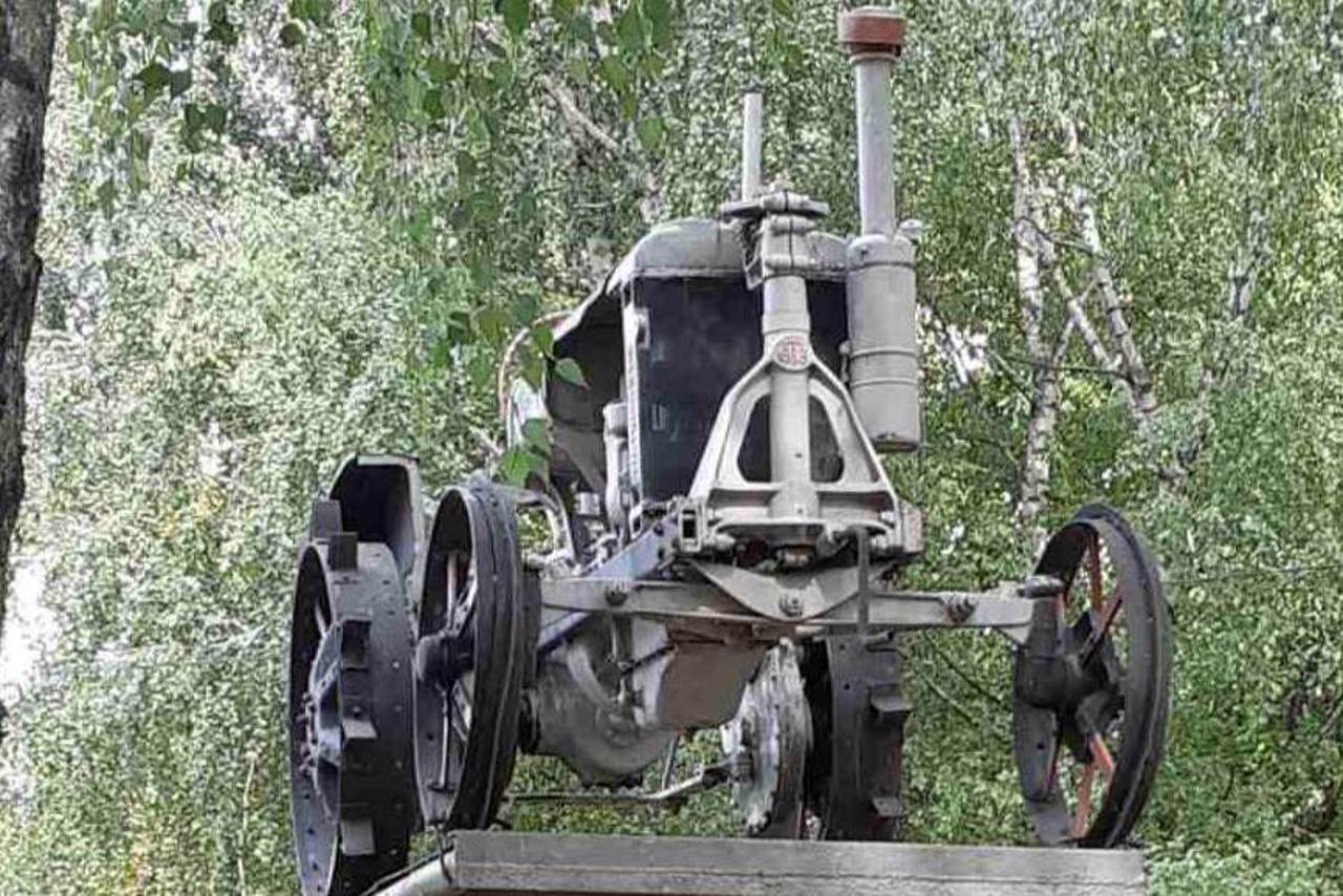
Of the architectural monuments of the past, only the half-ruined building of the two-class school, built in 1899, has survived. The Holy Trinity Church was built in 2005-2010. A 1955 "Universal" tractor is installed in front of the building of the local history museum.
Cелище Кам’янець на скелястих берегах річки Кам'янка розташоване за 35 кілометрів на південний схід від Кропивницького, по дорозі на Кривий Ріг. Адміністративно входить до складу Кропивницького району.
Історична хронологія селища починається з 1770 року, коли на цьому місці знаходився хутір Куцівка, заснований козацьким полковникам Панасом Куцим. У 1821 році Куцівка стала військовим поселенням, тут розквартирувався Новгородський кірасирський полк, на його честь село перейменували на Новгородку. В 1860 році Новгородка дістала статус містечка і стала волосним ...
Cелище Кам’янець на скелястих берегах річки Кам'янка розташоване за 35 кілометрів на південний схід від Кропивницького, по дорозі на Кривий Ріг. Адміністративно входить до складу Кропивницького району.
Історична хронологія селища починається з 1770 року, коли на цьому місці знаходився хутір Куцівка, заснований козацьким полковникам Панасом Куцим. У 1821 році Куцівка стала військовим поселенням, тут розквартирувався Новгородський кірасирський полк, на його честь село перейменували на Новгородку. В 1860 році Новгородка дістала статус містечка і стала волосним центром Олександрійського повіту Херсонської губернії. В 2024 році відповідно до вимог закону України "Про засудження та заборону пропаганди російської імперської політики в Україні і деколонізацію топонімії" селище було перейменоване на Кам’янець.
З архітектурних пам'яток минульщини збереглася лише напівзруйнована будівля двокласної школи, зведена у 1899 році. Свято-Троїцька церква збудована у 2005-2010 роках. Перед будівлею краєзнавчого музею встановлено трактор "Універсал" 1955 року випуску.
Сплануй своє перебування у Kamyanets
What to see and where to go in Kamyanets
Tourist attractions and museums of Kamyanets

Kamyanets Local Lore Museum
Museum / gallery
The Kamyanets Museum of Local Lore is located in the center of the town of Kamyanets. Founded in 1974 at the local cultural center, it has been operating in the current premises since 1991.
The exhibition "Archaeological finds of Kamyanets region" presents research materials of two mounds located near Kamyanets, belonging to different archaeological cultures - from the 3rd millennium BC to the 8th-9th centuries AD. The oldest exhibit is an ammonite (fossilized shell) about 25 million years old, found in the Kamyanets quarry.
The exhibition "Kamyanets region - Cossack Territory" is devoted to the period of the founding of Kamyanets in the second half of the 18th century. Household items and weapons from the Cossack period are exhibited here. The ethnographic collection exhibits towels of the 19th and 20th centuries, clothes, jewelry, household items and tools.
A special exhibit is a unique towel dedicated to the 25th anniversary of Ukraine's independence, started by the Petrokorbivka hromada, which was embroidered by 25 craftsmen from each rural hromada of the district over the course of two years.
Employees conduct tours of museum exhibits and organize trips along tourist routes of the region.
Reviews Kamyanets
Geographical information about Kamyanets
| {{itemKey}} | {{itemValue}} |
|---|---|
| Region |
Kirovohrad |


