Functional temporarily unavailable
Settlements
Kharkiv region
Cities and villages of
Kharkiv
region
Online travel guide to the settlements of
Kharkiv
region

Districts of Kharkiv region
Berestyn district
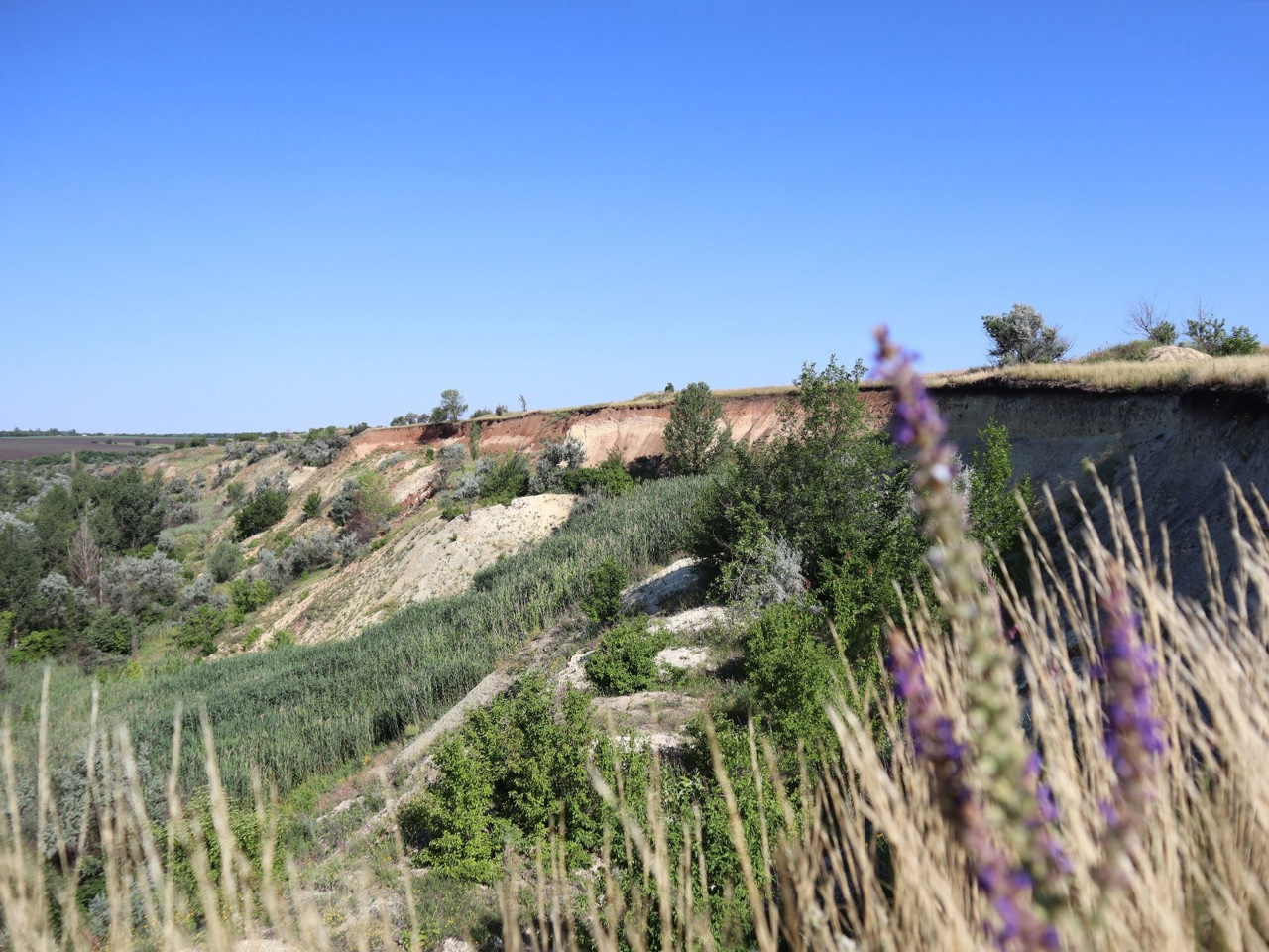
Berestyn district (Berestynskyi) is located in the south-western part of Kharkiv region, in the historical and ethnographic region of Slobozhanshchyna. The southern border runs along the Oril River.
Its natural complex is protected by the Priorilsky Landscape Reserve of national importance. In the XVIII century the Ukrainian defensive line passed here, the remains of s... Read more
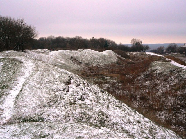
Berestyn district (Berestynskyi) is located in the south-western part of Kharkiv region, in the historical and ethnographic region of Slobozhanshchyna. The southern border runs along the Oril River.
Its natural complex is protected by the Priorilsky Landscape Reserve of national importance. In the XVIII century the Ukrainian defensive line passed here, the remains of several earthen fortresses have been preserved.
The administrative center of Berestyn district is the city of Berestyn. The area of the district is 4913 square kilometers. The population of the district reaches 110 thousand people.
The Berestyn district consists of 220 settlements, which are united into 6 territorial hromadas: Berestyn city hromada, Zachepylivska, Kehychivska and Sakhnovshchynska settlement hromadas, Natalynska and Starovirivska village territorial hromadas.
Bohodukhiv district
Bohodukhiv district (Bohodukhivskyi) is located in the north-western part of Kharkiv region, in the historical and ethnographic region of Slobozhanshchyna. It borders Russia to the north. The Merla River flows within the district.
The areas on the left and right banks of the Merla River and at the confluence of the Merla and Merchyk Rivers are part of the Slobozhansky ... Read more
Bohodukhiv district (Bohodukhivskyi) is located in the north-western part of Kharkiv region, in the historical and ethnographic region of Slobozhanshchyna. It borders Russia to the north. The Merla River flows within the district.
The areas on the left and right banks of the Merla River and at the confluence of the Merla and Merchyk Rivers are part of the Slobozhansky National Nature Park.
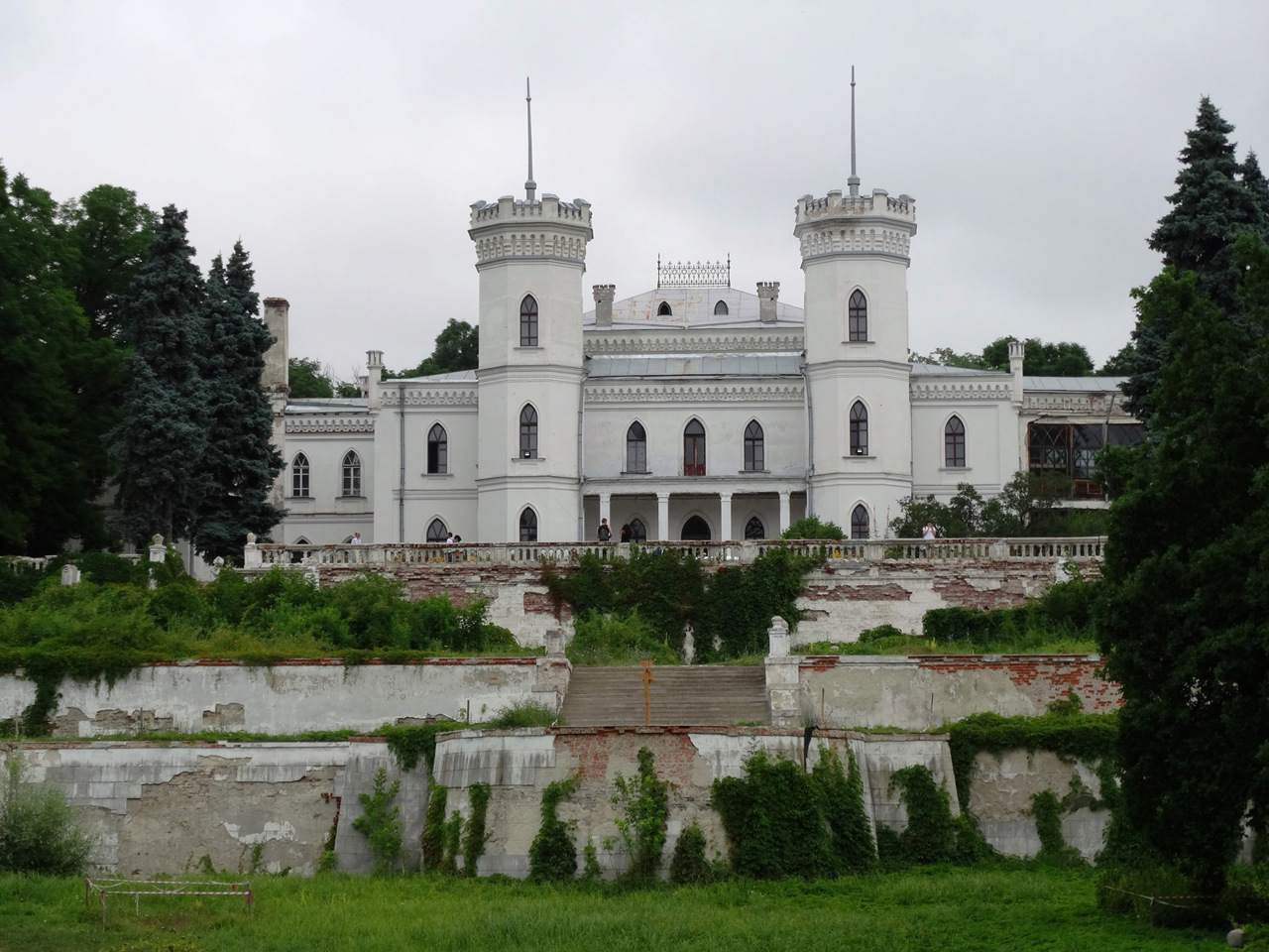
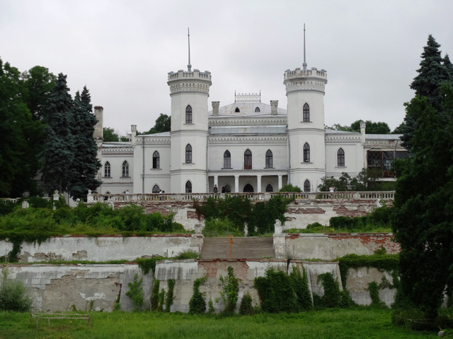
The parks-monuments of landscape art of national importance are Sharivsky Park with the Koenig Palace, Natalievsky Park with the Nataliyivka estate, Staromerchytsky Park with the Shydlovsky Palace, as well as Krasnokutsky Arboretum. Here are the Parkhomovsky Historical and Art Museum named after Panas Lunyov, famous for its rich collection of paintings.
The administrative center of Bohodukhivskyi district is the city of Bohodukhiv. The area of the district is more than 4510 square kilometers. The population of the district exceeds 128 thousand people.
Bohodukhiv district includes 353 settlements, which are united into 5 territorial hromadas: Bohodukhivska and Valkivska city hromadas, Zolochivska, Kolomatska and Krasnokutska settlement territorial hromadas.
Chuhuiv district
Chuhuiv district (Chuhuivskyi) is located in the central part of Kharkiv region, in the historical and ethnographic region of Slobozhanshchyna. The Siversky Donets River flows within the district.
Forests on the banks of the Siversky Donets at the confluence of the Homilsha River are protected by the Homilshansky Forests National Nature Park with the popular recreation... Read more
Chuhuiv district (Chuhuivskyi) is located in the central part of Kharkiv region, in the historical and ethnographic region of Slobozhanshchyna. The Siversky Donets River flows within the district.
Forests on the banks of the Siversky Donets at the confluence of the Homilsha River are protected by the Homilshansky Forests National Nature Park with the popular recreational zone Korobovi Khutory. The lower part of the Hnilytsia river beam is covered by the territory of the Pechenezke Field Landscape Park.
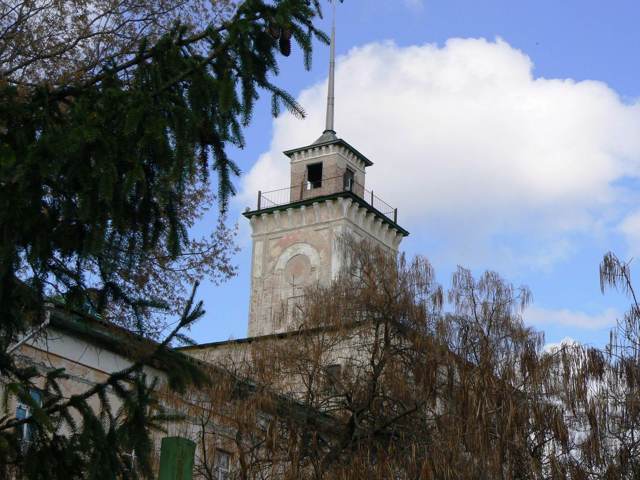
The administrative center of Chuhuivskyi district is the city of Chuhuiv, which preserves the architectural features of the ancient military settlement. The building of the Headquarters of military settlements is now part of the Historical and Memorial Museum of Ilia Repin, who was a native of Chuhuiv.
The area of the district is 4807 square kilometers. The population of the district exceeds 200 thousand people.
The Chuhuiv district consists of 226 settlements, which are united into 9 territorial hromadas: Chuhuivska, Vovchanska and Zmiivska city hromadas, Malynivska, Novopokrovska, Pechenizka, Slobozhanska, Starosaltivska and Prolisnenska settlement territorial hromadas.

Izium district
Izium district (Iziumskyi) is located in the south-eastern part of Kharkiv region, in the historical and ethnographic region of Slobozhanshchyna. The rivers Siversky Donets and Oskil flow within the district.
Mount Kremenets on the right bank of the Siversky Donets near the town of Izium is a complex monument of nature and history, the famous Iziumsky route of Tatar ra... Read more
Izium district (Iziumskyi) is located in the south-eastern part of Kharkiv region, in the historical and ethnographic region of Slobozhanshchyna. The rivers Siversky Donets and Oskil flow within the district.
Mount Kremenets on the right bank of the Siversky Donets near the town of Izium is a complex monument of nature and history, the famous Iziumsky route of Tatar raids passed by it.
The city of Izium is the administrative center of the Iziumskyi district. Here are such historical and cultural monuments as the Transfiguration Cathedral of the XVII century, the Church of the Exaltation of the Cross of the XVIII century, the Ascension Cathedral of the XIX century.
The area of the district is more than 5910 square kilometers. The population of the district reaches 182 thousand people.
The Izium district includes 228 settlements, which are united into 8 territorial hromadas: Iziumska, Balakliiska and Barvinkivska city hromadas, Borivska, Donetska and Savynska settlement hromadas, Kunievska and Oskilska village territorial hromadas.
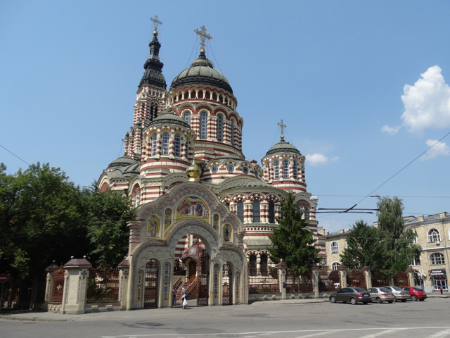
Kharkiv district
Kharkiv district (Kharkivskyi) is located in the central part of Kharkiv region, in the historical and ethnographic region of Slobozhanshchyna. It borders Russia to the north. The Uda and Lopan rivers flow within the district.
The administrative center of Kharkivskyi district is the city of Kharkiv - the largest industrial, financial, scientific, educational and cultur... Read more
Kharkiv district (Kharkivskyi) is located in the central part of Kharkiv region, in the historical and ethnographic region of Slobozhanshchyna. It borders Russia to the north. The Uda and Lopan rivers flow within the district.
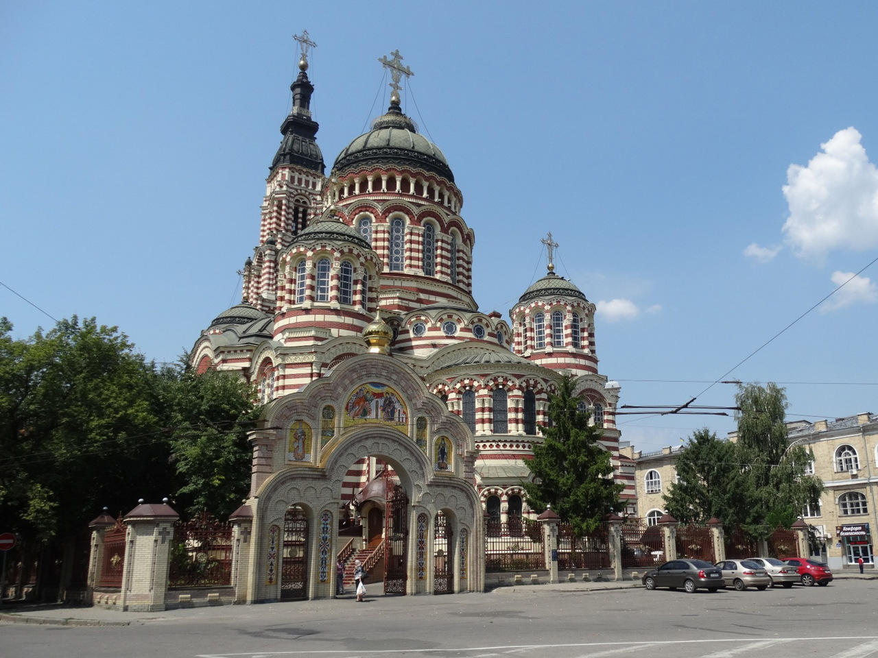
The administrative center of Kharkivskyi district is the city of Kharkiv - the largest industrial, financial, scientific, educational and cultural center in eastern Ukraine. There are such architectural monuments as the Intercession Cathedral of the XVII century, the Assumption Cathedral of the XVIII century, the Annunciation Cathedral of the XIX century, many other administrative and residential buildings of the XIX-XX centuries. The building of Gosprom is considered to be the first Soviet skyscraper. Interesting collections are the Kharkiv Historical Museum and the Kharkiv Art Museum. The main places of recreation and entertainment are the Central Park of Culture and Recreation with a Ferris wheel and a cable car, City Garden named after Taras Shevchenko with Kharkiv Zoo, Botanical Garden of Kharkiv State Agrarian University, Arboretum of Kharkiv State University, country "Feldman Ecopark". The museum-manor "Ukrainian House" in Nyzhnia Ozeriana acquaints with the traditional life of Slobozhanshchyna.
The area of the district is almost 2645 square kilometers. The population of the district exceeds 1760 thousand people.
Kharkiv district consists of 203 settlements, which are united in 15 territorial hromadas: Kharkivska, Liubotynska, Derhachivska, Merefyanska and Pivdennomiska city hromadas, Bezliudivska, Vysochanska, Malodanylivska, Solonytsivska, Novovodolazka, Pisochynska and Rohanska settlement hromadas, Lypetska, Vilkhivska and Tsyrkunivska village territorial hromadas.
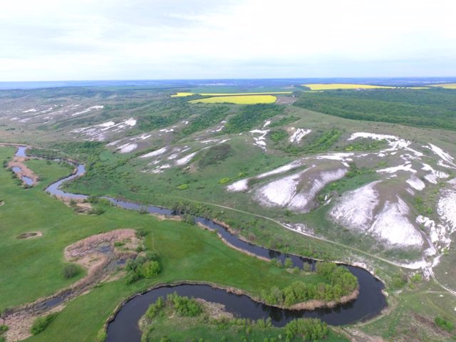
Kupyansk district
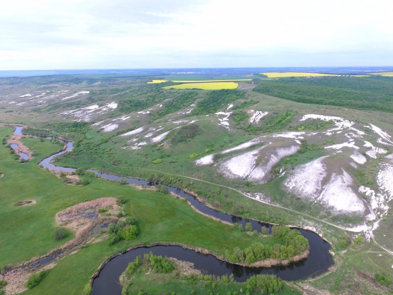
Kupyansk district (Kupyanskyi) is located in the eastern part of Kharkiv region, in the historical and ethnographic region of Slobozhanshchyna. The Oskil River flows within the district. The unique natural Cretaceous complexes along the right bank of the Oskol are guarded by the Dvorichansky National Nature Park.
The administrative center of Kupyanskyi district is the ... Read more
Kupyansk district (Kupyanskyi) is located in the eastern part of Kharkiv region, in the historical and ethnographic region of Slobozhanshchyna. The Oskil River flows within the district. The unique natural Cretaceous complexes along the right bank of the Oskol are guarded by the Dvorichansky National Nature Park.
The administrative center of Kupyanskyi district is the city of Kupyansk. The Mykolayiv Church of 1852 has been preserved here, and a museum of local lore operates. The area of the district is almost 4620 square kilometers. The population of the district reaches 137 thousand people.
Kupyansk district consists of 269 settlements, which are united into 8 territorial hromadas: Kupyanska city hromada, Velykoburlutska, Dvorichanska and Shevchenkivska settlement hromadas, Vilhuvatska, Kindrashivska, Kurylivska and Petropavlivska village territorial hromadas.
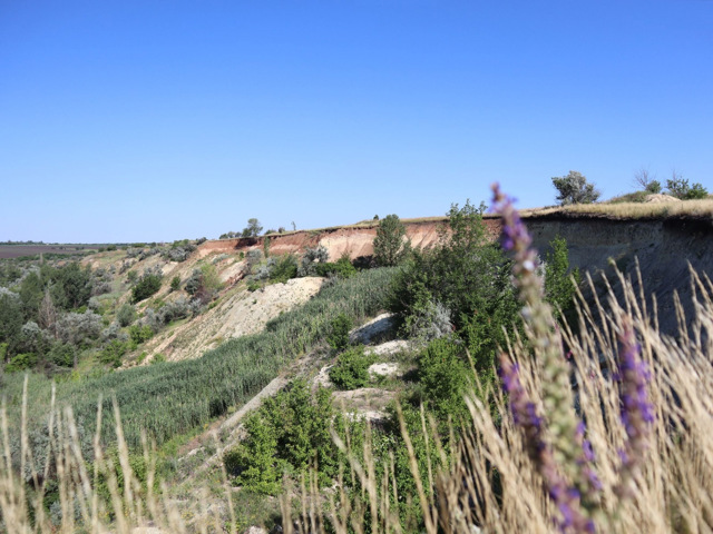
Lozova district
Lozova district (Lozivskyi) is located in the southern part of Kharkiv region, in the historical and ethnographic region of Slobozhanshchyna. The Berek River flows within the district. Here is a part of the National Natural Park "Homilshansky Forests".
The administrative center of Lozivskyi district is the city of Lozova, an important hub railway station of t... Read more
Lozova district (Lozivskyi) is located in the southern part of Kharkiv region, in the historical and ethnographic region of Slobozhanshchyna. The Berek River flows within the district. Here is a part of the National Natural Park "Homilshansky Forests".
The administrative center of Lozivskyi district is the city of Lozova, an important hub railway station of the Southern Railway. The area of the district is more than 4025 square kilometers. The population of the district reaches 155 thousand people.
Lozova district includes 247 settlements, which are united into 5 territorial hromadas: Lozivska and Zlatopilska city hromadas, Blyzniukivska settlement hromada, Biliaivska and Oleksiivska village territorial hromadas.

