Functional temporarily unavailable
Cities and villages of Sheptytskyi district
Online travel guide to the settlements of Sheptytskyi district
General information about Sheptytskyi district
Sheptytskyi district is located in the northern part of Lviv region, on the historical and ethnographic lands of Galicia and Opillya. It borders Poland to the west.
The Zakhidniy Buh River flows within the district, along which the administrative border of the Volyn region runs in the north. The main objects of the nature reserve fund are Volytsky Botanical and Lopatyn Forest Reserves of national importance.
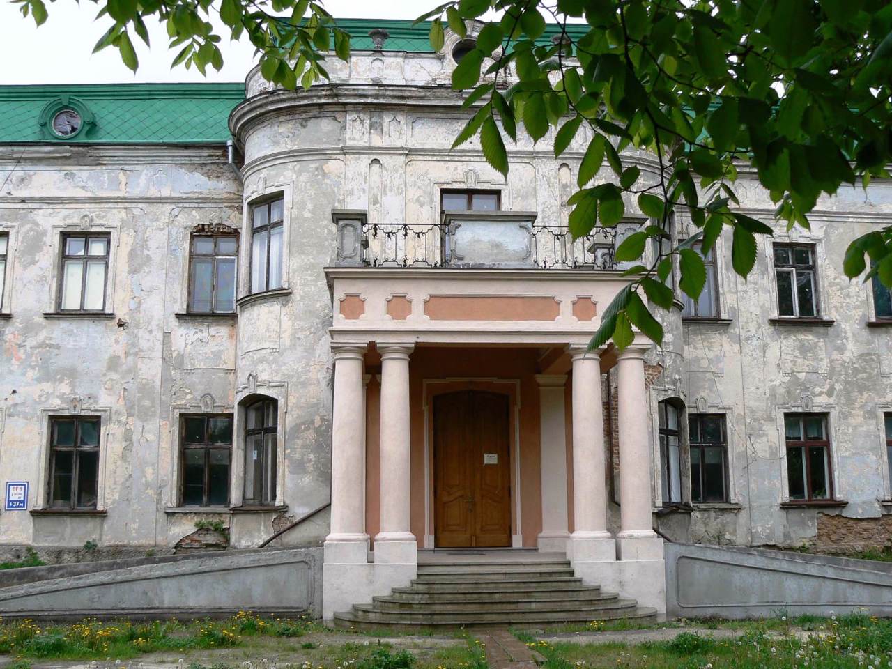
There are historical and cultural monuments such as the Potocki Palace, the Church of Saint Volodymyr and the Basilian Monastery of Saint George in Sheptytskyi, the Bernardine Monastery in Sokal, the Church of Saint Nicholas and the Church of Saint Nicholas in the former Belz Castle.
Until 2024, the district was called Chervonohradskyi. In 2024, in accordance with ...
Sheptytskyi district is located in the northern part of Lviv region, on the historical and ethnographic lands of Galicia and Opillya. It borders Poland to the west.
The Zakhidniy Buh River flows within the district, along which the administrative border of the Volyn region runs in the north. The main objects of the nature reserve fund are Volytsky Botanical and Lopatyn Forest Reserves of national importance.
There are historical and cultural monuments such as the Potocki Palace, the Church of Saint Volodymyr and the Basilian Monastery of Saint George in Sheptytskyi, the Bernardine Monastery in Sokal, the Church of Saint Nicholas and the Church of Saint Nicholas in the former Belz Castle.
Until 2024, the district was called Chervonohradskyi. In 2024, in accordance with the requirements of the law of Ukraine "On Condemnation and Prohibition of Propaganda of Russian Imperial Policy in Ukraine and Decolonization of Toponymy" Chervonohradskyi District was renamed Sheptytskyi.
The administrative center of Sheptytskyi district is the industrial city of Sheptytskyi - the main center of mining in Western Ukraine. The area of the district is more than 2970 square kilometers. The population of the district reaches 233 thousand people.
The Sheptytskyi district consists of 205 settlements, which are united into 7 territorial hromadas: Belzka, Velykomostivska, Radekhivska, Sokalska and Sheptytskyi city hromadas, Dobrotvirska and Lopatynska settlement territorial hromadas.
Шептицький район розташований у північній частині Львівської області, на історико-етнографічних землях Галичини та Опілля. Із заходу межує з Польщею. В межах району протікає річка Західний Буг, по якій на півночі проходить адміністративний кордон Волинської області.
Основними об'єктами природно-заповідного фонду є Волицький ботанічний та Лопатинський лісовий заказники загальнодержавного значення.
Тут розташовані такі історико-культурні пам'ятки, як Палац Потоцьких, церква Святого Володимира та Василіанський монастир Святого Юра в Шептицькому, Бернардинський монастир в місті Сокаль, костел Святого Миколая і церква Святого Миколая на території колишнього Белзького замку.
До 2024 року район називався Червоноградським. В 2024 році відповідно до вимог закону У ...
Шептицький район розташований у північній частині Львівської області, на історико-етнографічних землях Галичини та Опілля. Із заходу межує з Польщею. В межах району протікає річка Західний Буг, по якій на півночі проходить адміністративний кордон Волинської області.
Основними об'єктами природно-заповідного фонду є Волицький ботанічний та Лопатинський лісовий заказники загальнодержавного значення.
Тут розташовані такі історико-культурні пам'ятки, як Палац Потоцьких, церква Святого Володимира та Василіанський монастир Святого Юра в Шептицькому, Бернардинський монастир в місті Сокаль, костел Святого Миколая і церква Святого Миколая на території колишнього Белзького замку.
До 2024 року район називався Червоноградським. В 2024 році відповідно до вимог закону України "Про засудження та заборону пропаганди російської імперської політики в Україні і деколонізацію топонімії" Червоноградський район було перейменовано на Шептицький.
Адміністративним центром Шептицького району є промислове місто Шептицький – головний осередок гірничодобувної промисловості Західної Україні. Площа території району становить понад 2970 квадратних кілометрів. Чисельність населення району сягає 233 тисяч осіб.
До складу Шептицького району входять 205 населених пунктів, які об'єднані у 7 територіальних громад: Белзьку, Великомостівську, Радехівську, Сокальську та Шептицьку міські, Добротвірську та Лопатинську селищні територіальні громади.


