Functional temporarily unavailable
Cities and villages of Chortkiv district
Online travel guide to the settlements of Chortkiv district
General information about Chortkiv district
Chortkiv district (Chortkivskyi) is located in the southern part of Ternopil region, at the junction of historical and ethnographic regions of Halicia and Podillya. The Seret and Strypa rivers flow within the district, the southern border runs along the Dniester River, and the eastern border runs along the Zbruch.
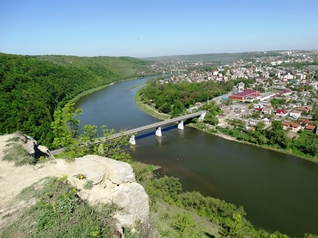
Here lies the ridge of the Halician Tovtry (Medobory), the nature of which in this part is protected by the reserve "Medobory" with the administration in Hrimailiv. The Dniester Canyon National Nature Park with its administration in Zalishchyky includes the Chervone tract with the ruins of the Chervonohorod Castle and the largest plain waterfall in Ukraine on the Dzhuryn River. Panorama of Zalishchyky in the meander of the Dniester is one of the tourist attract ...
Chortkiv district (Chortkivskyi) is located in the southern part of Ternopil region, at the junction of historical and ethnographic regions of Halicia and Podillya. The Seret and Strypa rivers flow within the district, the southern border runs along the Dniester River, and the eastern border runs along the Zbruch.
Here lies the ridge of the Halician Tovtry (Medobory), the nature of which in this part is protected by the reserve "Medobory" with the administration in Hrimailiv. The Dniester Canyon National Nature Park with its administration in Zalishchyky includes the Chervone tract with the ruins of the Chervonohorod Castle and the largest plain waterfall in Ukraine on the Dzhuryn River. Panorama of Zalishchyky in the meander of the Dniester is one of the tourist attractions of the region.
Chortkiv district is the main cave region of Ukraine. Here are the largest and most interesting karst caves available for viewing: Verteba Cave (arranged), Kryshtaleva Cave (arranged), Mlynky Cave, Ozerna Cave, Optimistic Cave, Pearl Cave, Jubilee Cave.
The administrative center of Chortkivskyi district is the city of Chortkiv, known for its distinctive architectural complex of the historical center and the ruins of Chortkiv Castle, which, together with Yazlovetsky Castle and Pidzamochkivsky Castle, is part of the National Reserve "Ternopil Castles". Also on the territory of the district there are Buchach Castle, Skala-Podilsky Castle, Yahilnytsky Castle, Sidoriv Castle, Zolotopotosky Castle, Kryvchansky Castle, etc. The artistic heritage of the outstanding sculptor Johann Pinzel is most widely represented on the streets and in the temples of the city of Buchach. The city of Borshchiv and its environs is known for its special embroidery, which is dominated by black.
The area of the district is 5022 square kilometers. The population of the district reaches 335 thousand people.
Chortkiv district includes 362 settlements, which are united in 22 territorial hromadas: Borshchivska, Buchatska, Zalishchytska, Kopychynetska, Monastyryska, Khorostkivska and Chortkivska city hromadas, Hrymailivska, Husiatynska, Zavodska, Zolotopotitska, Koropetska, Melnytse-Podilska, Skala-Podilska and Tovstenska settlement hromadas, Bilobozhnytska, Bilche-Zolotetska, Vasylkovetska, Ivane-Pustenska, Kolyndianska, Nahirianska and Trybukhivska village territorial hromadas.
Чортківський район розташований у південній частині Тернопільської області, на стику історико-етнографічних регіонів Галичини та Поділля. В межах району протікають річки Серет і Стрипа, південна межа проходить по річці Дністер, а східна - по Збручу.
Тут пролягає гряда Галицьких Товтрів (Медоборів), природу яких у цій частині охороняє заповідник "Медобори" з адміністрацією в Гримайлові. До Національного природного парку "Дністровський каньйон" з адміністрацією в Заліщиках входить урочище "Червоне" з руїнами Червоногородського замку і найбільшим в Україні рівнинним водоспадом на річці Джурин. Панорама Заліщиків у меандрі Дністра є однією з туристичних візитівок регіону.
Чортківщина - це головний печерний край України. Тут розташовані найбільші та ...
Чортківський район розташований у південній частині Тернопільської області, на стику історико-етнографічних регіонів Галичини та Поділля. В межах району протікають річки Серет і Стрипа, південна межа проходить по річці Дністер, а східна - по Збручу.
Тут пролягає гряда Галицьких Товтрів (Медоборів), природу яких у цій частині охороняє заповідник "Медобори" з адміністрацією в Гримайлові. До Національного природного парку "Дністровський каньйон" з адміністрацією в Заліщиках входить урочище "Червоне" з руїнами Червоногородського замку і найбільшим в Україні рівнинним водоспадом на річці Джурин. Панорама Заліщиків у меандрі Дністра є однією з туристичних візитівок регіону.
Чортківщина - це головний печерний край України. Тут розташовані найбільші та найцікавіші карстові печери, доступні для огляду: печера Вертеба (облаштована), печера Кришталева (облаштована), печера Млинки, печера Озерна, печера Оптимістична, печера Перлина, печера Ювілейна.
Адміністративним центром Чортківського району є місто Чортків, що відоме виразним архітектурним комплексом історичного центру і руїнами Чортківського замку, який, разом із Язловецьким замком та Підзамочківським замком, входить до складу Національного заповідника "Замки Тернопілля". Також на території району розташовані Бучацький замок, Скала-Подільський замок, Ягільницький замок, Сидорівський замок, Золотопотоцький замок, Кривчанский замок тощо. Мистецька спадщина видатного скульптора Йогана Пінзеля найширше представлена на вулицях та у храмах міста Бучач. Місто Борщів та його околиці відоме завдяки особливій вишивці, в якій домінує чорний колір.
Площа території району становить 5022 квадратних кілометри. Чисельність населення району сягає 335 тисяч осіб.
До складу Чортківського району входять 362 населені пункти, які об'єднані у 22 територіальні громади: Борщівську, Бучацьку, Заліщицьку, Копичинецьку, Монастириську, Хоростківську та Чортківську міські, Гримайлівську, Гусятинську, Заводську, Золотопотіцьку, Коропецьку, Мельнице-Подільську, Скала-Подільську і Товстенську селищні, Білобожницьку, Більче-Золотецьку, Васильковецьку, Іване-Пустенську, Колиндянську, Нагірянську і Трибухівську сільські територіальні громади.


