Functional temporarily unavailable
Prytulivka
Travel guide online Prytulivka
General information about Prytulivka
Village Prytulivka is located on the territory of Khmelnytsky region and is administratively part of Kamyanets-Podilskyi district of this region. According to the Codifier of Administrative Territorial Units and Territories of Territorial Communities of Ukraine, the settlement Prytulivka has the code UA68020050360080143.
The district center of Kamyanets-Podilskyi of the district is a city Kamyanets-Podilskyi. The distance from the district center to the settlement Prytulivka is 40 kilometers in a straight line (the length of the road route may be longer).
A detailed description of Prytulivka, including geographical location, date of foundation, history of the settlement of Prytulivka with main historical events and persons, main sights and interesting places of Prytulivka, n ...
Village Prytulivka is located on the territory of Khmelnytsky region and is administratively part of Kamyanets-Podilskyi district of this region. According to the Codifier of Administrative Territorial Units and Territories of Territorial Communities of Ukraine, the settlement Prytulivka has the code UA68020050360080143.
The district center of Kamyanets-Podilskyi of the district is a city Kamyanets-Podilskyi. The distance from the district center to the settlement Prytulivka is 40 kilometers in a straight line (the length of the road route may be longer).
A detailed description of Prytulivka, including geographical location, date of foundation, history of the settlement of Prytulivka with main historical events and persons, main sights and interesting places of Prytulivka, not yet available.
Cело Притулівка розташоване на території Хмельницької області та адміністративно входить до складу Кам’янця-Подільського району цієї області. Згідно з Кодифікатором адміністративно-територіальних одиниць та територій територіальних громад України, населений пункт Притулівка має код UA68020050360080143.
Районним центром Кам’янця-Подільського району є місто Кам’янець-Подільський. Відстань від райцентру до населеного пункта Притулівка становить 40 кілометрів по прямій (довжина маршруту автомобільними дорогами може бути більшою).
Детальний опис Притулівки, що включає географічне розташування, дату заснування, історію населеного пункта Притулівка з основними історичними подіями та персонами, основні пам'ятки та цікаві місця Притулівки, поки що відсутній.
Сплануй своє перебування у Prytulivka
What to see and where to go in Prytulivka
Tourist attractions and museums of Prytulivka

Lower Grotto
Natural object
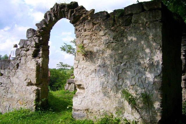
"Lower Grotto" (Nyzhniy hrot) in Prytulivka near Otrokiv is the longest park cave in Europe, created in the form of a two-story structure.
The upper tier is made in the form of an arched gazebo, previously decorated with frescoes, and the lower tier is carved from solid rock.
This artificial labyrinth was created by order of the landowner Ihnatiy Stsibor-Markhotsʹkoho, viknown for his eccentricity. The structure is part of the park cave complex "Tears Grotto", which consists of the "Upper Grotto" ("Old Monk"), located higher on the slopes of the hill closer to the village of Otrokiv, and the "Lower Grotto", located directly on the outskirts of the village of Prytulivka. In ancient times, there was a cave hermitage here, and the valley of the Ushytsia River, where the lower part of the complex is located, is still called Chernetska Valley.

Mill-Museum
Architecture , Museum / gallery
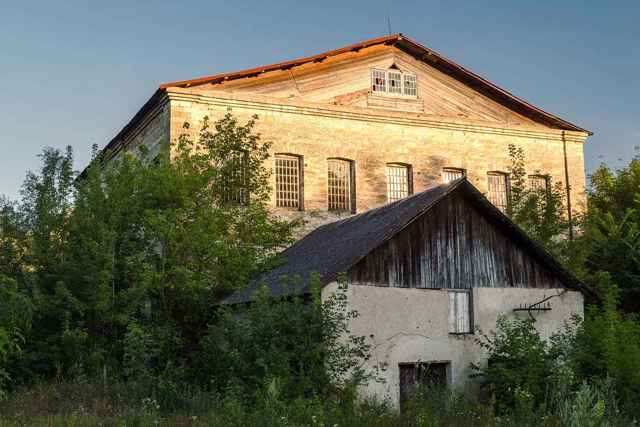
The Prytulivka grain-rolling mill on the Ushytsia River was built in 1846.
Was active until recently.
Currently, the three-story building of the mill houses a small museum exhibition.
Reviews Prytulivka
Geographical information about Prytulivka
| {{itemKey}} | {{itemValue}} |
|---|---|
| Region |
Khmelnytskyi |


