Functional temporarily unavailable
Horaivka
Travel guide online Horaivka
General information about Horaivka
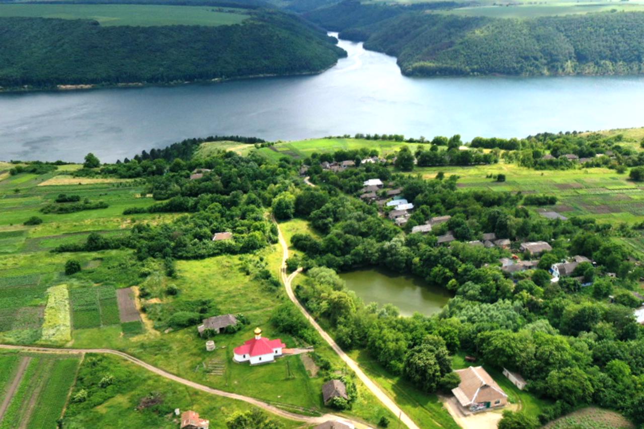
The village of Horaivka is located on the banks of the Dniester, 45 kilometers east of Kamyanets-Podilskyi, near Stara Ushytsia. Administratively, it is part of the Stara Ushytsia settlement hromada of the Kamyanets-Podilskyi district of the Khmelnytskyi region.
3 kilometers to the west of the village is the Bakota tract, where in the 11th and 13th centuries the city of the same name was located, which was the political and administrative center of Dniester Ponnyzzia, then Podillya. Remains of the Bakota Saint Michael Cave Monastery have been preserved.
In the field between Bakota and Horaivka, the remains of a Late Bronze Age altar were found in the form of a mound-like mound with specially laid out stone outgrowths at the base.
Horaivka itself has been known since 16 ...
The village of Horaivka is located on the banks of the Dniester, 45 kilometers east of Kamyanets-Podilskyi, near Stara Ushytsia. Administratively, it is part of the Stara Ushytsia settlement hromada of the Kamyanets-Podilskyi district of the Khmelnytskyi region.
3 kilometers to the west of the village is the Bakota tract, where in the 11th and 13th centuries the city of the same name was located, which was the political and administrative center of Dniester Ponnyzzia, then Podillya. Remains of the Bakota Saint Michael Cave Monastery have been preserved.
In the field between Bakota and Horaivka, the remains of a Late Bronze Age altar were found in the form of a mound-like mound with specially laid out stone outgrowths at the base.
Horaivka itself has been known since 1680. According to legend, the first settler was a Moldovan named Huray, who founded a pottery factory here.
Owing to the particularly mild climate in Horaivka, winemaking has recently begun to develop. Guests are hosted by green tourism estates.
Село Гораївка розташоване на березі Дністра за 45 кілометрів на схід від Кам'янця-Подільського, поблизу Старої Ушиці. Адміністративно входить до складу Староушицької селищної громади Кам’янець-Подільського району Хмельницької області.
За 3 кілометри на захід від села знаходиться урочище Бакота, де у XI-XIII сторіччях розташовувалося однойменне місто, що політико-адміністративним центром Дністровського Пониззя, потім Поділля. Збереглися залишки Бакотського Михайлівського скельно-печерного монастиря.
На полі між Бакотою і Гораївкою знайдено рештки жертовника пізнього бронзового віку у вигляді курганоподібного насипу із спеціально викладеними кам’яними виростками в основі.
Сама Гораївка відома з 1680 року. За легендою, першим поселенцем був молдаванин на п ...
Село Гораївка розташоване на березі Дністра за 45 кілометрів на схід від Кам'янця-Подільського, поблизу Старої Ушиці. Адміністративно входить до складу Староушицької селищної громади Кам’янець-Подільського району Хмельницької області.
За 3 кілометри на захід від села знаходиться урочище Бакота, де у XI-XIII сторіччях розташовувалося однойменне місто, що політико-адміністративним центром Дністровського Пониззя, потім Поділля. Збереглися залишки Бакотського Михайлівського скельно-печерного монастиря.
На полі між Бакотою і Гораївкою знайдено рештки жертовника пізнього бронзового віку у вигляді курганоподібного насипу із спеціально викладеними кам’яними виростками в основі.
Сама Гораївка відома з 1680 року. За легендою, першим поселенцем був молдаванин на прізвище Гурай, який заснував тут гончарне виробництво.
Завдяки особливому м'якому клімату в Гораївці останнім часом почало розвиватися виноробство. Гостей приймають садиби зеленого туризму.
Сплануй своє перебування у Horaivka
What to see and where to go in Horaivka
Tourist attractions and museums of Horaivka
Bakota Saint Michael Cave Monastery
Historic area , Temple
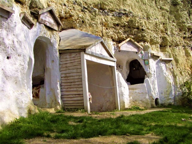
Remains of the ancient Bakota Saint Michael Rock-Cave Monastery, known since 1362, are located on the steep slope of Bila Mountain above the Bakota Bay of the Dniester. Limestone mountain rises 120 meters above the river. This is one of the most popular tourist sites of the National Nature Park "Podilskyi Tovtry".
During the study of the preserved cells and the rock monastery church, an inscription, probably from the 11th century, was discovered, which mentions the founding of the monastery by Abbot Hryhoriy in honor of Saint Michael. It is considered the oldest on the territory of Podillya. It was a part of the great ancient Rus city of Bakota, which is mentioned in the XI-XIII centuries as the most important political and administrative center of the Dniester Ponyzzia, then Podillya, which was part of the Galicia-Volyn principality.
According to legend, during the invasion of the Tatar horde, the monks who hid in the caves, refusing to renounce their faith, were stoned alive.
The revival of the monastery in the 14th century was facilitated by the Lithuanian princes Koriatovychi (Koryatovychi), however, after the uprising of 1431, Bakota lost the status of a city, and soon the mention of the monastery disappeared from the annals.
The settlement of Bakota existed until 1981, when it was completely flooded with water during the construction of the Novodnistrovskaya HPP. The collapse of White Mountain in 1996 destroyed most of the caves with ancient Russian frescoes. The few ruins of Saint Michael's Church and the remains of caves can be seen only in one place on the mountainside.
A breathtaking panorama of the Dniester opens from here.
Every year on Makovey (August 14) in the revived Bakota Michael Cave Church, festive services are held with a large number of people.
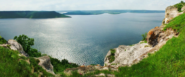
Bakota Tract
Historic area , Natural object , Visitor center
The Bakota tract on the banks of the Bakota Bay on the Dniester river is one of the most popular natural tourist locations in Ukraine, part of the National Nature Park "Podilski Tovtry".
It is located on the limestone Bila Mountain, rising 120 meters above the river, near the village of Horaivka, 45 kilometers east of Kamyanets-Podilskyi, on the road to Stara Ushytsia.
Bakota was the name of an ancient Rus city that existed in this place in the XII-XIII and was the capital of Dniester Ponyzzia. Subsequently, the same name was given to a large village on the banks of the Dniester, which was flooded in 1981 during the creation of an artificial Dniester reservoir. Only on the slope of Bila Mountain are the remains of the Bakota Saint Michael Cave Monastery, where a tourist trail leads.
Bakota owes its popularity to the stunning views of Bakota Bay from the observation deck at the top of Bila Mountain, which are especially enchanting at sunset. Within the framework of the project "Bakota - in search of the flooded heritage", a monument to the flooded villages was installed here.
The site is equipped with a suspended wooden walkway, binoculars for viewing the opposite bank, and a tactile map of Bakota for people with visual impairments. The tourist visitor center is open. The route along the "Ancient Bakota" trail has been arranged with QR codes at key points that allow you to listen to the tour online.
Entrance to the park and car parking are paid. Services of tour guides, rental of places for tents and fires, use of tables, etc. are offered. There is a beach at the foot of the mountain.
Reviews Horaivka
Geographical information about Horaivka
| {{itemKey}} | {{itemValue}} |
|---|---|
| Region |
Khmelnytskyi |
