Functional temporarily unavailable
Izobilne
Travel guide online Izobilne
General information about Izobilne
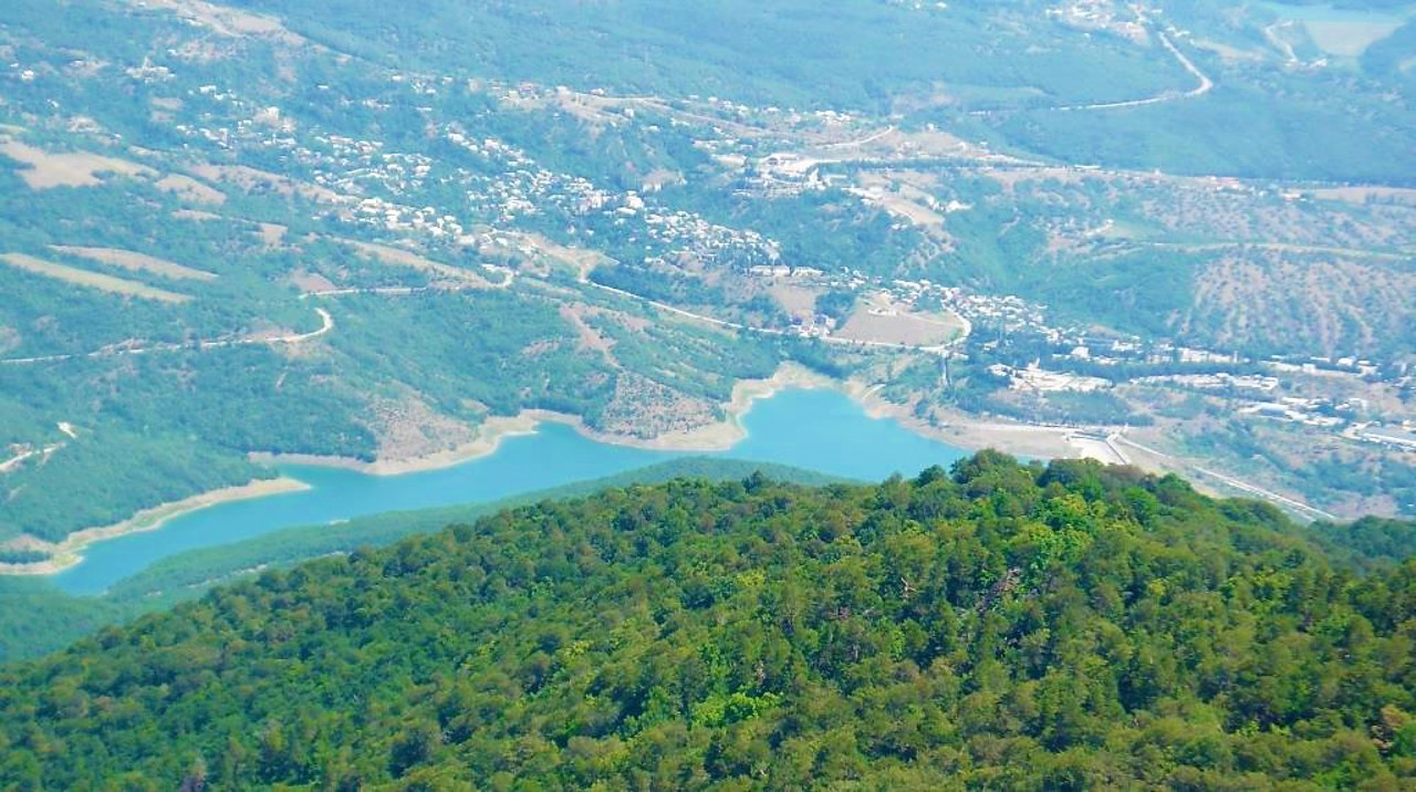
The village Izobilne is located in the Alushta region between the wooded hills in the foothills of Chatyr-Dah. Is administratively part of Yalta district of Autonomous Republic of Crimea.
Historical names - Korbek, Korbekul, Korbekly. The former Tatar village Korbekul received its name Izobilne in 1945 after the forced deportation of Crimean Tatars by the Soviet occupiers from Crimea to Central Asia.
The Izobilne Reservoir was established in the late 1970s to supply Alushta with fresh water.
Here begins one of the walking routes to Chaty ...
The village Izobilne is located in the Alushta region between the wooded hills in the foothills of Chatyr-Dah. Is administratively part of Yalta district of Autonomous Republic of Crimea.
Historical names - Korbek, Korbekul, Korbekly. The former Tatar village Korbekul received its name Izobilne in 1945 after the forced deportation of Crimean Tatars by the Soviet occupiers from Crimea to Central Asia.
The Izobilne Reservoir was established in the late 1970s to supply Alushta with fresh water.
Here begins one of the walking routes to Chatyr-Dah. Nearby in 2007 the village of Kuban Cossacks Vilna was founded.
Село Ізобільне розташоване в районі Алушти між лісистими пагорбами в передгір'ях Чатир-Дага. Адміністративно входить до складу Ялтинського району Автономної Республіки Крим.
Історичні назви - Корбек, Корбекуль, Корбекли. Назву Ізобільне колишнє татарське село Корьбєкуль отримало у 1945 році після примусової депортації кримських татар радянськими окупантами з Криму до Середньої Азії.
Ізобільненське водосховище створено в кінці 70-х років XX соліття для постачання Алушти прісною водою.
Тут починається один з пішохідних маршрутів на Чатир-Да ...
Село Ізобільне розташоване в районі Алушти між лісистими пагорбами в передгір'ях Чатир-Дага. Адміністративно входить до складу Ялтинського району Автономної Республіки Крим.
Історичні назви - Корбек, Корбекуль, Корбекли. Назву Ізобільне колишнє татарське село Корьбєкуль отримало у 1945 році після примусової депортації кримських татар радянськими окупантами з Криму до Середньої Азії.
Ізобільненське водосховище створено в кінці 70-х років XX соліття для постачання Алушти прісною водою.
Тут починається один з пішохідних маршрутів на Чатир-Даг. Поруч в 2007 році заснована станиця кубанських козаків Вільна.
Сплануй своє перебування у Izobilne
What to see and where to go in Izobilne
Reviews Izobilne
Geographical information about Izobilne
| {{itemKey}} | {{itemValue}} |
|---|---|
| Region |
Autonomous Republic of Crimea |


