Functional temporarily unavailable
General information about Simeiz
The resort settlement Simeiz is located 5 kilometers west of Alupka, on the spurs of Mount Cat. Is administratively part of Yalta district of Autonomous Republic of Crimea.
Remains of the Taurian settlement Limena-Isar of the IV century BC - V century AD are preserved on the mountain. On Mount Panea, opposite the Virgin Rock, are the remains of a Byzantine monastery and basilica of the tenth century with a mosaic floor, which the Genoese later used as a fortress.
The development of the resort in the XIX century was facilitated by the Maltsev indust ...
The resort settlement Simeiz is located 5 kilometers west of Alupka, on the spurs of Mount Cat. Is administratively part of Yalta district of Autonomous Republic of Crimea.
Remains of the Taurian settlement Limena-Isar of the IV century BC - V century AD are preserved on the mountain. On Mount Panea, opposite the Virgin Rock, are the remains of a Byzantine monastery and basilica of the tenth century with a mosaic floor, which the Genoese later used as a fortress.
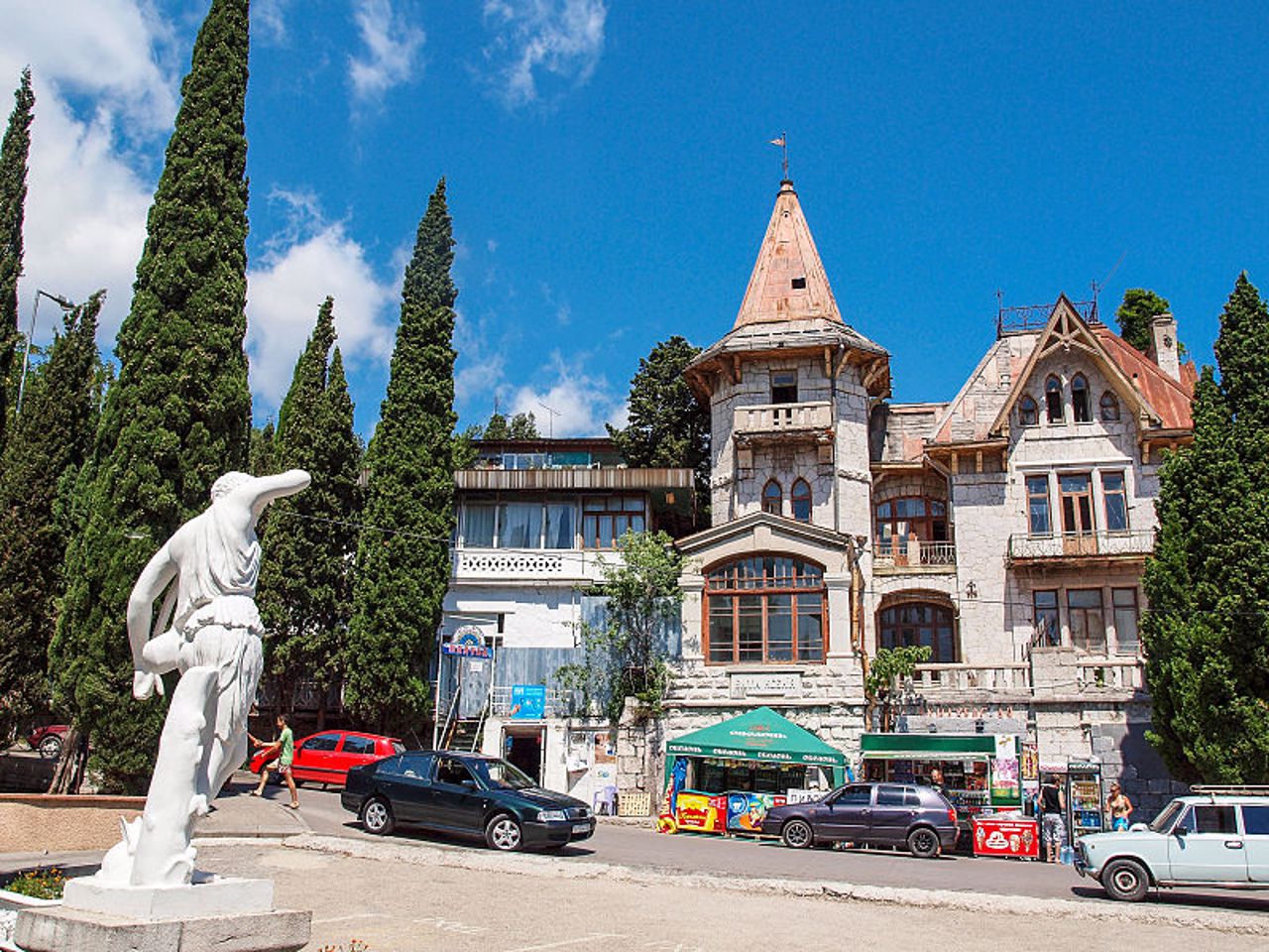
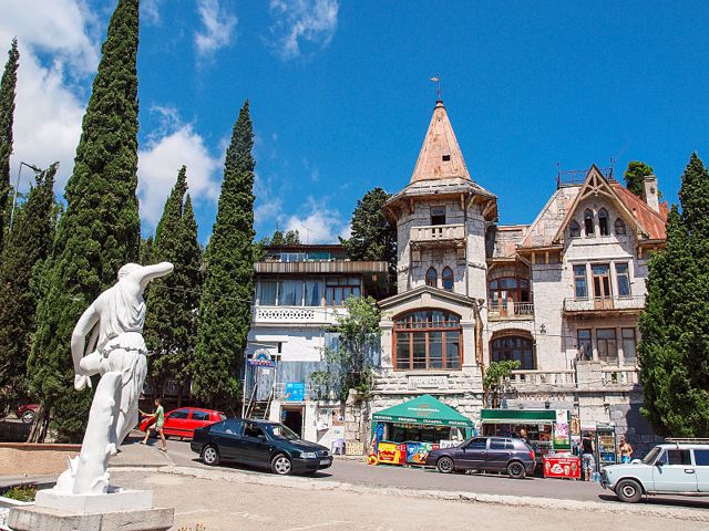
The development of the resort in the XIX century was facilitated by the Maltsev industrialists, who bought these lands from Potocki and Naryshkin. The dachas of some Russian dignitaries and industrialists have been preserved. Gothic villa "Xenia" has the fame of a "haunted house".
The first Crimean water park "Blue Bay" is located in the Blue Bay.
Pebble and boulder beaches in Simeiz.
Курортне селище Сімеїз розташоване в 5 кілометрах на захід від Алупки, у відрогів гори Кішка. Адміністративно входить до складу Ялтинського району Автономної Республіки Крим.
На горі збереглися залишки таврського поселення Лімена-Ісар IV століття до нашої ери - V століття нашої ери. На горі Панеа, навпроти скелі Діви, знаходяться залишки візантійського монастиря та базиліки Х сторіччя з мозаїчною підлогою, які генуезці пізніше використовували як фортецю.
Розвитку курорту в XIX столітті посприяли промисловці Мальцеви, які придбали ці землі у Потоцького т ...
Курортне селище Сімеїз розташоване в 5 кілометрах на захід від Алупки, у відрогів гори Кішка. Адміністративно входить до складу Ялтинського району Автономної Республіки Крим.
На горі збереглися залишки таврського поселення Лімена-Ісар IV століття до нашої ери - V століття нашої ери. На горі Панеа, навпроти скелі Діви, знаходяться залишки візантійського монастиря та базиліки Х сторіччя з мозаїчною підлогою, які генуезці пізніше використовували як фортецю.
Розвитку курорту в XIX столітті посприяли промисловці Мальцеви, які придбали ці землі у Потоцького та Наришкіна. Збереглися дачі деяких російських сановників і промисловців. Готична вілла "Ксенія" має славу "будинку з привидами".
У Блакитній затоці знаходиться перший кримський аквапарк "Блакитна затока".
Пляжі в Сімеїзі галькові та валунні.
Сплануй своє перебування у Simeiz
What to see and where to go in Simeiz
Tourist attractions and museums of Simeiz

Diva Rock
Natural object
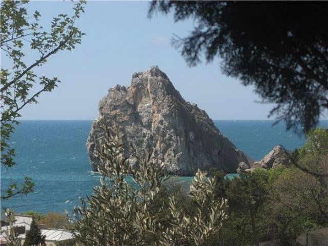
The Diva Rock is a high 70-meter cliff that juts out into the sea for several tens of meters, its silhouette vaguely resembles a girl with loose hair.
There used to be Monk Rock between Diva Rock and the shore, which looks like a hooded monk, but it was broken by a storm in 1931.
You can climb the stairs to the top of the Diva Rock, having overcome the stone chaos at the place of the ruined Monk.
On the shore, just above the Diva, there is the 80-meter Panea rapid, at the foot of which are preserved the remains of the fortified medieval Panea-Isar monastery of the 8th-15th centuries, which was used by the Genoese as a fortress. The remains of the 10th-century basilica with a mosaic floor and a stone crypt with thirty Byzantine burials from the 8th-10th centuries were discovered.

Mount Cat
Natural object
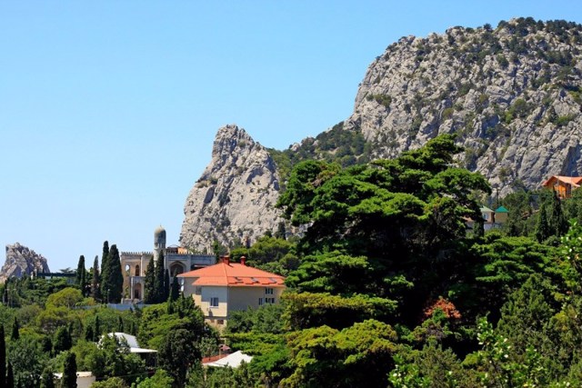
One of the most characteristic and picturesque landscape sights of Crimea is a mountain that resembles a silhouette of a cat ready to jump.
It is located between Simeiz and Katsiveli, on the territory of the Simeiz-Alupka amphitheater-like forest landscape. The name comes from the Tatar Kosh-kai - Falcon Mountain. This large limestone massif with a height of 254 meters was formed about a million years ago, breaking away from the Yalin ridge of the Main Crimean Ridge and gradually moving down the slope to the sea.
In ancient times, this natural barrier that separated the South Bank was supplemented in gaps by a stone wall. On the plateau of Mount Cat, the remains of the Tavr settlement Limen-Isar (VIII-I centuries BC) with fragments of buildings and defensive walls, as well as a large necropolis consisting of a hundred dolmen tombs (so-called "Tavr boxes"), were discovered.
In the 1960s, the South Coast Highway was built through the ridge of Mount Cat, which changed the natural landscape. The accumulation of stones to the southwest of the mountain is closed by the picturesque Krylo Lebeda rock, which is popular with climbers.
Reviews Simeiz
Geographical information about Simeiz
| {{itemKey}} | {{itemValue}} |
|---|---|
| Region |
Autonomous Republic of Crimea |


