Functional temporarily unavailable
Soniachna Dolyna
Travel guide online Soniachna Dolyna
General information about Soniachna Dolyna
The village Soniachna Dolyna is located 10 kilometers east of Sudak, 4 kilometers from the sea. Is administratively part of Feodosiia district of Autonomous Republic of Crimea.
The village Soniachna Dolyna lies in the Kozska valley surrounded by mountains, the most prominent of which is the isolated limestone mountain of Parsuk Kaya, which is an ancient coral reef. This is one of the sunniest places in Crimea - 2.5 thousand sunny hours a year.
Since the 14th century, the village has been known as Qoz or Qozio, although it existed earlier. ...
The village Soniachna Dolyna is located 10 kilometers east of Sudak, 4 kilometers from the sea. Is administratively part of Feodosiia district of Autonomous Republic of Crimea.
The village Soniachna Dolyna lies in the Kozska valley surrounded by mountains, the most prominent of which is the isolated limestone mountain of Parsuk Kaya, which is an ancient coral reef. This is one of the sunniest places in Crimea - 2.5 thousand sunny hours a year.
Since the 14th century, the village has been known as Qoz or Qozio, although it existed earlier. The former Tatar village Qoz received its name Soniachna Dolyna in 1948 after the forced deportation of Crimean Tatars by the Soviet occupiers from Crimea to Central Asia.
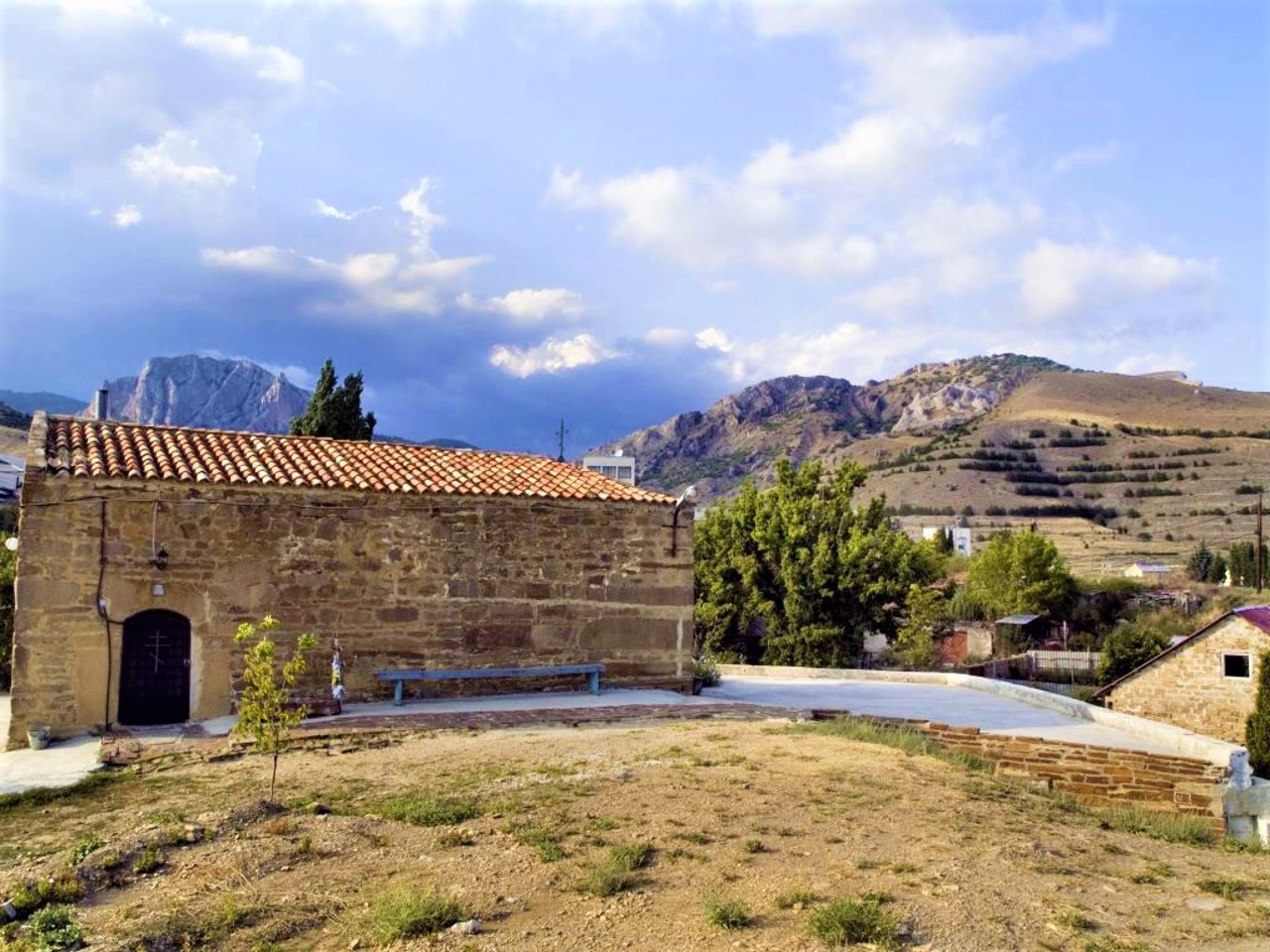
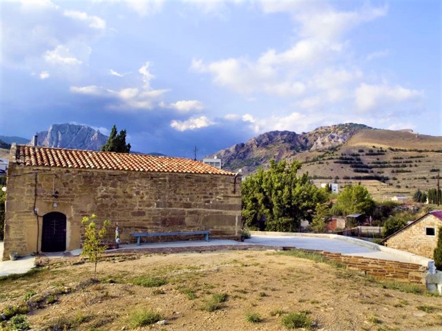
In the center of the village on a hill is an architectural landmark of the X-XI centuries - the Orthodox Church of Ilya the Prophet - the oldest of the active churches in Crimea.
Grapes have been cultivated here since ancient times. The surrounding valleys are occupied by vineyards planted in the 18th-19th centuries on the initiative of Prince Hrigory Potemkin on the basis of aboriginal vineyards. In 1893, Prince Lev Holitsyn laid the wine cellars of the Arkhaderesse wine estate, which belonged to Prince Horchakov, in the bowels of the Delikly-Kaya rock ("leaky rock"). Now it is the "Soniachna Dolyna" plant.
Село Сонячна Долина розташоване в 10 кілометрах на схід від Судака, в 4 кілометрах від моря. Адміністративно входить до складу Феодосійського району Автономної Республіки Крим.
Село Сонячна Долина лежить в Козській долині в оточенні гір, найпомітніша з яких - ізольована вапняна гора Парсук-Кая, що є давнім кораловим рифом. Це одне з найсонячних місць в Криму - 2,5 тисячі сонячних годин на рік.
З XIV сторіччя село відоме як Коз або Козио, хоча існувало і раніше. Назву Сонячна Долина колишнє татарське село Коз отримало у 1948 році після примусової де ...
Село Сонячна Долина розташоване в 10 кілометрах на схід від Судака, в 4 кілометрах від моря. Адміністративно входить до складу Феодосійського району Автономної Республіки Крим.
Село Сонячна Долина лежить в Козській долині в оточенні гір, найпомітніша з яких - ізольована вапняна гора Парсук-Кая, що є давнім кораловим рифом. Це одне з найсонячних місць в Криму - 2,5 тисячі сонячних годин на рік.
З XIV сторіччя село відоме як Коз або Козио, хоча існувало і раніше. Назву Сонячна Долина колишнє татарське село Коз отримало у 1948 році після примусової депортації кримських татар радянськими окупантами з Криму до Середньої Азії.
В центрі села на пагорбі розташована архітектурна пам'ятка X-XI століть - православний храм Іллі Пророка - найстаріший із діючих храмів Криму.
З найдавніших часів тут обробляють виноград. Навколишні долини зайняті виноградниками, закладеними в XVIII-XIX століттях з ініціативи князя Григорія Потьомкіна на основі аборигенних виноградників. В 1893 році князем Левом Голіциним в надрах скелі Делікли-Кая ( "дірява скеля") були закладені винні підвали виноробного маєтку "Архадерессе", що належав князю Горчакову. Тепер це завод "Сонячна долина".
Сплануй своє перебування у Soniachna Dolyna
What to see and where to go in Soniachna Dolyna
Tourist attractions and museums of Soniachna Dolyna

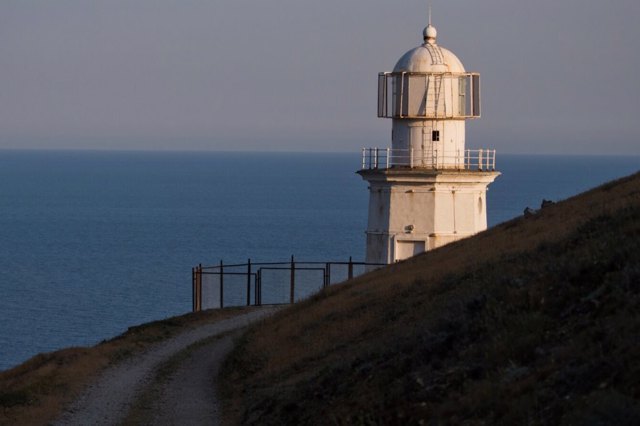
Meganom Cape
Natural object
Cape Meganom is the sunniest point of Crimea, a popular place for "wild" recreation and diving.
The cape is located between Sudak and Koktebel. The nearest settlement is Soniachna Dolyna.
Meganom is a long limestone rock with many traces of erosion that form bizarre shapes.
The lighthouse (early 20th century) is visible from the New World. The modern Buddhist sanctuary was built in the open air in 1992.
Reviews Soniachna Dolyna
Geographical information about Soniachna Dolyna
| {{itemKey}} | {{itemValue}} |
|---|---|
| Region |
Autonomous Republic of Crimea |


