Functional temporarily unavailable
General information about Nadvirna
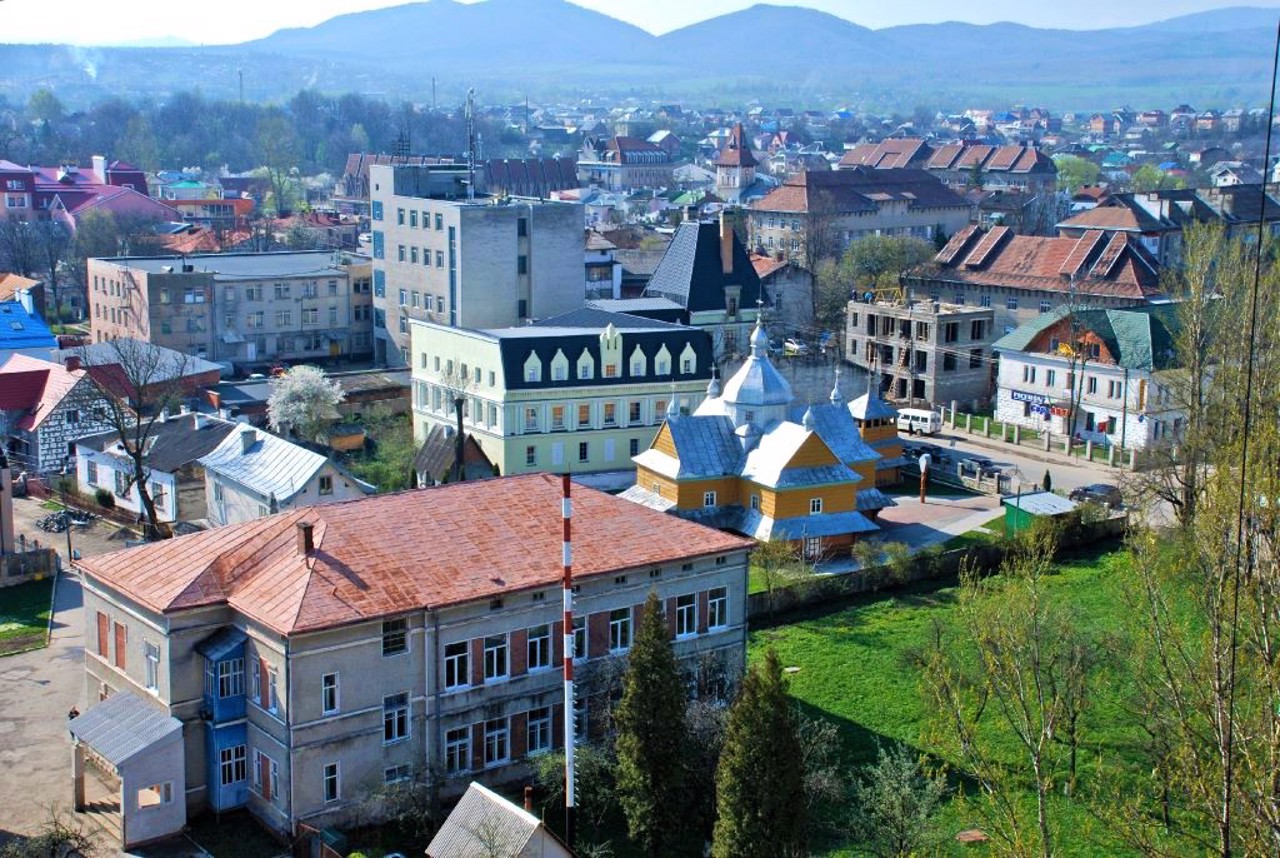
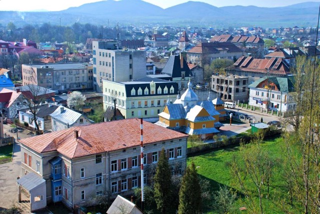
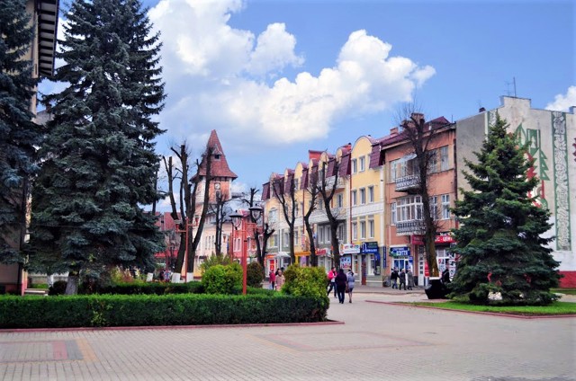
The large district center of Nadvirna is located on the right bank of the Bystrytsia-Nadvirnyanska River, between the mountains of Horodyshche and Potoky, 30 kilometers from Ivano-Frankivsk in the direction of Yaremche.
It is assumed that the city arose in the 16th century as a satellite settlement of the Pniv, where there was a castle of the great Kuropatvy landowners ("in the yard" of the Pniv). However, in the center of the current city there are ruins of an older castle of the 15th century, probably built on the site of an ancient Rus fortress.
Nadvirna was first mentioned in 1589, at that time it already had the status of a city. In the 17th and 18th centuries, due to its favorable location, trade and crafts developed here, and the city received Magdeburg righ ...
The large district center of Nadvirna is located on the right bank of the Bystrytsia-Nadvirnyanska River, between the mountains of Horodyshche and Potoky, 30 kilometers from Ivano-Frankivsk in the direction of Yaremche.
It is assumed that the city arose in the 16th century as a satellite settlement of the Pniv, where there was a castle of the great Kuropatvy landowners ("in the yard" of the Pniv). However, in the center of the current city there are ruins of an older castle of the 15th century, probably built on the site of an ancient Rus fortress.
Nadvirna was first mentioned in 1589, at that time it already had the status of a city. In the 17th and 18th centuries, due to its favorable location, trade and crafts developed here, and the city received Magdeburg rights. In 1601, the town hall was built.
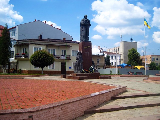
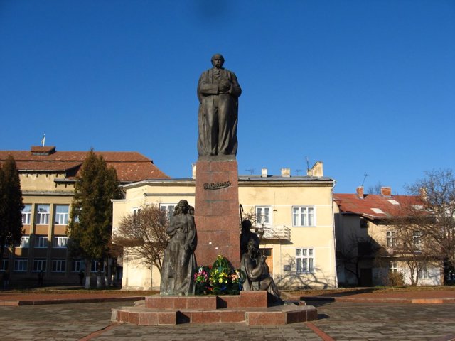
Until 1918, the city was under the rule of Austria-Hungary, which contributed to the development of the oil industry (an impressive 16-meter monument was installed). In 1919, the city was occupied by the Poles, against whom the units of the OUN acted. In 1939, the Soviet government was established, which led to further repressions. In Soviet times, industry developed.
Now it is a transit point on the tourist route to the Carpathians.
Великий райцентр Надвірна розташований на правому березі річки Бистриця-Надвірнянська, між горами Городище та Потоки, в 30 кілометрах від Івано-Франківська в бік Яремчі.
Припускають, що місто виникло в XVI сторіччі як як поселення-супутник Пніва, де був замок великих землевласників Куропатвів ( "на дворі" Пніва). Однак в центрі нинішнього міста є руїни більш давнього замку XV століття, ймовірно спорудженого на місці давньоруської фортеці.
Вперше Надвірна згадується в 1589 році, на той час вона вже мала статус міста. В XVII-XVIII століттях, завдяки вигідному розташуванню, тут активно розвивалася торгівля та ремесла, місто отримало Магдебурзьке право. В 1601 році була побудована ратуша.
До 1918 року місто перебувало під владою Австро-Угорщини, що посприяло розв ...
Великий райцентр Надвірна розташований на правому березі річки Бистриця-Надвірнянська, між горами Городище та Потоки, в 30 кілометрах від Івано-Франківська в бік Яремчі.
Припускають, що місто виникло в XVI сторіччі як як поселення-супутник Пніва, де був замок великих землевласників Куропатвів ( "на дворі" Пніва). Однак в центрі нинішнього міста є руїни більш давнього замку XV століття, ймовірно спорудженого на місці давньоруської фортеці.
Вперше Надвірна згадується в 1589 році, на той час вона вже мала статус міста. В XVII-XVIII століттях, завдяки вигідному розташуванню, тут активно розвивалася торгівля та ремесла, місто отримало Магдебурзьке право. В 1601 році була побудована ратуша.
До 1918 року місто перебувало під владою Австро-Угорщини, що посприяло розвитку нафтопромислу (встановлено ефектний 16-метровий пам'ятник). В 1919 році місто окупували поляки, проти яких діяли загони ОУН. В 1939 році була встановлена радянська влада, що призвело до чергових репресій. В радянські часи розвивалася промисловість.
Зараз це транзитний пункт на туристичному шляху до Карпат.
Сплануй своє перебування у Nadvirna
What to see and where to go in Nadvirna
Tourist attractions and museums of Nadvirna
Nadvirna Region History Museum
Museum / gallery
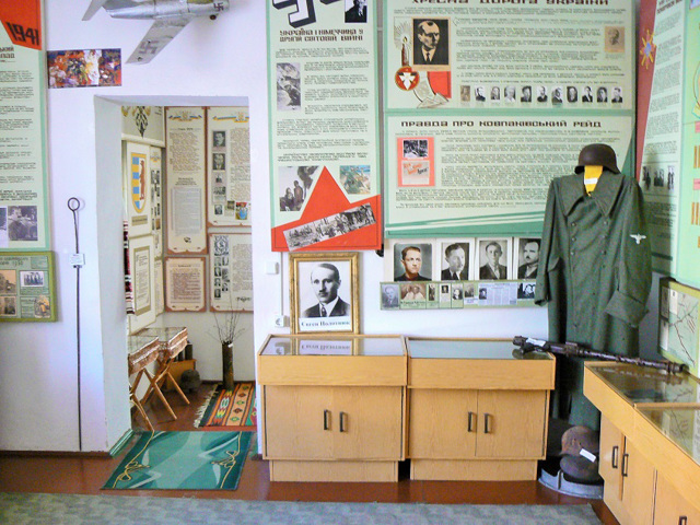
The Museum of the History of Nadvirna Region is located in a building built in the city center in 1939 and where the NKVD-KGB bodies were located.
The exposition occupies 14 rooms and has more than 6,000 exhibits.
In the basements of the museum, the conditions of the pre-trial detention center are recreated. Inscriptions made by residents of the region who were tortured by the NKVD were preserved on the walls of the prison cell.
Exaltation of Holy Cross Church
Temple , Architecture
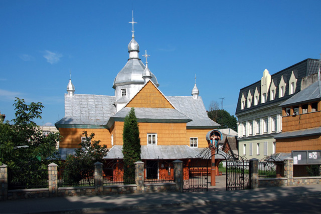
The wooden Church of the Exaltation of the Holy Cross was moved to Nadvirna from the Maniava Monastery, which was closed in 1793.
From that time, it bore the name of the Annunciation of the Most Holy Theotokos.
Rebuilt in 1840 by master Molot. It burned down during the First World War in 1914, but was restored in its original form.
The Exaltation of Holy Cross Church belongs to the Ukrainian Greek Catholic Church. It is a typical example of the Hutsul school of folk architecture.
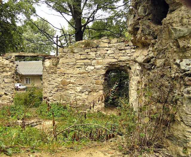
Nadvirna Castle
Castle / fortress
The ruins of the Nadvirna Castle are located in the Nadvirna City Park, behind the building of the Nadvirnya District Department of the Ministry of Internal Affairs.
At the time of the first mention of Nadvirna in 1589, the castle already existed. It is assumed that it was built by someone from the Potocki family. According to one version, after the castle was destroyed by Tatars at the end of the 16th century, the new owners from the Kuropatvy family moved their residence to Pniv.
In 2007, according to the district program for the protection of monuments, archaeological excavations began near the ruins of the castle tower.
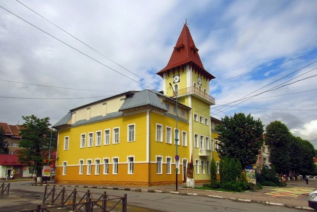
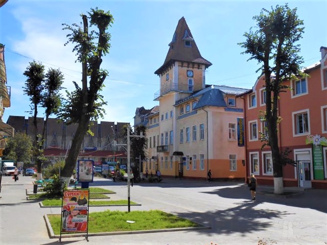
Nadvirna City Hall
Architecture , Visitor center
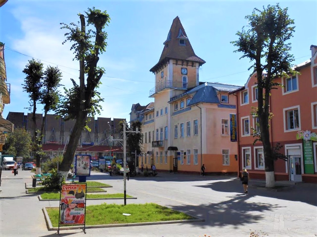
The city hall in Nadvirna was first built in 1601 to house the town government.
The magistrate then consisted of two boards, which consisted of elected officials who performed administrative-judicial functions. Viyt (chief magistrate) was appointed by the owner of the city.
In the 19th century, the Nadvirna City Hall was rebuilt and acquired its current appearance.
During Soviet times, the district cultural center was located in the town hall building. On the second floor is the Nadvirna Tourist Information Center.
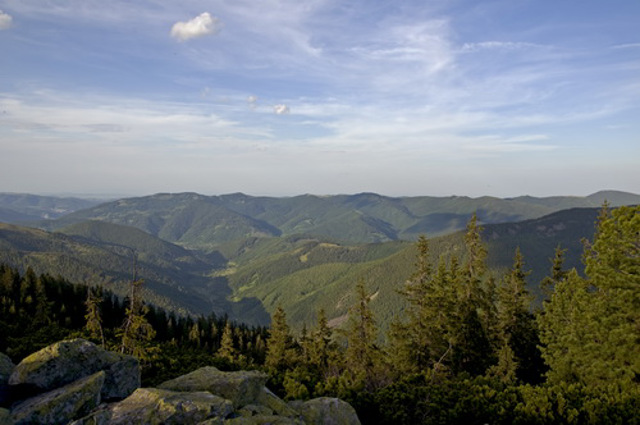
Nature Reserve "Gorgany"
Reserve
The nature reserve "Gorgany" was created to preserve the mountain landscapes of the central part of the Ukrainian Carpathians in their natural state.
The first European cedar pine reserve (previously this species was called cedar) in the Carpathians was created in the headwaters of the Limnytsia River near the village of Yasen in 1919. The current reserve "Gorgany" with an area of 5344.2 hectares was established in 1996. It included landscape reserves of national importance "Djurdzhi" and "Sadky", protected tracts "Chornyk", "Hnylyak", "Novobudova", "Elmy", "Dovzhynets", "Stoli".
The Gorgany Mountains occupy the central part of the Ukrainian Carpathians and are difficult to access due to very steep slopes and rocky outcrops. The reserve covers mountain slopes from 710 to 1754 meters above sea level (Mount Dovbushanka).
The uniqueness of the territory of the reserve is the high security of natural forests and primeval forests, which differ in the hardness of their natural structure. Coniferous forests dominate. Broad-leaved forests occupy approximately 1% of the area. Flora includes more than 450 species. 42 species of mammals and 104 species of birds are common on the territory of the reserve. Red deer, forest cat, brown bear and others are found.
Reviews Nadvirna
Geographical information about Nadvirna
| {{itemKey}} | {{itemValue}} |
|---|---|
| Region |
Ivano-Frankivsk |
