Functional temporarily unavailable
General information about Keleberda
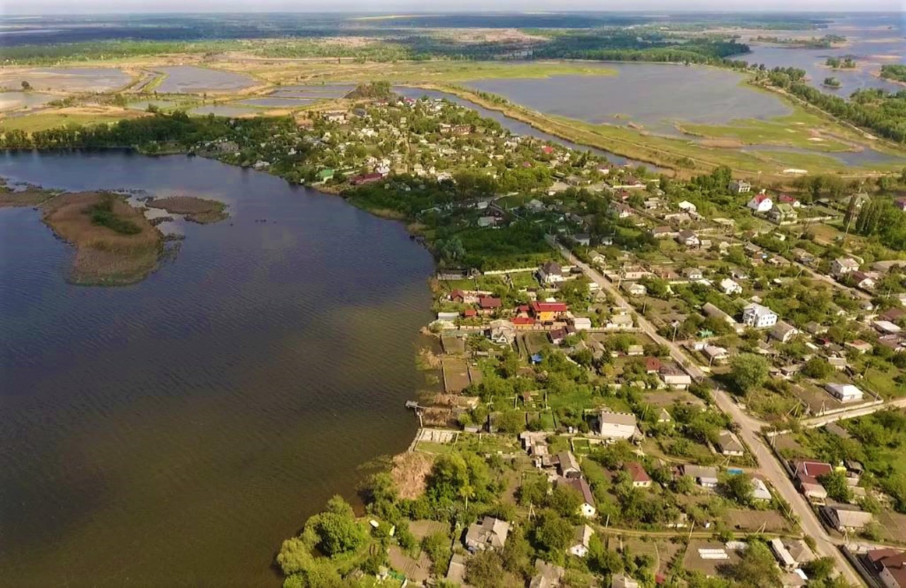
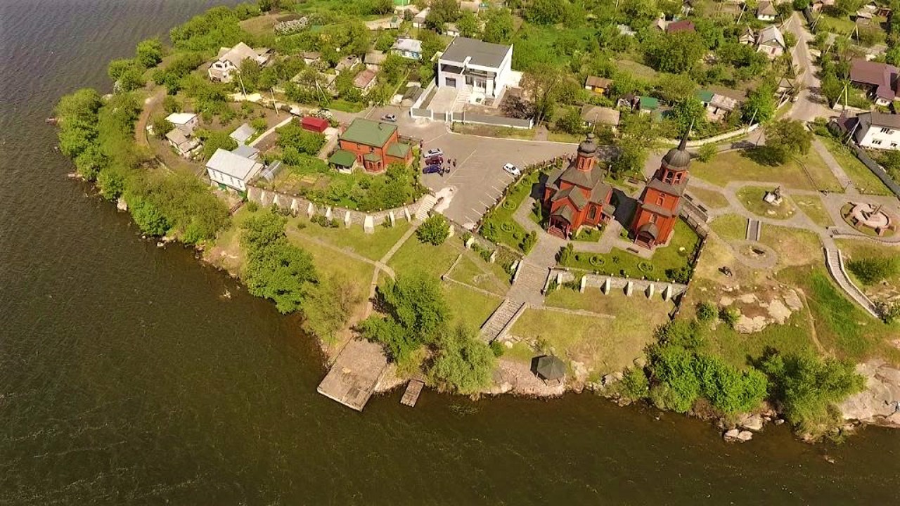
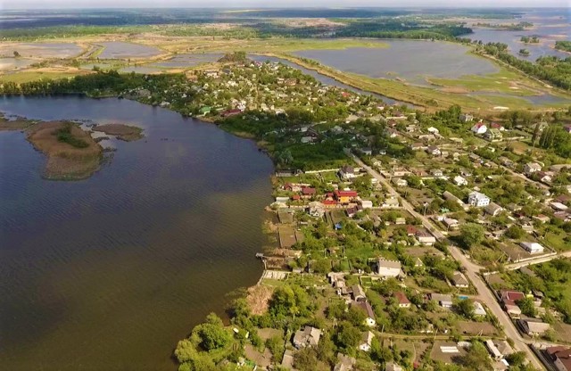
The village of Keleberda is located on the left bank of the Dnipro, on a rocky promontory south of Horishni Plavni.
A layer of light pink granite 3 billion years old protrudes to the surface here.
The settlement of Koroberda was first mentioned in 1646, although the geographical name Hereberdeev Rih is found even earlier. In 1660, Keleberda became the centenary center of the Poltava regiment, protecting the Dnipro crossing from the Tatars. In 1764, these lands became part of the Novorossiysk province.
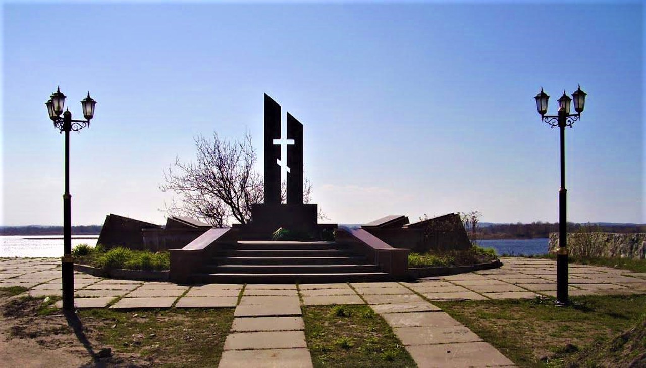
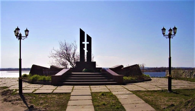
In 1943, in the area of the village of Keleberda, the troops of the 92nd Guards Rifle Division of the 37th Army of the Steppe Front forced the Dnipro, suffering heavy losses (an obelisk monument was ...
The village of Keleberda is located on the left bank of the Dnipro, on a rocky promontory south of Horishni Plavni.
A layer of light pink granite 3 billion years old protrudes to the surface here.
The settlement of Koroberda was first mentioned in 1646, although the geographical name Hereberdeev Rih is found even earlier. In 1660, Keleberda became the centenary center of the Poltava regiment, protecting the Dnipro crossing from the Tatars. In 1764, these lands became part of the Novorossiysk province.
In 1943, in the area of the village of Keleberda, the troops of the 92nd Guards Rifle Division of the 37th Army of the Steppe Front forced the Dnipro, suffering heavy losses (an obelisk monument was installed).
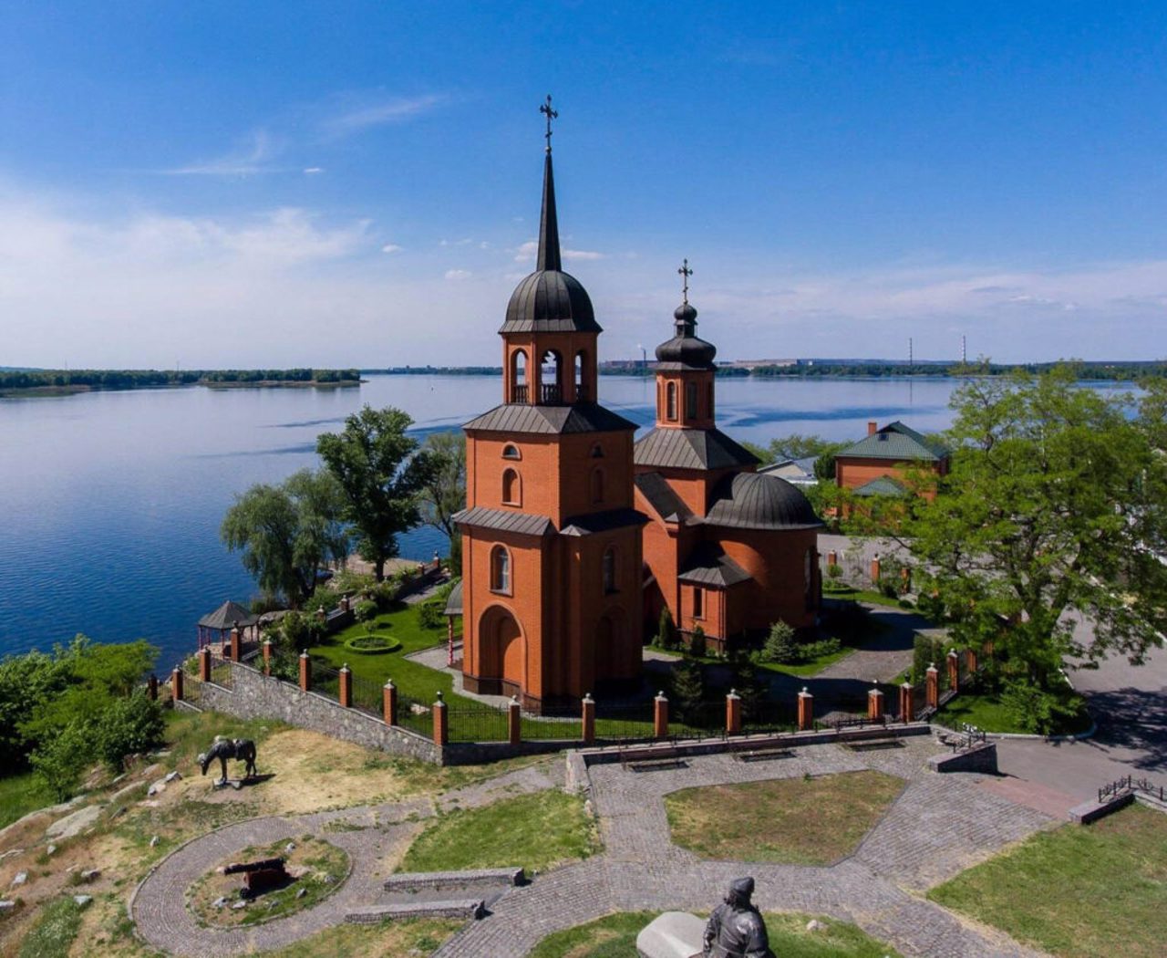
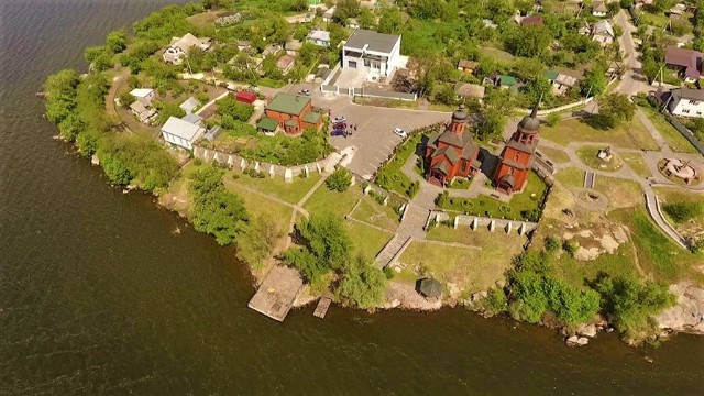
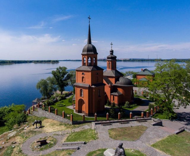
The Transfiguration Church was built on the edge of the cape in 2005. For the 200th anniversary of the birth of Mykola Hohol, a monument to Taras Bulba, the hero of the writer's work of the same name, was erected near the church.
Село Келеберда розташоване на лівому березі Дніпра, на скелястому мисі на південь від Горішніх Плавнів.
На поверхню тут виступає шар світло-рожевого граніту віком 3 мільярди років.
Вперше поселення Короберда згадується в 1646 році, хоча географічна назва Геребердєєв Ріг зустрічається і раніше. В 1660 році Келеберда стала сотенним центром в складі Полтавського полку, захищала Дніпровську переправу від татар. В 1764 році ці землі увійшли до складу Новоросійської губернії.
В 1943 році в районі села Келеберда війська 92-ї гвардійської стрілецької дивізії 37-ї армії Степового фронту форсували Дніпро, зазнавши великих втрат (встановлено пам'ятник-обеліск).
На краю мису в 2005 році зведено Преоб ...
Село Келеберда розташоване на лівому березі Дніпра, на скелястому мисі на південь від Горішніх Плавнів.
На поверхню тут виступає шар світло-рожевого граніту віком 3 мільярди років.
Вперше поселення Короберда згадується в 1646 році, хоча географічна назва Геребердєєв Ріг зустрічається і раніше. В 1660 році Келеберда стала сотенним центром в складі Полтавського полку, захищала Дніпровську переправу від татар. В 1764 році ці землі увійшли до складу Новоросійської губернії.
В 1943 році в районі села Келеберда війська 92-ї гвардійської стрілецької дивізії 37-ї армії Степового фронту форсували Дніпро, зазнавши великих втрат (встановлено пам'ятник-обеліск).
На краю мису в 2005 році зведено Преображенську церкву. До 200-річчя від дня народження Миколи Гоголя біля храму встановили пам'ятник Тарасу Бульбі, героєві однойменного твору письменника.
Сплануй своє перебування у Keleberda
What to see and where to go in Keleberda
Tourist attractions and museums of Keleberda
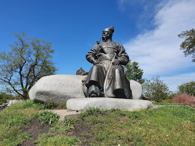
Taras Bulba Monument
Monument
A monument to Taras Bulba, the hero of Mykola Hohol's work of the same name, was erected in Keleberda to mark the 200th anniversary of the writer's birth.
The bronze sculpture depicts the Zaporizhzhian chieftain Bulba sitting on a stone with a pipe in his mouth on a high rocky promontory and looking thoughtfully at the wide expanse of the Dnipro. A horse grazes next to him, and a Cossack cannon stands nearby.
The authors of the sculptural composition are artist Volodymyr Chepelyk and his son, sculptor Oleksiy Chepelyk.
Nearby is the Transfiguration Church (2005) and a monument to the soldiers who died during the crossing of the Dnipro in 1943.
Reviews Keleberda
Geographical information about Keleberda
| {{itemKey}} | {{itemValue}} |
|---|---|
| Region |
Poltava |
