Functional temporarily unavailable
General information about Buky
The picturesque settlement Buky is located on the rocky banks of the Hirskyi Tikych River, 20 kilometers southeast of Mankivka.
It was first mentioned in official documents in 1592, when Yezhy Strus, a Galician castellan, bought it from the nobleman Fedir Bazanovych and built Strushorod Castle here. In 1604, Buky came into the possession of Elzhbeta Kalynovska, and 10 years later the village was completely destroyed by the Tatars. Soon it was restored, it received the status of a town.
During the Liberation War, a hundred Uman regiments were formed here. The development began in the 19th century under Prince Lyubomirskyi, when Buky became one of the centers of grain trade in the Kyiv region, a ...
The picturesque settlement Buky is located on the rocky banks of the Hirskyi Tikych River, 20 kilometers southeast of Mankivka.
It was first mentioned in official documents in 1592, when Yezhy Strus, a Galician castellan, bought it from the nobleman Fedir Bazanovych and built Strushorod Castle here. In 1604, Buky came into the possession of Elzhbeta Kalynovska, and 10 years later the village was completely destroyed by the Tatars. Soon it was restored, it received the status of a town.
During the Liberation War, a hundred Uman regiments were formed here. The development began in the 19th century under Prince Lyubomirskyi, when Buky became one of the centers of grain trade in the Kyiv region, a water mill was built.
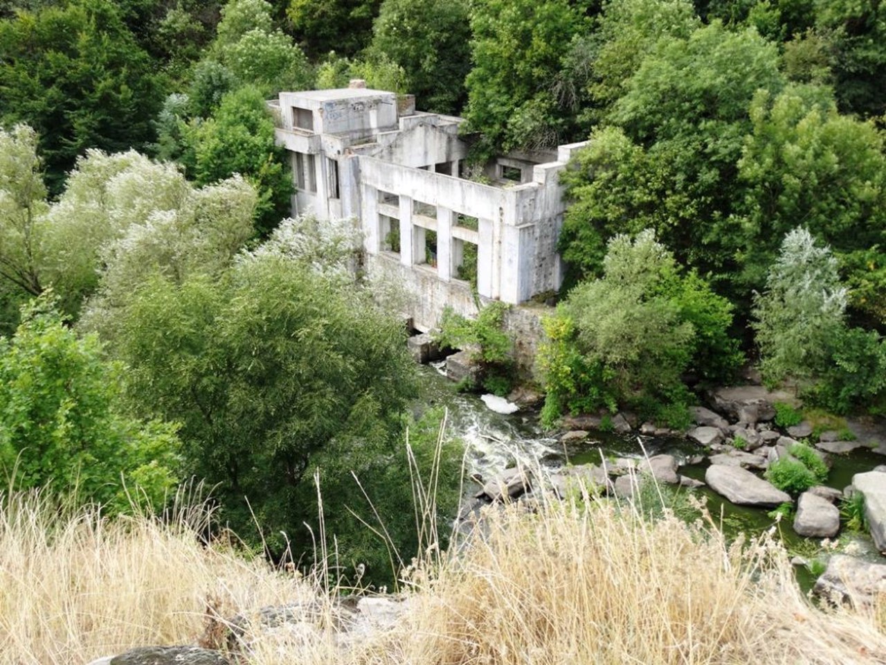
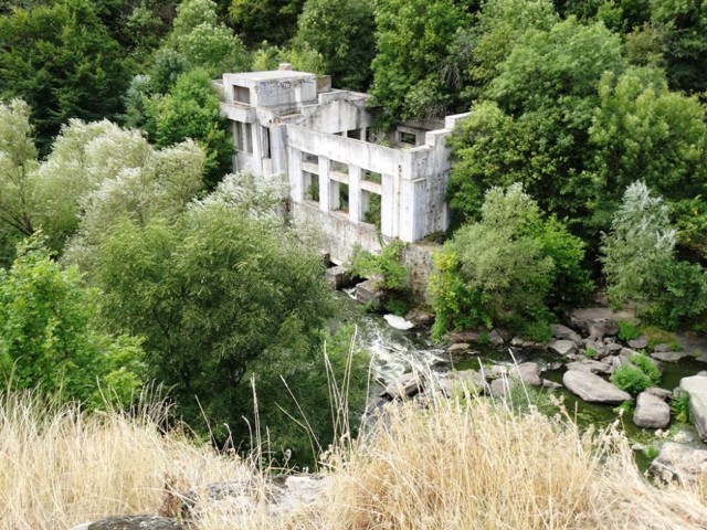
In 1929, the Buky small hydroelectric power plant was put into operation, according to Lenin's GOERLO electrification plan (it worked until 1965).
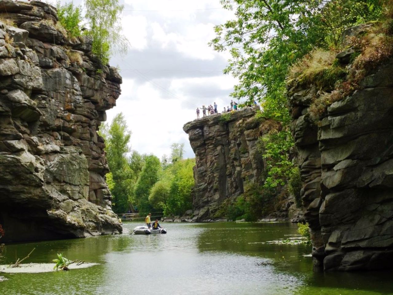
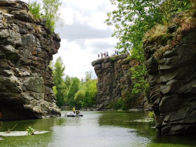
Now the village attracts tourists with a stunningly beautiful river canyon with steep rocky slopes more than 25 meters high and a loud two-meter waterfall-rolling Vyr.
Мальовничий селище Буки розташоване на скелястих берегах річки Гірський Тикич, в 20 кілометрах на південний схід від Маньківки.
Вперше згадується в офіційних документах в 1592 році, коли його купив у шляхтича Федора Базановича галицький кастелян Єжи Струсь і побудував тут замок Струсгород. В 1604 році Буки перейшли у володіння Ельжбети Каліновської, а вже через 10 років село повністю знищили татари. Незабаром його відновили, воно отримало статус містечка.
Під час Визвольної війни тут була створена сотня Уманського полку. Розвиток почався в XIX столітті за князя Любомирського, коли Буки стали одним із центрів хлібної торгівлі на Київщині, був побудований водяний млин.
В 1929 році стала до ладу Буцьк ...
Мальовничий селище Буки розташоване на скелястих берегах річки Гірський Тикич, в 20 кілометрах на південний схід від Маньківки.
Вперше згадується в офіційних документах в 1592 році, коли його купив у шляхтича Федора Базановича галицький кастелян Єжи Струсь і побудував тут замок Струсгород. В 1604 році Буки перейшли у володіння Ельжбети Каліновської, а вже через 10 років село повністю знищили татари. Незабаром його відновили, воно отримало статус містечка.
Під час Визвольної війни тут була створена сотня Уманського полку. Розвиток почався в XIX столітті за князя Любомирського, коли Буки стали одним із центрів хлібної торгівлі на Київщині, був побудований водяний млин.
В 1929 році стала до ладу Буцька мала ГЕС, згідно з ленінським планом електрифікації ГОЕРЛО (пропрацювала до 1965 року).
Зараз село приваблює туристів приголомшливо красивим річковим каньйоном з крутими скелястими схилами висотою понад 25 метрів і гучним двометровим водоспадом-перекатом Вир.
Сплануй своє перебування у Buky
What to see and where to go in Buky
Tourist attractions and museums of Buky
Buky Canyon (Vyr Waterfall)
Natural object , Rest on the water , Recreation area
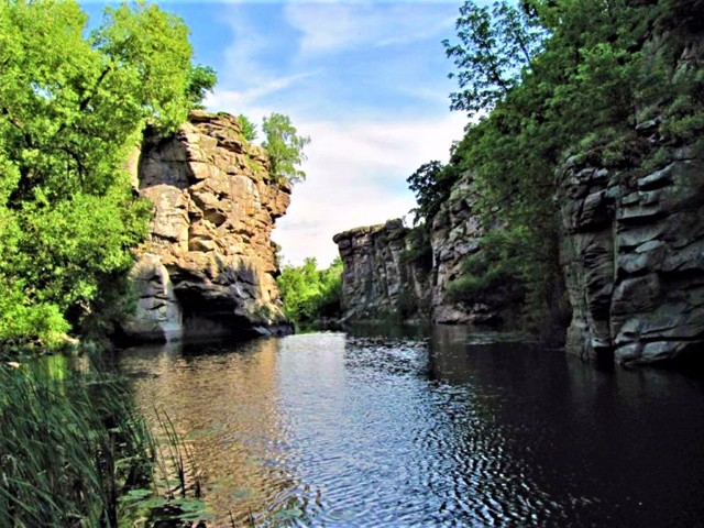
The extremely picturesque Buky Canyon in Cherkasy region is formed by the high rocky banks of the Hirsky Tykich river.
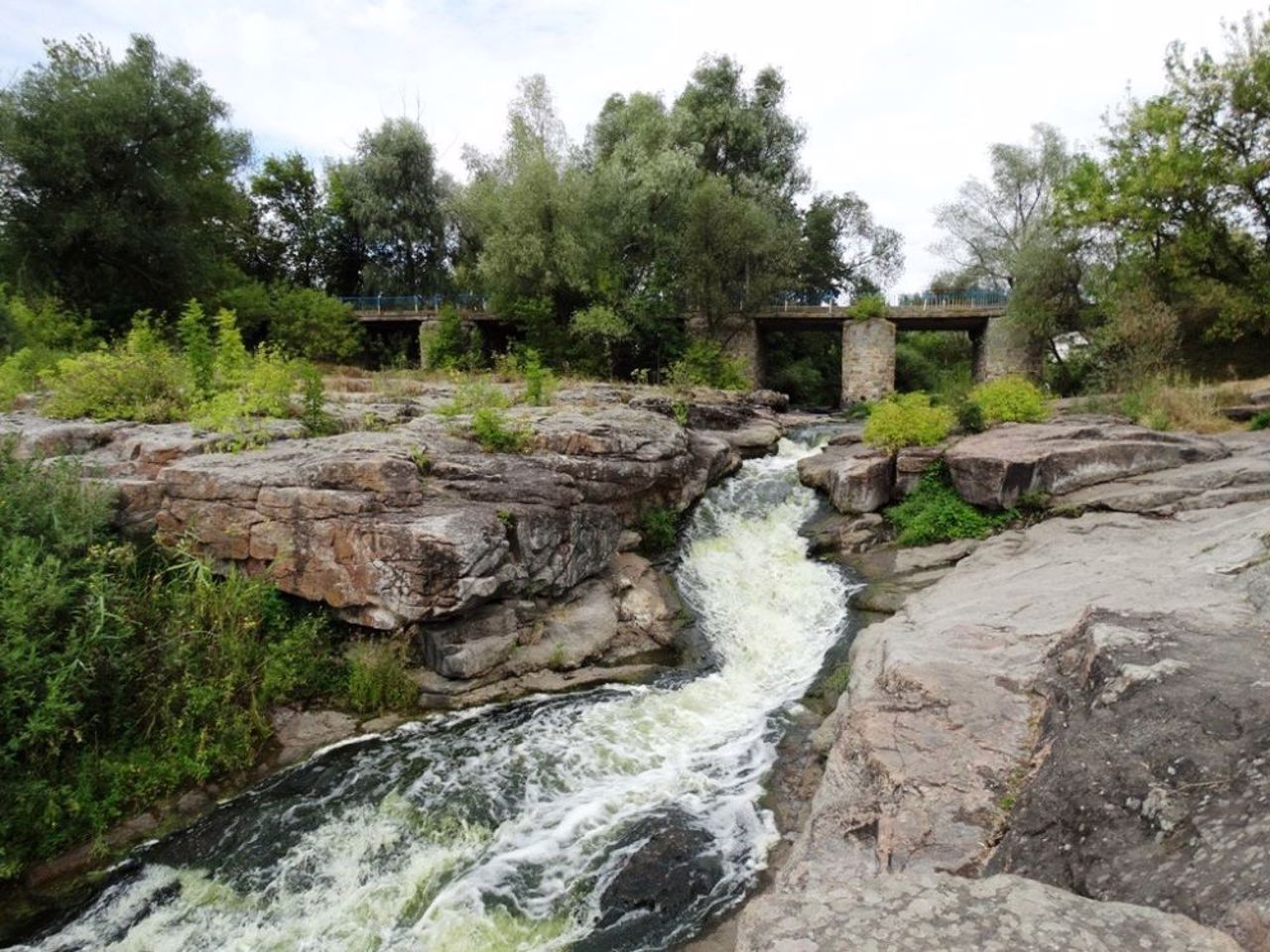
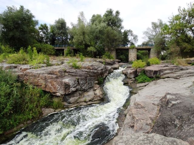
The river cut its channel in granite deposits, the age of which is about 2 billion years. The canyon is narrow (20-40 meters in places), deep (up to 20 meters), winding and long (about 1 kilometer). It starts from the artificial two-meter overturning of the former hydroelectric dam, which is called the Vyr waterfall.
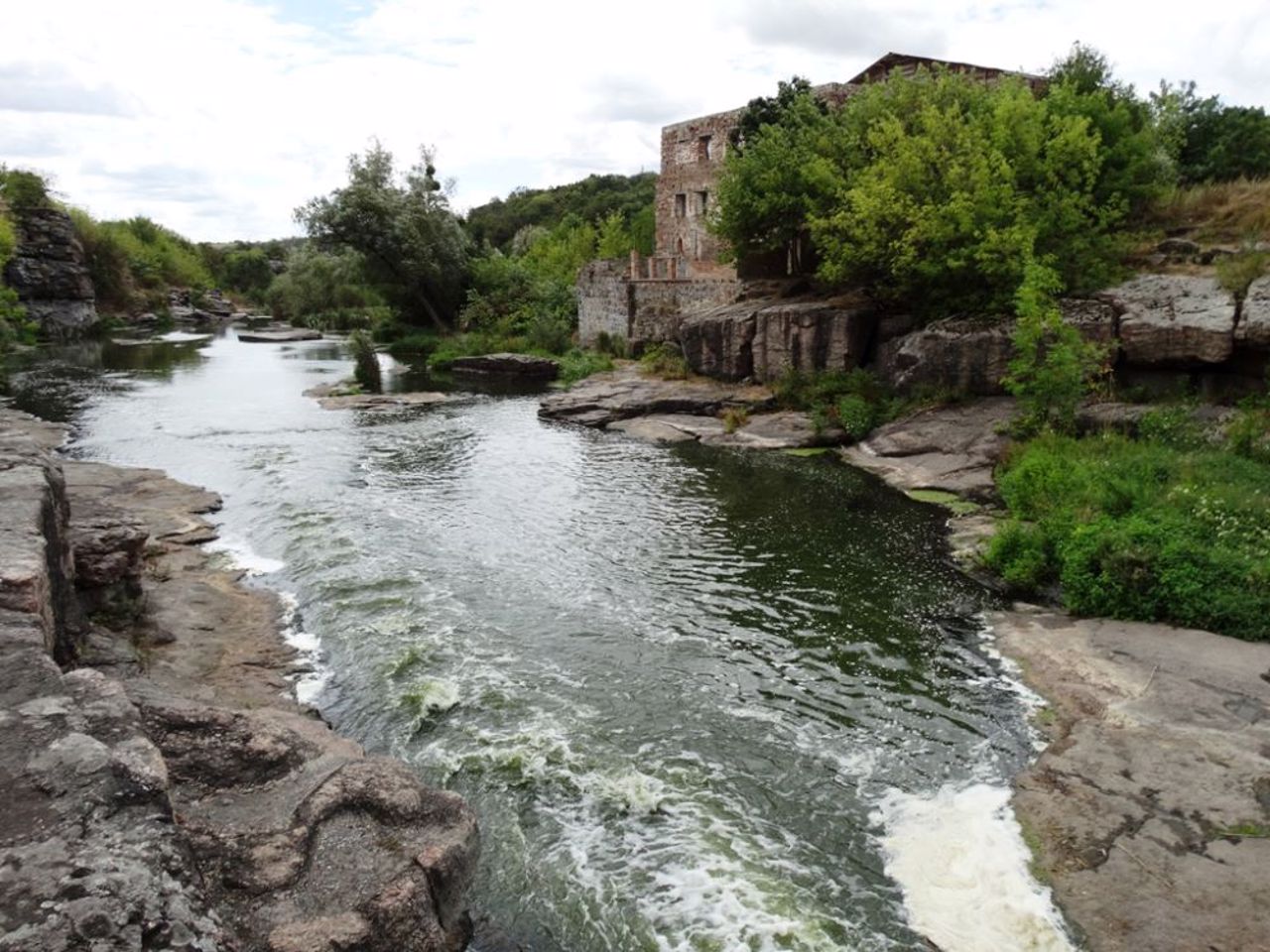
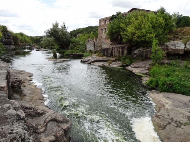
You can admire the rocky outcrops of the banks, between which the river runs along the rapids, in the center of the village of Buky, from the bridge over Hirsky Tykich.
The ruins of a 19th-century water mill and a hydroelectric power station from 1929 have been preserved.
Downstream is the Vyr itself - a deep place in the river bed, drilled by eddies. Next, you can find the most interesting place, where high sharp rocks very picturesquely hang directly over the water, creating a landscape that is completely uncharacteristic for central Ukraine, similar to a fjord.
There are convenient picnic areas along the entire length of Buky Canyon (there are many people on warm weekends).
Reviews Buky
Geographical information about Buky
| {{itemKey}} | {{itemValue}} |
|---|---|
| Region |
Cherkasy |
