Functional temporarily unavailable
Attractions of Ukraine
Attractions region
Attractions Kyiv region
Attractions Obukhiv district
Attractions Kruhlyk
Serpent's Wall (Great Khodosivka Hillfort)
Serpent's Wall (Great Khodosivka Hillfort), Kruhlyk
Historic area
General information about Serpent's Wall (Great Khodosivka Hillfort) (Kruhlyk)
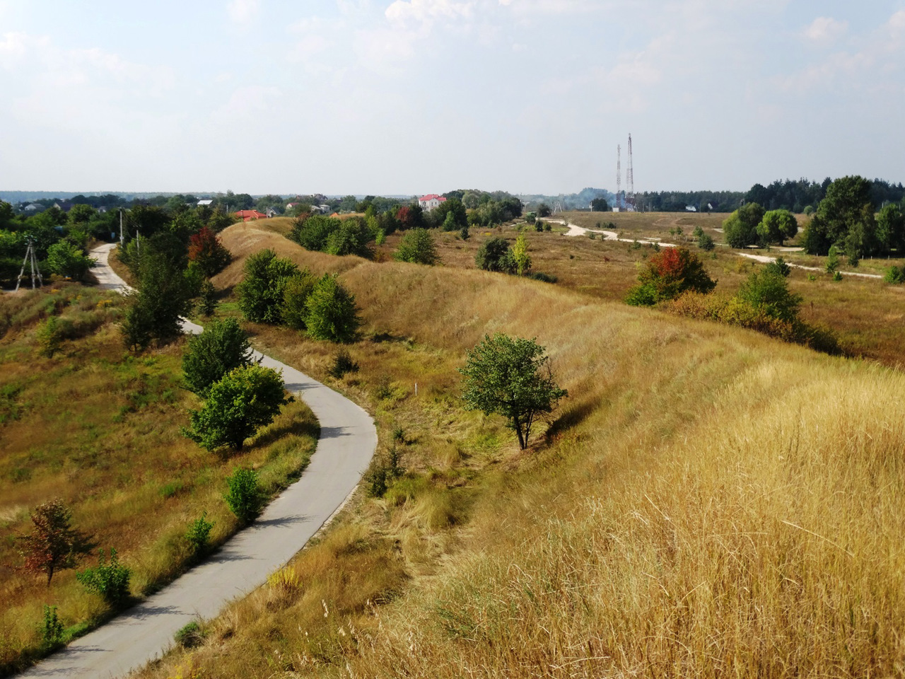
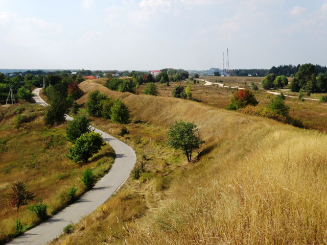
The Great Khodosivka Hillfort (Kruhlyk Settlement) is located on the southern outskirts of Kyiv between the villages of Khotiv, Lisnyki, Khodosivka, and Ivankovychi. Inside the settlement are the villages of Kruhlyk and Kremenishche.
This is one of the three giant hillforts of the forest-steppe of Ukraine, an archeological monument of national importance, which is part of the Khodosivka archaeological complex and is part of the Serpent's Wall system.
The settlement belongs to the early Iron Age (VI–V centuries BC). It was a settlement of Scythian ploughmen, surrounded by a protective rampart with a total length of 10-12 kilometers. Now this rampart has a height of up to 8 meters, in some places a defensive ditch can still be seen along it. In the days of Kyivan Rus ...
The Great Khodosivka Hillfort (Kruhlyk Settlement) is located on the southern outskirts of Kyiv between the villages of Khotiv, Lisnyki, Khodosivka, and Ivankovychi. Inside the settlement are the villages of Kruhlyk and Kremenishche.
This is one of the three giant hillforts of the forest-steppe of Ukraine, an archeological monument of national importance, which is part of the Khodosivka archaeological complex and is part of the Serpent's Wall system.
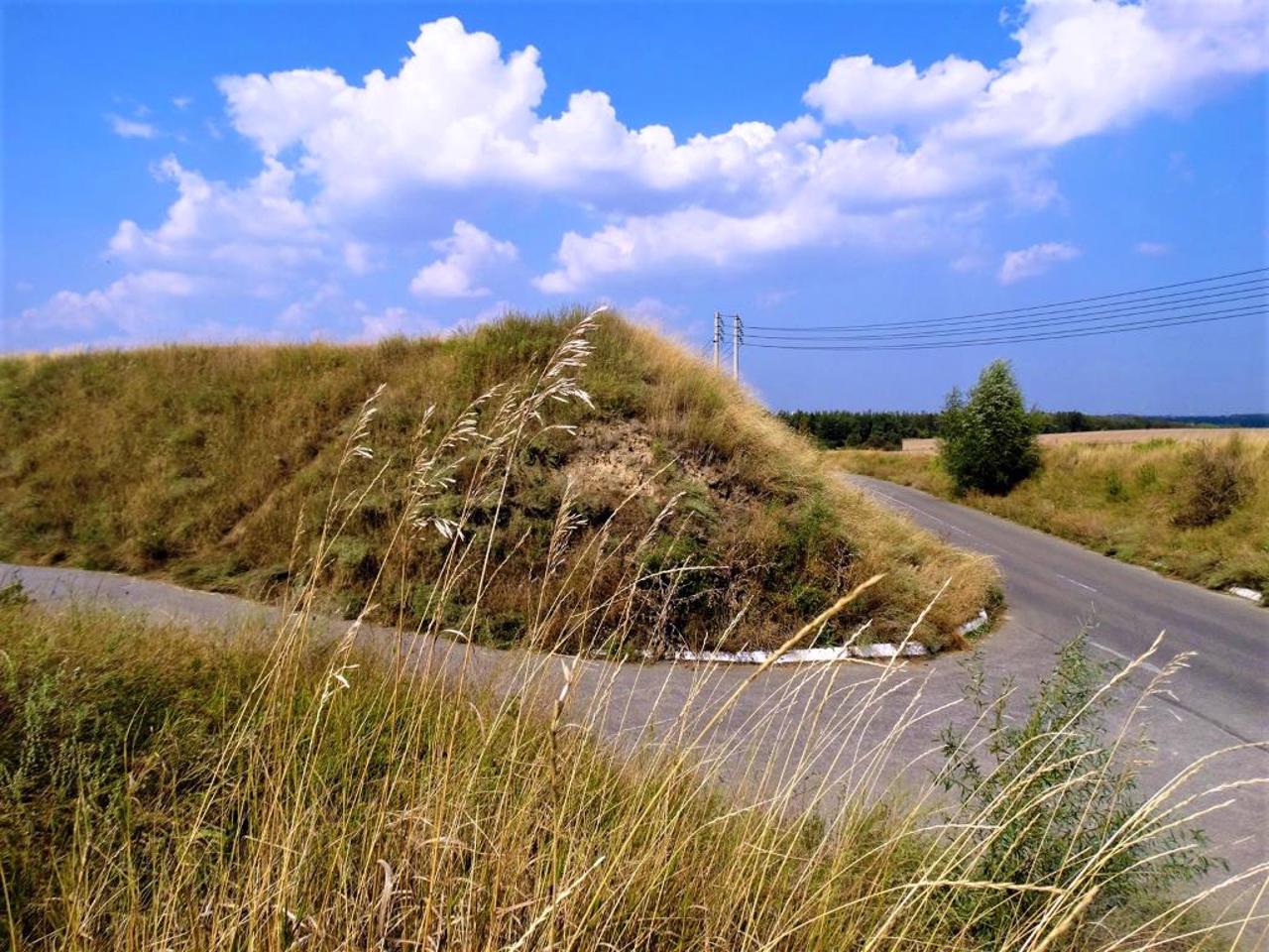
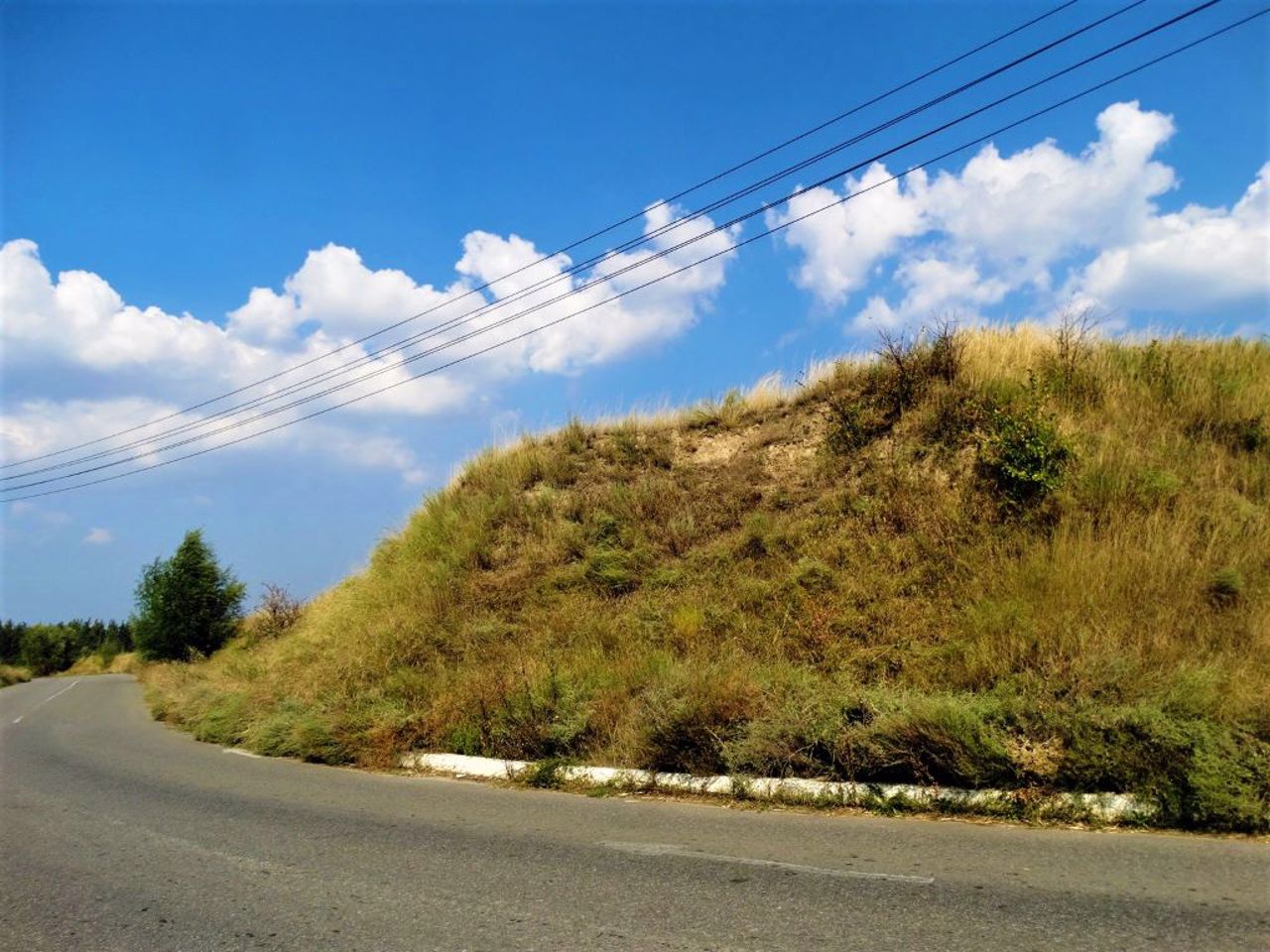
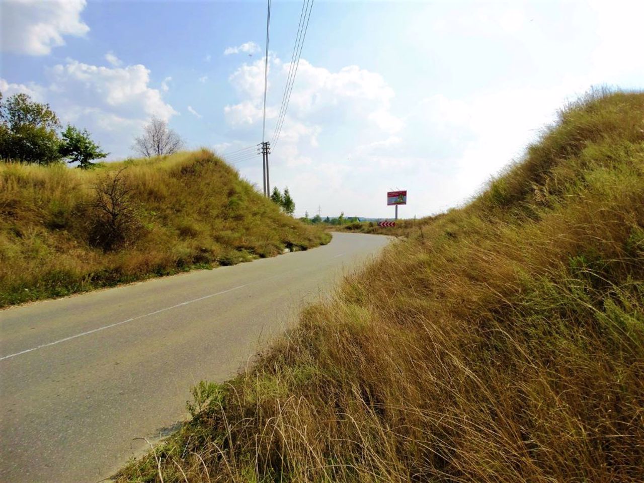
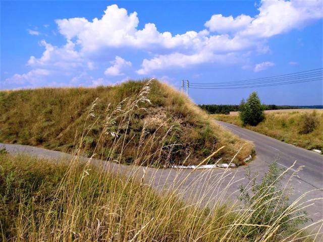
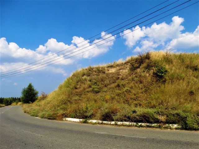
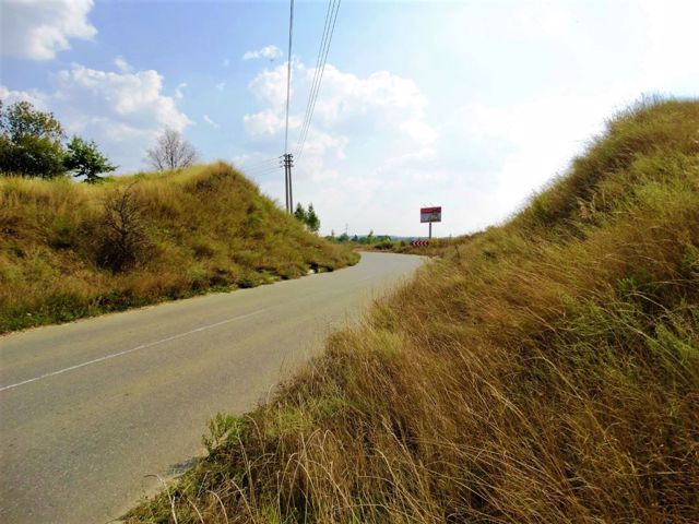
The settlement belongs to the early Iron Age (VI–V centuries BC). It was a settlement of Scythian ploughmen, surrounded by a protective rampart with a total length of 10-12 kilometers. Now this rampart has a height of up to 8 meters, in some places a defensive ditch can still be seen along it. In the days of Kyivan Rus', the rampart of the hillfort was built into the system of the Serpent's Wall (Zmiyevi valy) as the last line of defense in front of Kyiv.
The remnants of the Ancient Rus' system of earthen fortifications, located on the southern outskirts of Kyiv and in other places on the territory of the Middle Dnieper region, are called snake ramparts. Their total length, according to various estimates, reaches from 900 to 1500 kilometers. Presumably, the ramparts served to protect the southern borders of the Kyiv state from nomads. The history of their construction and functions have not been sufficiently studied.
The legend tells about the legendary hero Mykyta KozhemIaka, who harnessed the Zmiy Horynych (Slavic dragon, snake) to a plow and plowed giant furrows, from which the name of the wall came.
According to archaeologists, most of the Serpent's Wall were built in the X-XI centuries. Earth ramparts with wooden structures inside were up to 15 meters high, and were fortified with a wooden palisade along the crest. They formed a front in the direction of the steppe - to the south and southeast. At least 4,000 construction workers were to participate in the construction work, and the work could last about 4-5 years.
Fragments of the Serpent's Wall have been preserved along the tributaries of the Dnipro: Vita, Chervona, Stuhna, Trubizh, Sula, Ros and others. One of the best places to look is the section of the shaft on the road from Kruhlyk to Ivankovychi. There is a parking lot nearby. A wooden sign mistakenly indicates that these are Cossack ramparts of the 16th century.
Велике Ходосівське городище (городище Круглик) розташоване на південній околиці Києва між селами Хотів, Лісники, Ходосівка та Іванковичі.
Всередині городища знаходяться села Круглик і Кременище. Це одне з трьох городищ-гігантів лісостепу України, пам'ятка археології національного значення, що є частиною Ходосівського археологічного комплексу і входить до системи Змієвих валів.
Городище належить до ранньої залізної доби (VI–V століття до нашої ери). Це було поселення скіфів-орачів, оточене захисним валом загальною довжиною 10-12 кілометрів. Зараз цей вал має висоту до 8 метрів, у деяких місцях вздовж нього досі проглядається оборонний рів. В часи Київської Русі вал городища був вбудований у систему Змієвих валів як останній рубеж оборони перед Києвом.
Змієвими ...
Велике Ходосівське городище (городище Круглик) розташоване на південній околиці Києва між селами Хотів, Лісники, Ходосівка та Іванковичі.
Всередині городища знаходяться села Круглик і Кременище. Це одне з трьох городищ-гігантів лісостепу України, пам'ятка археології національного значення, що є частиною Ходосівського археологічного комплексу і входить до системи Змієвих валів.
Городище належить до ранньої залізної доби (VI–V століття до нашої ери). Це було поселення скіфів-орачів, оточене захисним валом загальною довжиною 10-12 кілометрів. Зараз цей вал має висоту до 8 метрів, у деяких місцях вздовж нього досі проглядається оборонний рів. В часи Київської Русі вал городища був вбудований у систему Змієвих валів як останній рубеж оборони перед Києвом.
Змієвими валами називають залишки давньоруської системи земляних фортифікаційних споруд, розташовані на південних околицях Києва та в інших місцях на території Середньої Наддніпрянщини. Їх загальна протяжність, за різними оцінками, сягає від 900 до 1500 кілометрів. Імовірно, вали служили для захисту південних рубежів Київської держави від кочівників. Історія їх спорудження та функції недостатньо досліджені.
Легенда оповідає про билинного героя Микиту Кожум'яку, який запряг у плуг Змія Горинича й проорав гігантські борозни, звідки пішла назва валів.
За оцінками археологів, більша частина Змієвих валів була зведена у X-XI століттях. Земляні вали з дерев'яними конструкціями всередині мали до 15 метрів заввишки, були укріплені дерев'яним частоколом вздовж гребеня. Створювалися фронтом у бік степу – на південь та південний схід. В будівельних роботах мали брати участь не менше 4000 будівельників, роботи могли тривати близько 4-5 років.
Фрагменти Змієвих валів збереглися вздовж приток Дніпра: Віта, Красна, Стугна, Трубіж, Сула, Рось та інших. Одним із найкращих місць для огляду є розріз валу по дорозі від Круглика до Іванковичів. Поруч облаштовано паркінг. Дерев'яний знак помилково вказує, що це козацькі вали XVI століття.
Practical information about Serpent's Wall (Great Khodosivka Hillfort) (Kruhlyk)
Last update
8/20/2025
| Categories | Historic area |
|---|---|
| Date of foundation | VI century BC – XI century AD |
| Address |
Ozerna Street
Kruhlyk |
| Coordinates |
50.280736° N, 30.449495° E
|
| Phone | , |
| Additional services |
Аccessibility information
Have you visited Serpent's Wall (Great Khodosivka Hillfort) in Kruhlyk?
Add practical or descriptive information, photos, links
What to see, where to go next?

