Functional temporarily unavailable
Maidan Konstytutsii, Kharkiv
Historic area
General information about Maidan Konstytutsii (Kharkiv)
The Maidan Konstytutsii arose at the same time as the Kharkiv Fortress and until the 19th century was called the Yarmarkova (Fair) Square (since 1659, the annual Assumption Fair was held here, which by the middle of the 19th century had become one of the largest in the country).
In winter, the square was a favorite place for sledding. Over time, the square was named Mykolaivska in honor of the church of the same name, which was located on it.
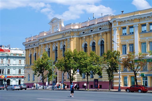
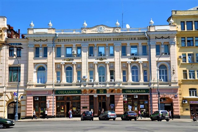
In the 19th century, the first brick buildings appeared on the square. In particular, the Noble Gathering, near which stood two cannons that were once armed with the Kharkiv fortress (not preserved). Opposite, according to the project of the architect Oleksiy Beketov, the following bank buildings were built: St. Petersburg International ...
The Maidan Konstytutsii arose at the same time as the Kharkiv Fortress and until the 19th century was called the Yarmarkova (Fair) Square (since 1659, the annual Assumption Fair was held here, which by the middle of the 19th century had become one of the largest in the country).
In winter, the square was a favorite place for sledding. Over time, the square was named Mykolaivska in honor of the church of the same name, which was located on it.
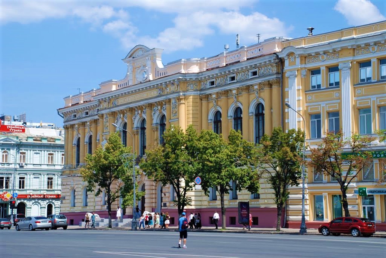
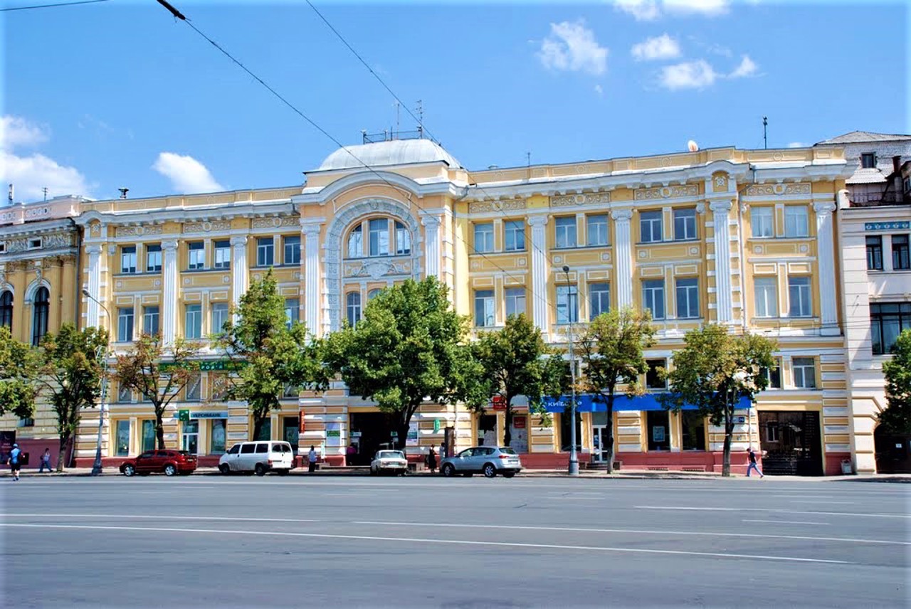
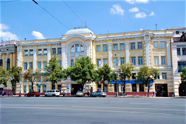
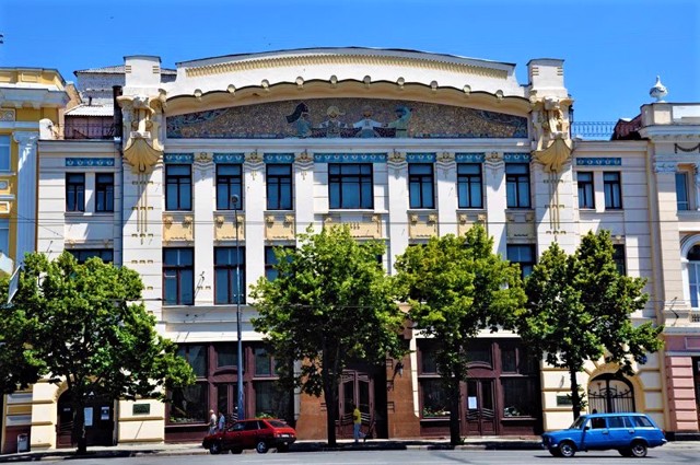
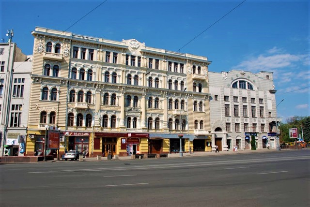
In the 19th century, the first brick buildings appeared on the square. In particular, the Noble Gathering, near which stood two cannons that were once armed with the Kharkiv fortress (not preserved). Opposite, according to the project of the architect Oleksiy Beketov, the following bank buildings were built: St. Petersburg International (building 22; now the Central branch of the Savings Bank), Volga-Kamsky (building 24; now the Puppet Theater), Moscow Merchant (building 26; now the House of Technology) and Zemelny (building 28 ; currently a motor vehicle technical school).
At the beginning of the 20th century, the building of the square was supplemented by the Metropol hotel, the multi-apartment residential building of the insurance company "Russia" (building 1/17; now the Labor Palace), the building of the Azov-Donskoy Bank (building 14; now "Ukrbiznesbank") and others.
In 1919, Mykolaiv Square was named after Moisei Tevelev, a member of the Kharkiv underground regional committee of the CP(b)U. In Soviet times, the stock exchange building and the Mykolaiv Church were demolished to make way for a tram line.
During the Second World War, many buildings were destroyed. After the liberation of the city, the people of Kharkiv restored the Maidan, including the Beckett houses. For a long time, the square had the name of the revolutionary Tevelev, then - Soviet Ukraine. Since 1996 - Maidan Konstytutsii.
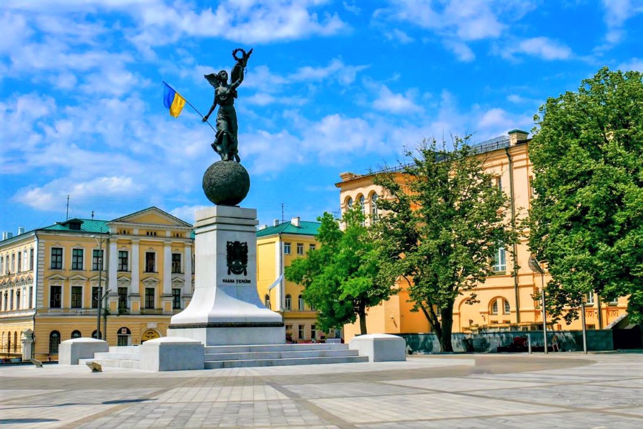
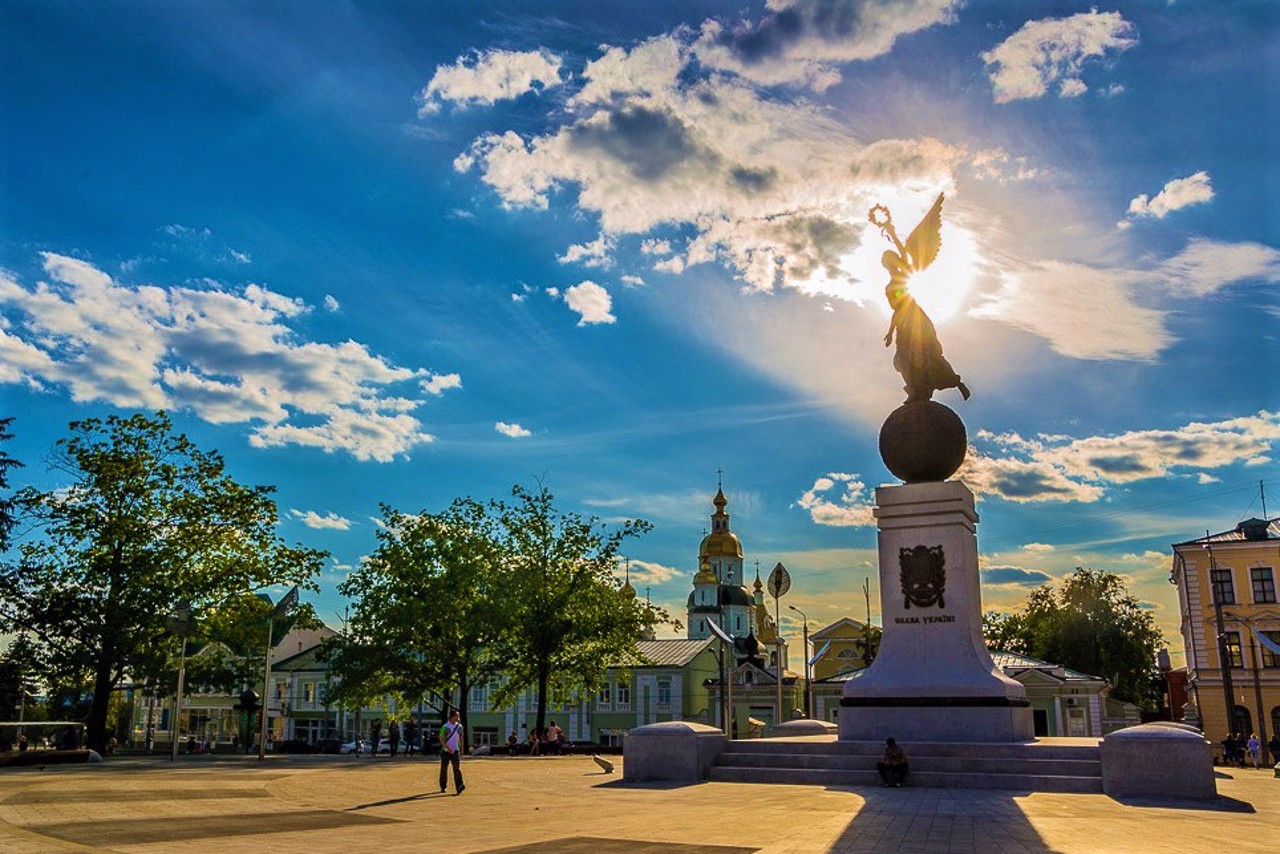
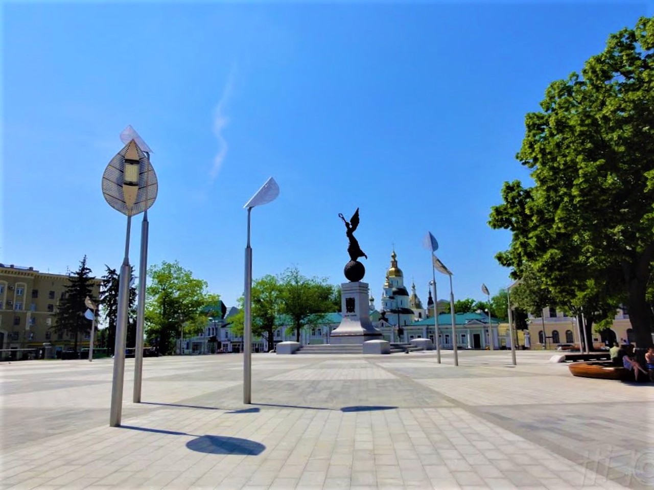
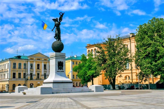
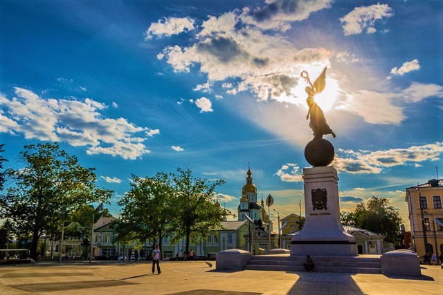
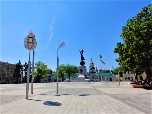
In 2012, the Monument to the Independence of Ukraine was opened in the center of the Maidan Konstytutsii, created by Kharkiv sculptors Oleksandr Ridnyi and Hanna Ivanova.
On March 2, 2022, during the battles for Kharkiv during the Russian-Ukrainian war, the Maidan Konstytutsii in Kharkiv was fired upon by the Russian army. The Palace of Labor was severely damaged. Buildings adjacent to it were damaged, in particular, an adjacent residential building, the building of the Kharkiv City Council, and others.
Майдан виник одночасно з Харківською фортецею та до XIX століття називався Ярмарковою площею (з 1659 року тут проходив щорічний Успенський ярмарок, що до середини XIX століття став одним з найбільших в країні).
Взимку площа була улюбленим місцем катання на санях. З часом площа отримала назву Миколаївської на честь однойменної церкви, яка розташовувалась на ній.
В ХІХ столітті на майдані з'явилися перші муровані будівлі. Зокрема, Дворянське зібрання, біля якого стояли дві гармати, що колись перебували на озброєнні Харківської фортеці (не збереглися). Навпроти за проєктом архітектора Олексія Бекетова були споруджені будівлі банків: Петербурзького міжнародного (будинок 22; нині Центральне відділення Ощадбанку), Волзько-Камського (будинок 24; нині Театр ляльок), Московського ...
Майдан виник одночасно з Харківською фортецею та до XIX століття називався Ярмарковою площею (з 1659 року тут проходив щорічний Успенський ярмарок, що до середини XIX століття став одним з найбільших в країні).
Взимку площа була улюбленим місцем катання на санях. З часом площа отримала назву Миколаївської на честь однойменної церкви, яка розташовувалась на ній.
В ХІХ столітті на майдані з'явилися перші муровані будівлі. Зокрема, Дворянське зібрання, біля якого стояли дві гармати, що колись перебували на озброєнні Харківської фортеці (не збереглися). Навпроти за проєктом архітектора Олексія Бекетова були споруджені будівлі банків: Петербурзького міжнародного (будинок 22; нині Центральне відділення Ощадбанку), Волзько-Камського (будинок 24; нині Театр ляльок), Московського купецького (будинок 26; нині Будинок техніки) та Земельного (будинок 28 ; нині автотранспортний технікум).
На початку XX століття забудову площі доповнив готель "Метрополь", багатоквартирний житловий будинок страхового товариства "Росія" (будинок 1/17; нині Палац праці), будівля Азовсько-Донського банку (будинок 14; нині "Укрбізнесбанк") та інші.
В 1919 році Миколаївську площу назвали ім'ям члена Харківського підпільного обкому КП(б)У Мойсея Тевелєва. За радянських часів для прокладання трамвайної колії було знесено будівлю біржі та Миколаївську церкву.
Під час Другої світової війни багато будівель було зруйновано. Після звільнення міста харків'яни відновили майдан, зокрема бекетівські будинки. Довгий час площа мала ім'я революціонера Тевелєва, потім - Радянської України. З 1996 року - майдан Конституції.
В 2012 році в центрі майдану Конституції відкрили Монумент на честь Незалежності України, авторами якого є харківські скульптори Олександр Рідний та Ганна Іванова.
2 березня 2022 року, під час боїв за Харків в ході російсько-української війни, майдан Конституції в Харкові був обстріляний російською армією. Сильних руйнувань зазнав Палац праці. Постраждали сусідні до нього будівлі, зокрема прилеглий житловий будинок, будівля міської ради Харкова та інші.
Practical information about Maidan Konstytutsii (Kharkiv)
Last update
4/14/2025
| Categories | Historic area |
|---|---|
| Date of foundation | 1659 |
| Address |
maidan Konstytutsii
Kharkiv |
| Coordinates |
49.99222222° N, 36.23138889° E
|
| Additional services |
Аccessibility information
Have you visited Maidan Konstytutsii in Kharkiv?
Add practical or descriptive information, photos, links
What to see, where to go next?

