Functional temporarily unavailable
Novoplanivsky Bridge, Kamyanets-Podilskyi
Architecture
General information about Novoplanivsky Bridge (Kamyanets-Podilskyi)
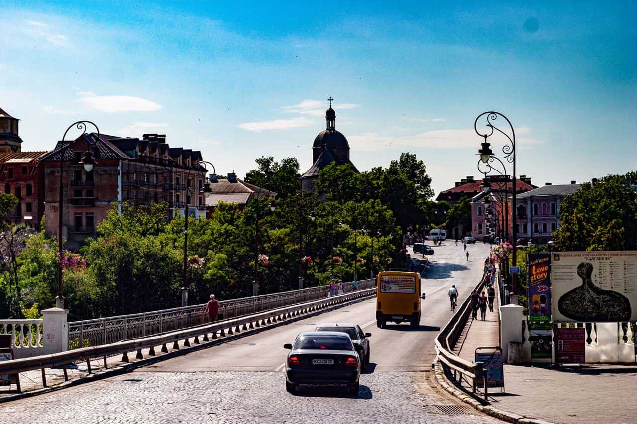
The Novoplanivsky Bridge in Kamyanets-Podilskyi connects the Old Town with the so-called "Noviy Plan" - the current administrative center of the city.
In the middle of the 19th century, when the provincial center of Kamyanets-Podilskyi, with the growth of the population and the bureaucratic apparatus, became cramped within the medieval walls, the idea of expanding the city beyond the Smotrych Canyon arose. The decision was made in 1859 during the visit of the Russian Emperor Oleksandr II, who was fascinated by the view of the city from the hill near where the Oleksandr Nevsky Cathedral is now located. Five years later, construction began, and in 1872, the Novoplaniv bridge with a wooden deck on stone b ...
The Novoplanivsky Bridge in Kamyanets-Podilskyi connects the Old Town with the so-called "Noviy Plan" - the current administrative center of the city.
In the middle of the 19th century, when the provincial center of Kamyanets-Podilskyi, with the growth of the population and the bureaucratic apparatus, became cramped within the medieval walls, the idea of expanding the city beyond the Smotrych Canyon arose. The decision was made in 1859 during the visit of the Russian Emperor Oleksandr II, who was fascinated by the view of the city from the hill near where the Oleksandr Nevsky Cathedral is now located. Five years later, construction began, and in 1872, the Novoplaniv bridge with a wooden deck on stone bulls was put into operation.
Simultaneously with the laying of the bridge, the city gardener Severyn Kovalsky laid out a park.
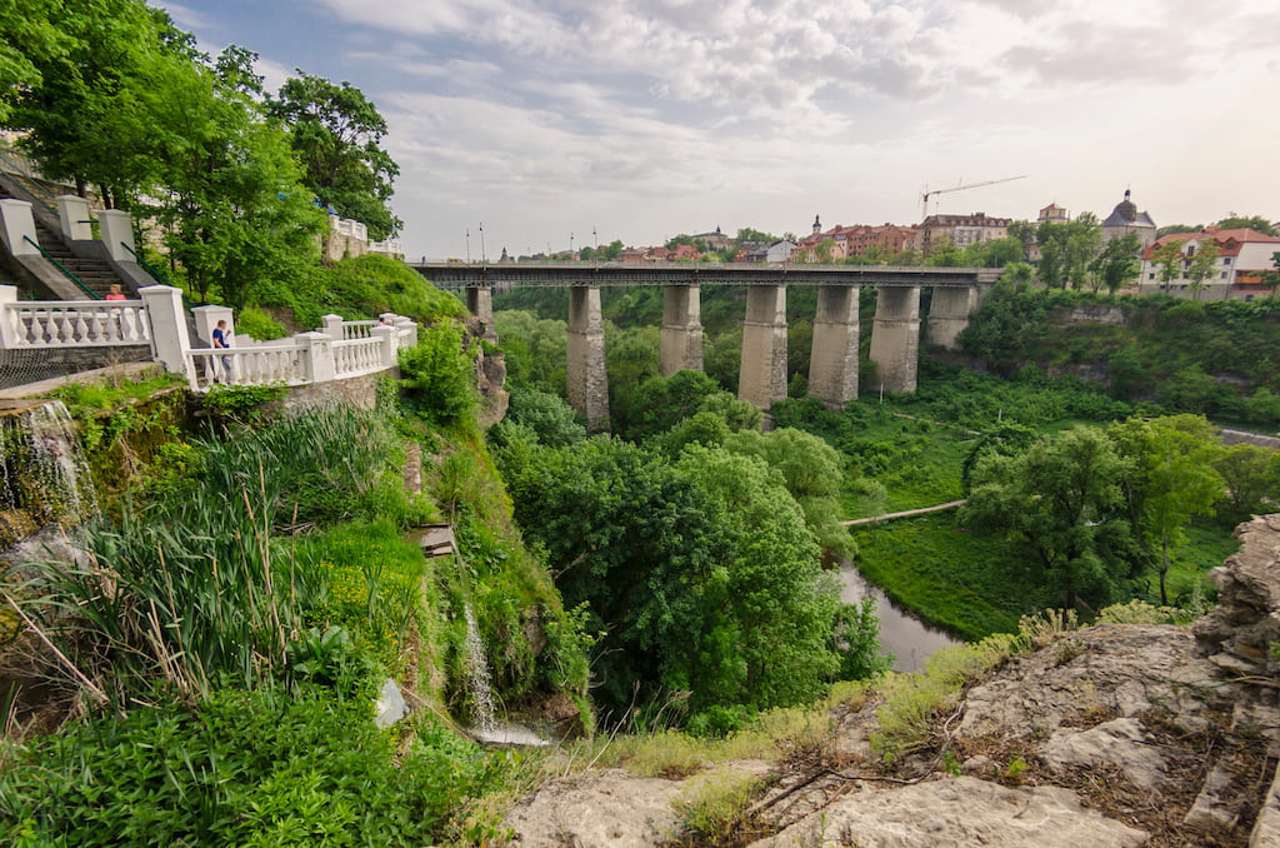
From the Novoplanivsky bridge over the deep canyon of Smotrych, a breathtaking view of the medieval towers and walls of Kamyanets-Podilskyi, rocks above the ribbon of the river with a natural waterfall and a park with figures of deer on the hills and stones opens up.
Новопланівський міст у Кам'янці-Подільському з'єднує Старе місто з так званим "Новим планом" – нинішнім адміністративним центром міста.
В середині ХІХ століття, коли губернському центру Кам'янцю-Подільському зі зростанням населення та чиновницького апарату стало тісно у середньовічних стінах, виникла ідея розширення міста за межі каньйону Смотрича. Рішення було прийнято в 1859 році під час візиту російського імператора Олександра II, який був зачарований видом на місто з пагорба неподалік того місця, де зараз розташований собор Олександра Невського. Через п'ять років почалося будівництво, і в 1872 році Новопланівський міст з дерев'яним настилом на кам'яних биках був введен ...
Новопланівський міст у Кам'янці-Подільському з'єднує Старе місто з так званим "Новим планом" – нинішнім адміністративним центром міста.
В середині ХІХ століття, коли губернському центру Кам'янцю-Подільському зі зростанням населення та чиновницького апарату стало тісно у середньовічних стінах, виникла ідея розширення міста за межі каньйону Смотрича. Рішення було прийнято в 1859 році під час візиту російського імператора Олександра II, який був зачарований видом на місто з пагорба неподалік того місця, де зараз розташований собор Олександра Невського. Через п'ять років почалося будівництво, і в 1872 році Новопланівський міст з дерев'яним настилом на кам'яних биках був введений в експлуатацію.
Одночасно із закладкою мосту міським садівником Северином Ковальським було розбито парк.
З Новопланівського мосту над глибоким канйоном Смотрича відкривається захоплюючий вид на середньовічні вежі та стіни Кам'янця-Подільського, скелі над стрічкою річки з природним водоспадиком та парк із фігурами оленів на пагорбах та камінні.
Practical information about Novoplanivsky Bridge (Kamyanets-Podilskyi)
Last update
5/29/2025
| Categories | Architecture |
|---|---|
| Date of foundation | 1864 |
| Address |
Knyaziv Koriatovychiv Street
Kamyanets-Podilskyi |
| Coordinates |
48.67782° N, 26.57757° E
|
| Additional services |
Аccessibility information
Have you visited Novoplanivsky Bridge in Kamyanets-Podilskyi?
Add practical or descriptive information, photos, links
Novoplanivsky Bridge (Kamyanets-Podilskyi) in photos and videos
What to see, where to go next?


