Functional temporarily unavailable
Attractions of Ukraine
Attractions region
Attractions Kharkiv region
Attractions Lozova district
Attractions Oleksiivka
Oleksiyivska Fortress (Saint Oleksiy Fortress)
Oleksiyivska Fortress (Saint Oleksiy Fortress), Oleksiivka
Castle / fortress
General information about Oleksiyivska Fortress (Saint Oleksiy Fortress) (Oleksiivka)
The Oleksiyivska Fortress of the Ukrainian Defense Line was built in 1831, during the second stage of the construction of the line of fortifications on the then southern borders of the Russian Empire.
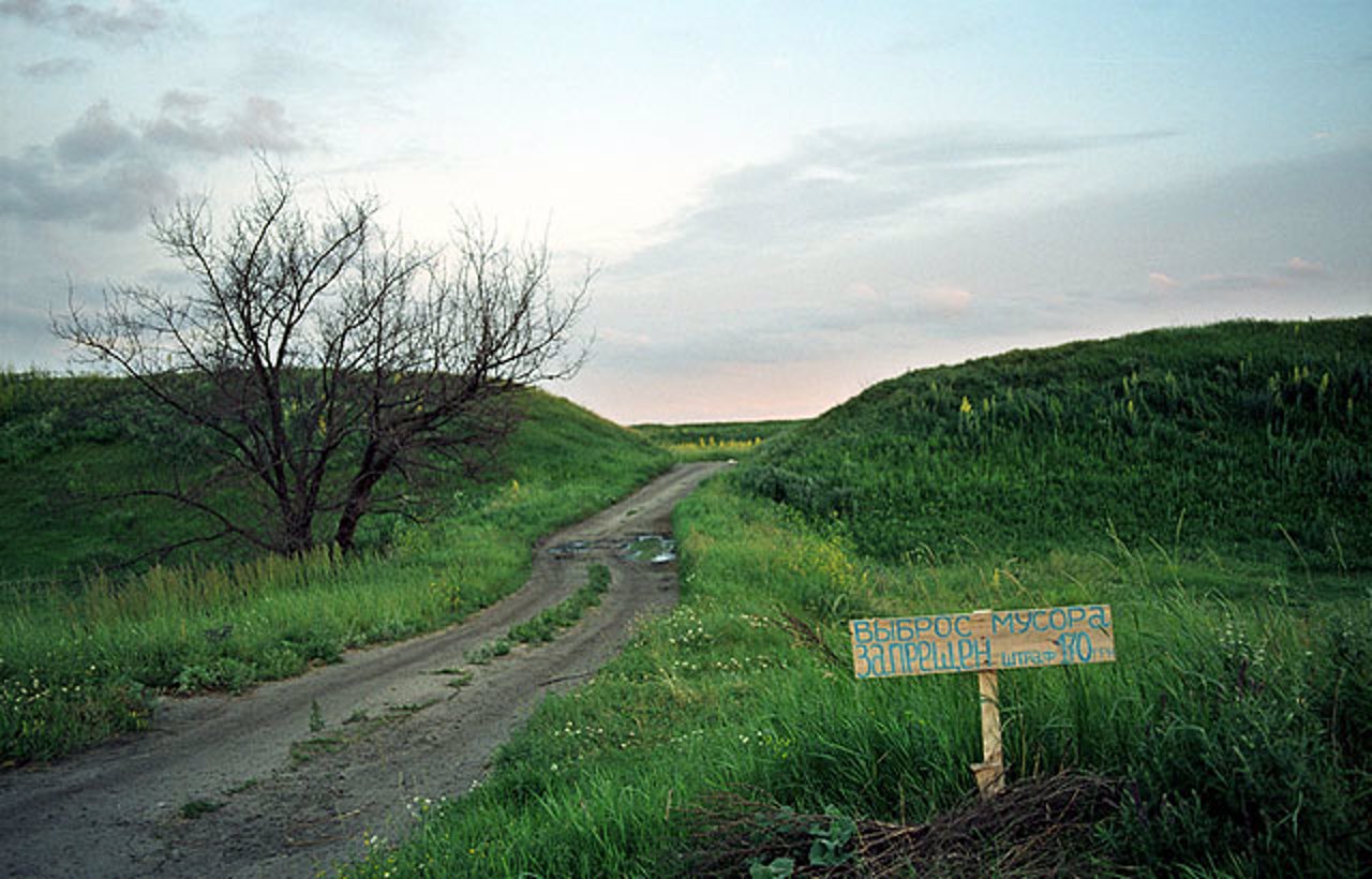
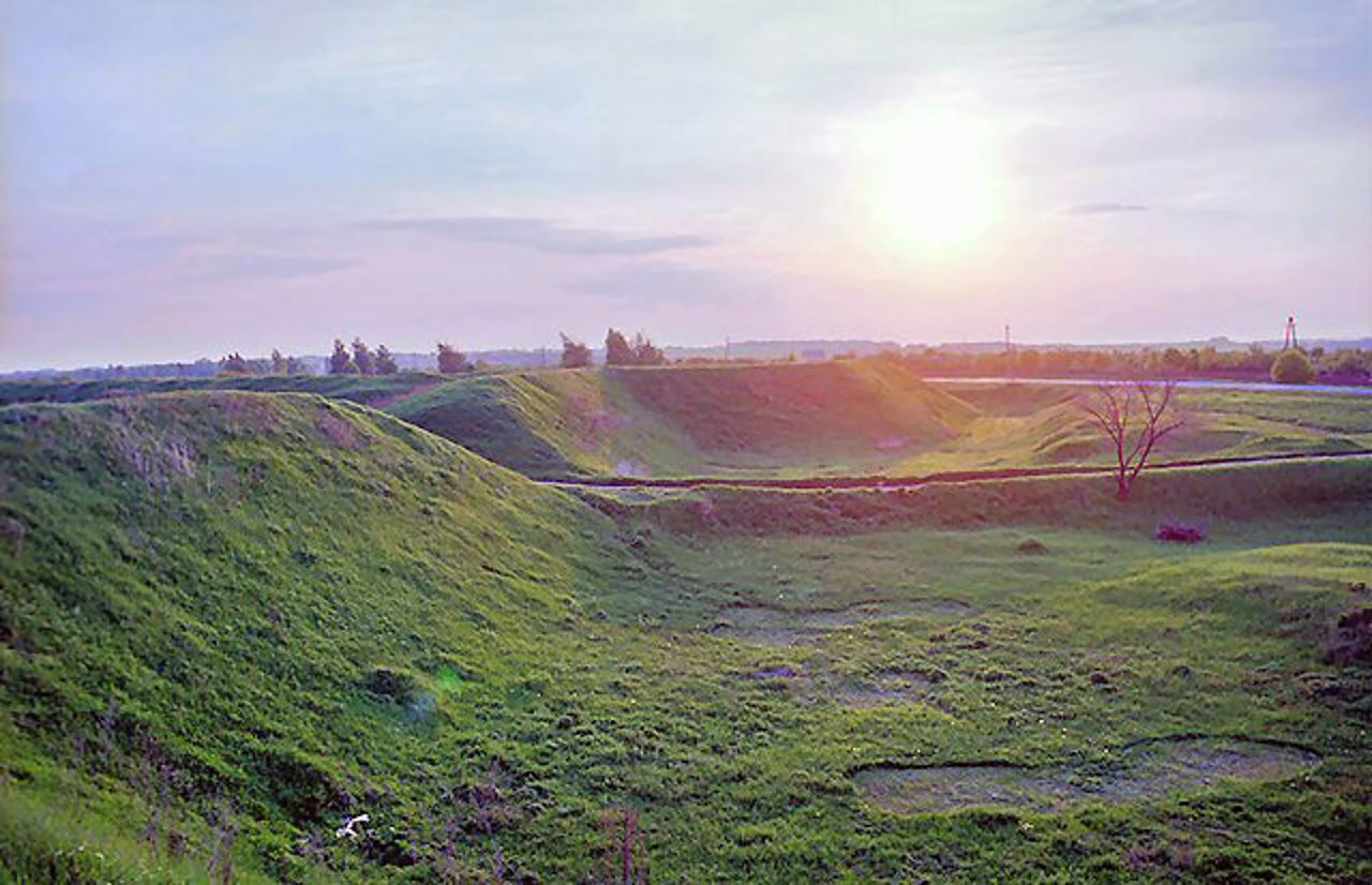
The original name was Beretska, in 1738 it was renamed to the fortress of Saint Oleksiy. Earthen, almost square in plan, four bastions. The height of the shafts is more than 5 meters. The area of the serf yard is more than 1.5 hectares. A dirt road with a length of about 100 meters is brought up by an embankment to the north-western curtain, in which the entrance is located. The eastern curtain is strengthened by a ravelin directed towards the Bereka River. The length of the fortress on the outer side of the base of the shaft is more than 1030 meters.
The Aleksiivskaya fortre ...
The Oleksiyivska Fortress of the Ukrainian Defense Line was built in 1831, during the second stage of the construction of the line of fortifications on the then southern borders of the Russian Empire.
The original name was Beretska, in 1738 it was renamed to the fortress of Saint Oleksiy. Earthen, almost square in plan, four bastions. The height of the shafts is more than 5 meters. The area of the serf yard is more than 1.5 hectares. A dirt road with a length of about 100 meters is brought up by an embankment to the north-western curtain, in which the entrance is located. The eastern curtain is strengthened by a ravelin directed towards the Bereka River. The length of the fortress on the outer side of the base of the shaft is more than 1030 meters.
The Aleksiivskaya fortress was connected by a rampart with a dry moat to the fourth on the line of Mykhaylivska and the sixth - Yefremivska fortresses. The garrison consisted of one infantry regiment of land militiamen, later transferred to dragoons and reinforced by a half-company of grenadiers.
The monument is well preserved and gives a clear idea of the shape and size of the earthen fortification of the first third of the 18th century.
Олексіївська фортеця Української оборонної лінії споруджена в 1831 році, під час другого етапу будівництва лінії укріплень на тодішніх південних кордонах російської імперії.
Початкова назва - Берецька (Беретська), в 1738 році перейменована на фортецю Святого Олексія. Земляна, майже квадратна у плані, чотирибастіонія. Висота валів – понад 5 метрів. Площа кріпосного двору становить понад 1,5 гектари. До північно-західної куртини, в якій розташований в'їзд, підведена насипом грунтова дорога довжиною близько 100 метрів. Східна куртина посилена равеліном, спрямованим у бік річки Береки. Протяжність фортеці на зовнішній стороні основи валу становить понад 1030 метрів.
Олексіївська фортеця була з'єднана валом із сухим ровом із четвертою на лінії Михайлівської та шосто ...
Олексіївська фортеця Української оборонної лінії споруджена в 1831 році, під час другого етапу будівництва лінії укріплень на тодішніх південних кордонах російської імперії.
Початкова назва - Берецька (Беретська), в 1738 році перейменована на фортецю Святого Олексія. Земляна, майже квадратна у плані, чотирибастіонія. Висота валів – понад 5 метрів. Площа кріпосного двору становить понад 1,5 гектари. До північно-західної куртини, в якій розташований в'їзд, підведена насипом грунтова дорога довжиною близько 100 метрів. Східна куртина посилена равеліном, спрямованим у бік річки Береки. Протяжність фортеці на зовнішній стороні основи валу становить понад 1030 метрів.
Олексіївська фортеця була з'єднана валом із сухим ровом із четвертою на лінії Михайлівської та шостої - Єфремівською фортецями. Гарнізон складався з одного піхотного полку ландміліціонерів, переведеного потім у драгунські та посиленого гренадерською напівротою.
Пам'ятка добре зберіглася, дає ясне уявлення про форму та розміри земляного укріплення першої третини XVIII сторіччя.
Practical information about Oleksiyivska Fortress (Saint Oleksiy Fortress) (Oleksiivka)
Last update
6/26/2025
| Categories | Castle / fortress |
|---|---|
| Date of foundation | 1731 |
| Address |
Tsentralna Street
Oleksiivka |
| Coordinates |
49.3922789° N, 36.2638538° E
|
| Additional services |
Аccessibility information
Have you visited Oleksiyivska Fortress (Saint Oleksiy Fortress) in Oleksiivka?
Add practical or descriptive information, photos, links
What to see, where to go next?


