Functional temporarily unavailable
Krasukha Mountain, Vytachiv
Archaeological site
General information about Krasukha Mountain (Vytachiv)
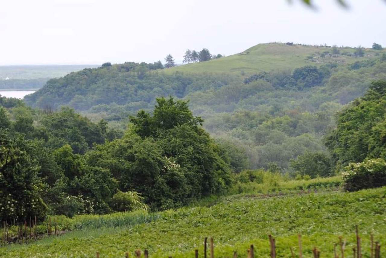
Mountain Krasukha rises 189 meters above sea level in the northeastern part of the Vytachiv village. Archaeological studies indicate that the top of the mountain is an artificial mound of the 2nd-4th centuries, probably from the times of the Ant kingdom.
There is a popular version that the barrow was built in 375 at the place of death of the famous Gothic king Ermanaric by order of his successor Vithimiris, which gave rise to the village of Vytachiv.
Archeological research discovered objects of the Chernyakhiv culture of the 2nd-3rd centuries, artifacts from the time of the Huns (5th century) and the remains of a pagan temple from the 6th-8th centuries on the mountain. The mountain was probably used as a burial place at all times.
Now there is also a village cemetery o ...
Mountain Krasukha rises 189 meters above sea level in the northeastern part of the Vytachiv village. Archaeological studies indicate that the top of the mountain is an artificial mound of the 2nd-4th centuries, probably from the times of the Ant kingdom.
There is a popular version that the barrow was built in 375 at the place of death of the famous Gothic king Ermanaric by order of his successor Vithimiris, which gave rise to the village of Vytachiv.
Archeological research discovered objects of the Chernyakhiv culture of the 2nd-3rd centuries, artifacts from the time of the Huns (5th century) and the remains of a pagan temple from the 6th-8th centuries on the mountain. The mountain was probably used as a burial place at all times.
Now there is also a village cemetery on Krasukha Mountain, so it is considered the oldest active necropolis in Kyiv region. Adherents of esoteric teachings consider the mountain a "place of power".
To the west of the mountain is the historical area of Okip, where there is a settlement of the ancient Rus city of Vytychiv of the 10th-13th centuries. Remains of ramparts and ditches can still be seen among private estates there.
Гора Красуха височить на 189 метрів над рівнем моря у північно-східній частині села Витачів. Археологічні дослідження вказують на те, що верхівка гори є штучним курганом ІІ-IV століть, імовірно часів Антського царства.
Існує поширена версія, що курган був насипаний у 375 році на місці загибелі відомого готського короля Германаріха за наказом його наступника Витимира, що і дало початок селу Витачів.
Археологічні дослідження виявили на горі предмети Черняхівської культури ІІ-ІІІ століть, артефакти часів панування гунів (V століття) та залишки язичницького капища VI-VIII століть. Ймовірно, гора в усі часи використовувалася як місце поховань.
Зараз на горі Красуха також функціонує сільське кладовище, тож його вважають найстарішим чинним некрополем Київщини. Прих ...
Гора Красуха височить на 189 метрів над рівнем моря у північно-східній частині села Витачів. Археологічні дослідження вказують на те, що верхівка гори є штучним курганом ІІ-IV століть, імовірно часів Антського царства.
Існує поширена версія, що курган був насипаний у 375 році на місці загибелі відомого готського короля Германаріха за наказом його наступника Витимира, що і дало початок селу Витачів.
Археологічні дослідження виявили на горі предмети Черняхівської культури ІІ-ІІІ століть, артефакти часів панування гунів (V століття) та залишки язичницького капища VI-VIII століть. Ймовірно, гора в усі часи використовувалася як місце поховань.
Зараз на горі Красуха також функціонує сільське кладовище, тож його вважають найстарішим чинним некрополем Київщини. Прихильники езотеричних вчень вважають гору "місцем сили".
На захід від гори розташована історична місцевість Окіп, де знаходиться городище давноруського міста Витичів X-XIII століть. Серед приватних садиб там досі простежуються залишки валів та ровів.
Practical information about Krasukha Mountain (Vytachiv)
Last update
8/7/2025
| Categories | Archaeological site |
|---|---|
| Date of foundation | IV century |
| Address |
Prydniprovska Street
Vytachiv |
| Coordinates |
50.116865° N, 30.880192° E
|
| Phone | , |
| Additional services |
Аccessibility information
Have you visited Krasukha Mountain in Vytachiv?
Add practical or descriptive information, photos, links
What to see, where to go next?


