Functional temporarily unavailable
Trayan's Wall, Tabaky
Historic area
Archaeological site
General information about Trayan's Wall (Tabaky)
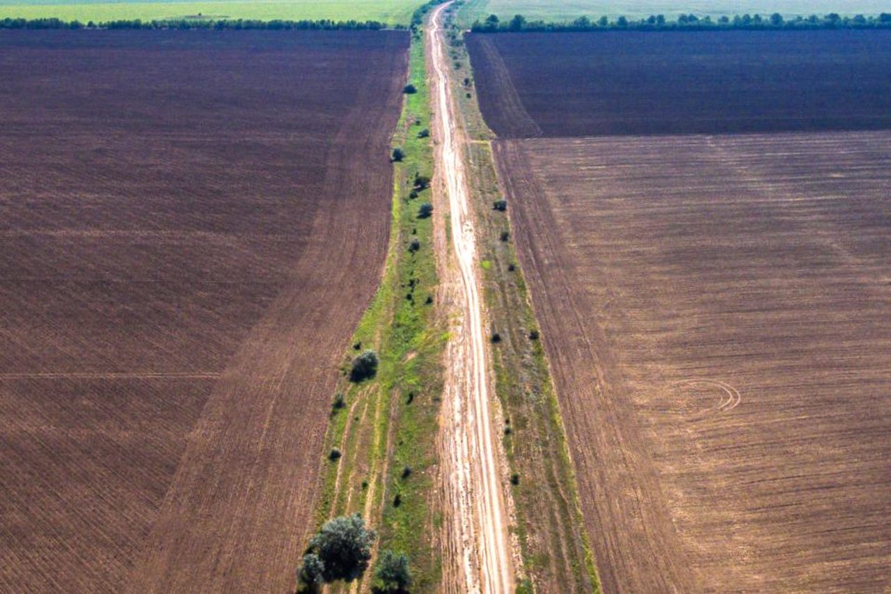
Trayan's Wall near the village of Tabaky is part of a system of earthen ramparts preserved from the times of the Roman Empire, which was built on the territory of Podillya, Bessarabia and Dobrudsh. It was a kind of southeastern border of the empire during its heyday in the 2nd century AD, during the reign of Emperor Trayan.
Trayan's Wall in the territory of Bessarabia is 150 kilometers long. It originates from the village of Vadul-lui-Isac (Moldova), then extends into the territory of Ukraine, crosses the village of Tabaky and rests on a high steep bank against Lake Sasyk. A memorial sign to this ancient border has been erected between the villages of Borysivka and Hlyboke, which are located on the shore of Lake Sasyk.
Near the village of Tabaky, crossing modern high ...
Trayan's Wall near the village of Tabaky is part of a system of earthen ramparts preserved from the times of the Roman Empire, which was built on the territory of Podillya, Bessarabia and Dobrudsh. It was a kind of southeastern border of the empire during its heyday in the 2nd century AD, during the reign of Emperor Trayan.
Trayan's Wall in the territory of Bessarabia is 150 kilometers long. It originates from the village of Vadul-lui-Isac (Moldova), then extends into the territory of Ukraine, crosses the village of Tabaky and rests on a high steep bank against Lake Sasyk. A memorial sign to this ancient border has been erected between the villages of Borysivka and Hlyboke, which are located on the shore of Lake Sasyk.
Near the village of Tabaky, crossing modern highways, sections of the rampart have been preserved, which give an idea of the power of these engineering structures.
In the middle Dnipro region, similar structures are called Serpent's Wall.
Траянів вал біля села Табаки - частина збережених з часів римської імперії системи земляних валів, що була збудована на території Поділля, Бессарабії та Добруджі. Був своєрідним південно-східним кордоном імперії за часів її розквіту в ІІ столітті нашої ери, за правління імператора Траяна.
Траянів вал на території Бессарабії має довжину 150 кілометрів. Бере початок від села Вадул-луй-Ісак (Молдова), далі простягається на теріторію України, перетинає село Табаки і на високому обривистому березі упирається в озеро Сасик. Між селами Борисівка та Глибоке, які знаходяться на березі озера Сасик, встановлено пам’ятний знак цьому стародавньому кордону.
Біля села Табаки, перетинаючи сучасні магістралі, збереглися ділянки вала, які дають уяву про потужність цих інженерних с ...
Траянів вал біля села Табаки - частина збережених з часів римської імперії системи земляних валів, що була збудована на території Поділля, Бессарабії та Добруджі. Був своєрідним південно-східним кордоном імперії за часів її розквіту в ІІ столітті нашої ери, за правління імператора Траяна.
Траянів вал на території Бессарабії має довжину 150 кілометрів. Бере початок від села Вадул-луй-Ісак (Молдова), далі простягається на теріторію України, перетинає село Табаки і на високому обривистому березі упирається в озеро Сасик. Між селами Борисівка та Глибоке, які знаходяться на березі озера Сасик, встановлено пам’ятний знак цьому стародавньому кордону.
Біля села Табаки, перетинаючи сучасні магістралі, збереглися ділянки вала, які дають уяву про потужність цих інженерних споруд.
У середньому Придніпров'ї подібні споруди мають назву Змієвих валів.
Practical information about Trayan's Wall (Tabaky)
Last update
8/10/2025
| Categories | Historic area, Archaeological site |
|---|---|
| Date of foundation | II century AD |
| Address |
Tabaky |
| Coordinates |
45.73407° N, 28.62572° E
|
| Phone | , |
| Additional services |
Аccessibility information
Have you visited Trayan's Wall in Tabaky?
Add practical or descriptive information, photos, links
What to see, where to go next?


