Functional temporarily unavailable
Cities and villages of Kamyanets-Podilskyi district
Online travel guide to the settlements of Kamyanets-Podilskyi district
General information about Kamyanets-Podilskyi district
Kamianets-Podilskyi district is located in the southern part of Khmelnytsky region, in the historical and ethnographic region of Podillya. The southern border runs along the Dniester River, and the western - along Zbruch. The Smotrych and Ushytsia rivers flow within the district.
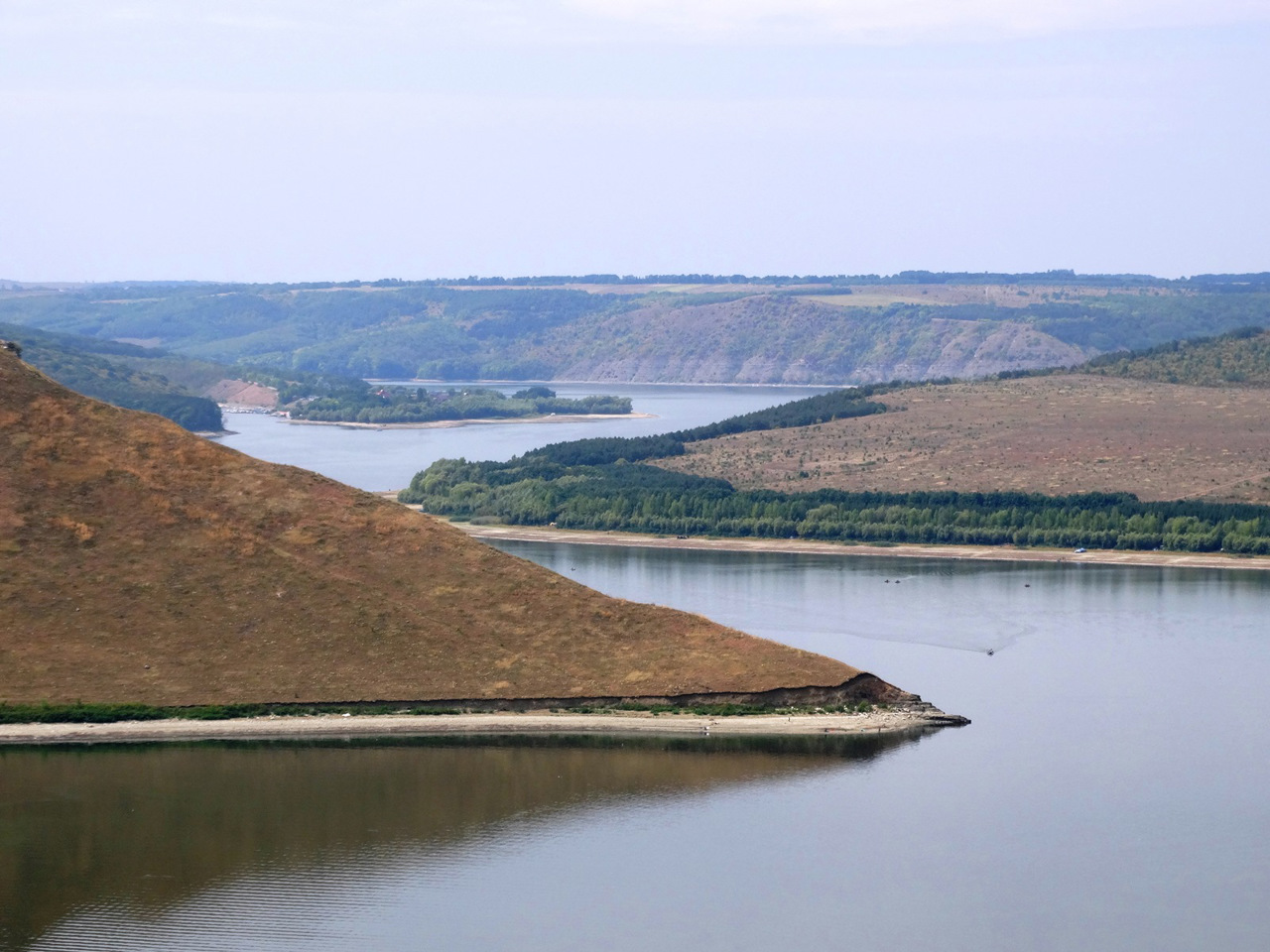
The area is crossed by the Tovtry ridge, which are the remains of an ancient barrier reef. These natural complexes with the historical and cultural monuments available here are protected by the Podilski Tovtry National Nature Park. It includes the Bay of Bakota, Kytaihorod outcrop, Tovtra Samovita, Karmalyukova mountain, Atlantis Cave and other natural monuments. You can find out more about Bakota rest, accommodation and entertainment at bakota.com.ua...
Kamianets-Podilskyi district is located in the southern part of Khmelnytsky region, in the historical and ethnographic region of Podillya. The southern border runs along the Dniester River, and the western - along Zbruch. The Smotrych and Ushytsia rivers flow within the district.
The area is crossed by the Tovtry ridge, which are the remains of an ancient barrier reef. These natural complexes with the historical and cultural monuments available here are protected by the Podilski Tovtry National Nature Park. It includes the Bay of Bakota, Kytaihorod outcrop, Tovtra Samovita, Karmalyukova mountain, Atlantis Cave and other natural monuments. You can find out more about Bakota rest, accommodation and entertainment at bakota.com.ua.
On one of the meanders of the Smotrytsky canyon is the Old Town of Kamianets-Podilskyi, the administrative center of Kamianets-Podilskyi district, one of the most popular tourist centers in Ukraine. Its unique Renaissance architectural complex consists of the Old Castle with the Turkish Bridge, the Polish Magistrate, the Peter and Paul Cathedral, the Dominican Monastery, the Trinitarian Monastery, the Trinity Basilian Monastery, the bell tower of the Armenian Church, the defensive towers and gates. The city regularly hosts various festivals, including a balloon festival.
Among other historical and cultural monuments of Kamianets-Podilsky district: Zhvanetsky Castle, Panovetsky Castle, Chornokozynsky Castle, Orlovsky Palace and Malievetsky Park, Scybor-Markhotsky Estate in Otrokiv, Ratsyborovsky Estate with Mikhailovsky Park in Makiv, etc.
The area of the district is more than 4520 square kilometers. The population of the district exceeds 290 thousand people.
The Kamianets-Podilsky district consists of 336 settlements, which are united into 15 territorial hromadas: Dunaievetska and Kamianets-Podilska city hromadas, Zakupnenska, Novodunaievetska, Smotrytska, Staroushytska and Chemerovetska settlement hromadas, Hukivska, Humenetska, Zhvanetska, Kytaihorodska, Makivska, Novoushytska, Orynynska and Slobidsko-Kulchiievetska village territorial hromadas.
Кам'янець-Подільський район розташований у південній частині Хмельницької області, в історико-етнографічному регіоні Поділля. Південна межа пролягає по річці Дністер, а західна – по Збручу. В межах району протікають річки Смотрич та Ушиця.
Район перетинає Товтровий кряж, що є залишками прадавнього бар'єрного рифу. Ці природні комплекси з наявними тут історико-культурними пам'ятками охороняє Національний природний парк "Подільські Товтри". До його складу входять Бакотська затока, Китайгородське відслонення, Товтра Самовита, Кармалюкова гора, Печера Атлантида та інші пам'ятки природи. Детальніше про відпочинок, проживання та розваги на Бакоті можна дізнатися на bakota.com.ua.
На одно ...
Кам'янець-Подільський район розташований у південній частині Хмельницької області, в історико-етнографічному регіоні Поділля. Південна межа пролягає по річці Дністер, а західна – по Збручу. В межах району протікають річки Смотрич та Ушиця.
Район перетинає Товтровий кряж, що є залишками прадавнього бар'єрного рифу. Ці природні комплекси з наявними тут історико-культурними пам'ятками охороняє Національний природний парк "Подільські Товтри". До його складу входять Бакотська затока, Китайгородське відслонення, Товтра Самовита, Кармалюкова гора, Печера Атлантида та інші пам'ятки природи. Детальніше про відпочинок, проживання та розваги на Бакоті можна дізнатися на bakota.com.ua.
На одному з меандрів Смотрицького каньйону розташоване Старе місто Кам'янця-Подільського, адміністративного центру Кам'янець-Подільського району, одного з найпопулярніших туристичних центрів України. Його неповторний ренесансний архітектурний комплекс складають Старий замок з Турецьким мостом, Польський магістрат, Катедральний Петропавлівський костел, Домініканський монастир, Тринітарський монастир, Троїцький василіанський монастир, дзвіниця Вірменського костелу, оборонні вежі та брами Старого міста. В місті регулярно проходять різноманітні фестивалі, серед яких фестиваль повітряних куль.
Серед інших історико-культурних пам'яток Кам'янець-Подільського району: Жванецький замок, Пановецький замок, Чорнокозинський замок, палац Орловських і Малієвецький парк у Маліївцях, садиба Сцибор-Мархоцького в Отрокові, маєток Рациборовських з Михайлівським парком у Макові тощо.
Площа території району становить понад 4520 квадратних кілометрів. Чисельність населення району перевищує 290 тисяч осіб.
До складу Кам'янець-Подільського району входять 336 населених пунктів, які об'єднані у 15 територіальних громад: Дунаєвецька, Кам'янець-Подільська міські, Закупненська, Новодунаєвецька, Смотрицька, Староушицька, Чемеровецька селищні, Гуківська, Гуменецька, Жванецька, Китайгородська, Маківська, Новоушицька, Орининська, Слобідсько-Кульчієвецька сільські територіальні громади.


