Functional temporarily unavailable
General information about Aktove
Village Aktove is located on the territory of Mykolaiv region and is administratively part of Voznesensk district of this region. According to the Codifier of Administrative Territorial Units and Territories of Territorial Communities of Ukraine, the settlement Aktove has the code UA48040190020081514.
The district center of Voznesensk of the district is a city Voznesensk. The distance from the district center to the settlement Aktove is 18 kilometers in a straight line (the length of the road route may be longer).
A detailed description of Aktove, including geographical location, date of foundation, history of the settlement of Aktove with main historical events and persons, main sights and interesting places of Aktove, not yet available.
Село Актове розташоване на території Миколаївської області та адміністративно входить до складу Вознесенського району цієї області. Згідно з Кодифікатором адміністративно-територіальних одиниць та територій територіальних громад України, населений пункт Актове має код UA48040190020081514.
Районним центром Вознесенського району є місто Вознесенськ. Відстань від райцентру до населеного пункта Актове становить 18 кілометрів по прямій (довжина маршруту автомобільними дорогами може бути більшою).
Детальний опис Актового, що включає географічне розташування, дату заснування, історію населеного пункта Актове з основними історичними подіями та персонами, основні пам'ятки та цікаві місця Актового, поки що відсутній.
Сплануй своє перебування у Aktove
What to see and where to go in Aktove
Tourist attractions and museums of Aktove

Aktove Canyon
Natural object
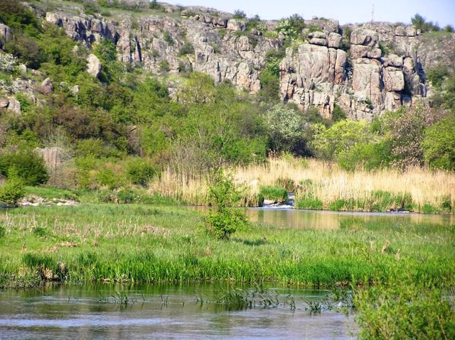
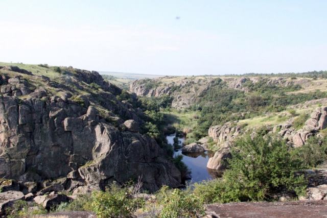
The Aktove Canyon on the Mertvovod River, also known as the "Devil's Valley" or Little Crimea, stretches 3 kilometers from the village of Aktove to the village of Petropavlivka.
The depth of the canyon reaches 40-50 meters, the area is more than 250 hectares.
Aktove Canyon is a unique complex of forest and water ecosystems with an ensemble of rocks and granite boulders. The only one in Europe, which, according to its geological and landscape indicators, resembles the famous canyons of North America in miniature with great accuracy in the time of formation.
The whimsical ornateness of the Mertvovod channel (due to the high concentration of hydrogen sulfide in the water), steep walls, the magnificent beauty of granite-basalt rocks (up to 100 meters high) and unique natural beauty attract tourists from all over Europe. The difficult topography of the area does not allow river rafting, but the canyon is attractive for fans of extreme sports, rock climbers and climbers.
The natural complex of the Aktove Canyon, like all the banks of the Mertvovod, is a part of the National Nature Park "Buzky Gard".
Nearby, between Aktove and Trykraty, at the confluence of the Arbuzynka River with the Mertvovod, is the equally picturesque Arbuzynsky (Maly Aktove) canyon.

Arbuzynsky Canyon
Natural object
The Arbuzynsky Canyon near the village of Aktove is also called the Small Aktivsky Canyon, "Valley of the Devil".
The granite rocks that form the relief of the Arbuzynka River valley were formed 4 billion years ago as a result of volcanic activity (it is believed that the volcano has not yet cooled, so violets sometimes bloom on the rocks even in winter). Here you can meet pheasants, turtles, hawks, muskrats, moles, bison, wild boars and even deer.
Arbuzynsky Canyon is a part of the National Nature Park "Buzky Gard". It is often confused with the larger and more difficult-to-access Aktove Canyon ("Devil's Valley"), located on the Mertvovod River behind the village of Aktove.
The view of both canyons opens simultaneously from the rock "Navel of the Earth" - the highest point of the tract.
Reviews Aktove
Geographical information about Aktove
| {{itemKey}} | {{itemValue}} |
|---|---|
| Region |
Mykolaiv |


