Functional temporarily unavailable
Cities and villages of Rakhiv district
Online travel guide to the settlements of Rakhiv district
General information about Rakhiv district
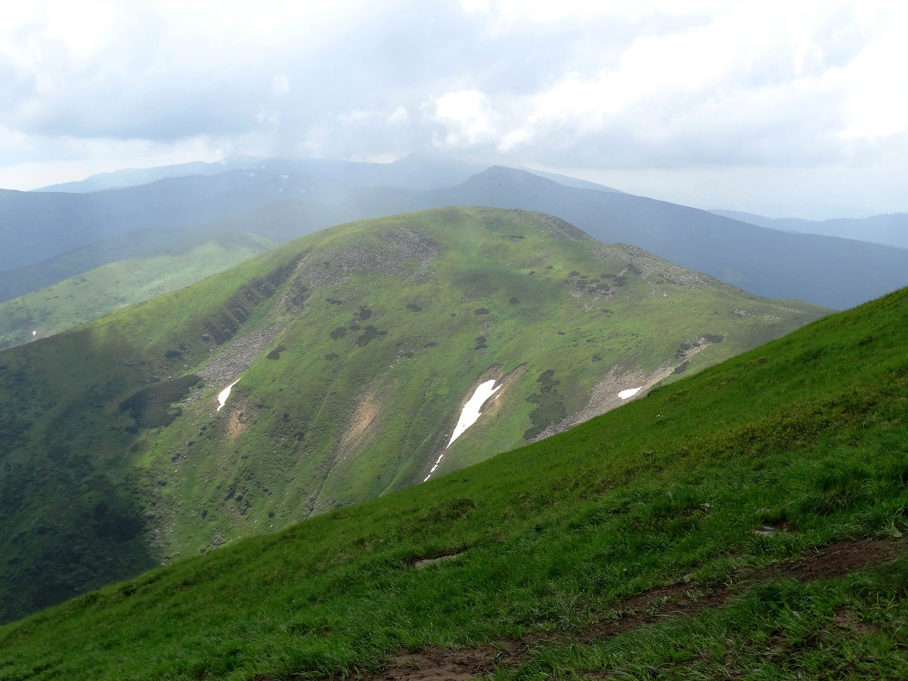
Rakhiv district (Rakhivskyi) is located in the eastern part of the Transcarpathian region, bordering Romania to the south. It covers the highest part of the Ukrainian Carpathians - the Montenegrin massif, where the highest peak of Ukraine is located - Mount Hoverla. The nature of these areas is protected by the Carpathian Biosphere Reserve with Svydovets and Chornohirsky protected areas - one of the largest areas of Beech virgin forests of the Carpathians, a UNESCO World Heritage Site.
The former Polish White Elephant Observatory is located on Mount Pip-Ivan Chornohirsky, where the Yavirnytsya Search and Rescue Department of the State Emergency Service now operates. Drahobrat ski resort is the highest in the Ukrainian Carpathians, the season here sometimes lasts from December to M ...
Rakhiv district (Rakhivskyi) is located in the eastern part of the Transcarpathian region, bordering Romania to the south. It covers the highest part of the Ukrainian Carpathians - the Montenegrin massif, where the highest peak of Ukraine is located - Mount Hoverla. The nature of these areas is protected by the Carpathian Biosphere Reserve with Svydovets and Chornohirsky protected areas - one of the largest areas of Beech virgin forests of the Carpathians, a UNESCO World Heritage Site.
The former Polish White Elephant Observatory is located on Mount Pip-Ivan Chornohirsky, where the Yavirnytsya Search and Rescue Department of the State Emergency Service now operates. Drahobrat ski resort is the highest in the Ukrainian Carpathians, the season here sometimes lasts from December to March. A memorial sign "Center of Europe" was erected near the village of Dilove in Austrian times. The wooden Mykolayiv Church in the village of Seredne Vodiane is considered to be the oldest religious building in Transcarpathia and Ukraine. At the springs of mineral waters in Kvasy there is a balneological sanatorium "Mountain Tisza".
The administrative center of Rakhivskyi district is the city of Rakhiv. The area of the district is more than 1845 square kilometers. The population of the district reaches 83 thousand people.
Rakhiv district consists of 29 settlements, which are united into 4 territorial hromadas: Rakhivska city hromada, Bohdanska village hromada, Velykobychkivska and Yasinianska settlement territorial hromadas.
Рахівський район розташований у східній частині Закарпатської області, з півдня межує з Румунією. Охоплює найвисокогірнішу частину Українських Карпат – Чорногірський масив, де знаходиться найвища вершина України - гора Говерла. Природу цих територій охороняє Карпатський біосферний заповідник зі Свидовецьким та Чорногірським заповідними масивами - одними з найбільших масивів Букових пралісів Карпат, внесених до світової спадщини ЮНЕСКО.
На горі Піп-Іван Чорногірський розташована колишня польська обсерваторія "Білий слон", де зараз функціонує Явірницьке пошуково-рятувальне відділення ДСНС. Гірськолижний курорт Драгобрат є найбільш високогірним в Українських Карпатах, сезон тут подекуди триває з грудня по березень. Поблизу села Ділове за австрійських часів встановлено ...
Рахівський район розташований у східній частині Закарпатської області, з півдня межує з Румунією. Охоплює найвисокогірнішу частину Українських Карпат – Чорногірський масив, де знаходиться найвища вершина України - гора Говерла. Природу цих територій охороняє Карпатський біосферний заповідник зі Свидовецьким та Чорногірським заповідними масивами - одними з найбільших масивів Букових пралісів Карпат, внесених до світової спадщини ЮНЕСКО.
На горі Піп-Іван Чорногірський розташована колишня польська обсерваторія "Білий слон", де зараз функціонує Явірницьке пошуково-рятувальне відділення ДСНС. Гірськолижний курорт Драгобрат є найбільш високогірним в Українських Карпатах, сезон тут подекуди триває з грудня по березень. Поблизу села Ділове за австрійських часів встановлено пам'ятний знак "Центр Європи". Дерев'яна Миколаївська церква у селі Середнє Водяне вважається найдавнішою культовою спорудою на Закарпатті і в Україні. На джерелах мінеральних вод у Квасах функціонує бальнеологічний санаторій "Гірська Тиса".
Адміністративним центром Рахівського району є місто Рахів. Площа території району становить понад 1845 квадратних кілометрів. Чисельність населення району сягає 83 тисяч осіб.
До складу Рахівського району входять 29 населених пунктів, які об'єднані у 4 територіальні громади: Рахівська міська, Богданська сільська, Великобичківська, Ясінянська селищні територіальні громади.


