Functional temporarily unavailable
Cities and villages of Starobilsk district
Online travel guide to the settlements of Starobilsk district
General information about Starobilsk district
Starobilsk district (Starobilskyi) is located in the north-eastern part of Luhansk region, on the historical and ethnographic territory of Slobozhanshchyna. It borders Russia to the east.
Milove town is the easternmost point of Ukraine - the state border and the North Caucasus Railway line actually divide it into two parts, with the Russian village of Chortkove located close to it.
The Aidar River flows within the district. Bilovodsk Regional Landscape Park with the Yunitsky Botanical Reserve, which houses the Yunitsky Museum.
The administrative center of Starobilskyi district is the city of Starobilsk. Here are such historical and cultural monuments as Starobilsky convent "Joy of All Who Sorrow", the building of Catherine's Women's Gymnasium, fragmen ...
Starobilsk district (Starobilskyi) is located in the north-eastern part of Luhansk region, on the historical and ethnographic territory of Slobozhanshchyna. It borders Russia to the east.
Milove town is the easternmost point of Ukraine - the state border and the North Caucasus Railway line actually divide it into two parts, with the Russian village of Chortkove located close to it.
The Aidar River flows within the district. Bilovodsk Regional Landscape Park with the Yunitsky Botanical Reserve, which houses the Yunitsky Museum.
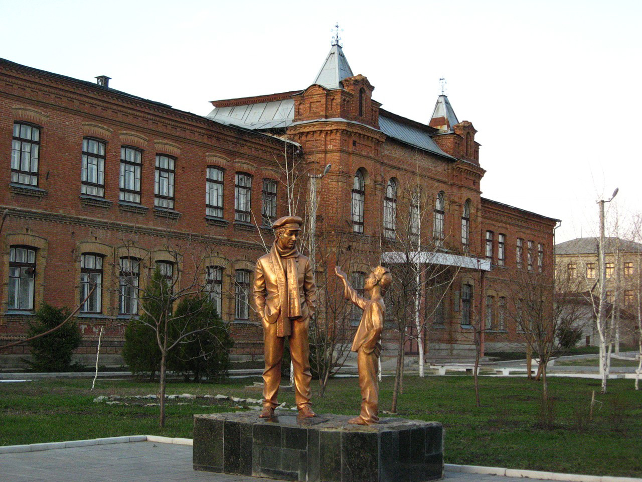
The administrative center of Starobilskyi district is the city of Starobilsk. Here are such historical and cultural monuments as Starobilsky convent "Joy of All Who Sorrow", the building of Catherine's Women's Gymnasium, fragments of old city buildings. The monument to Ostap Bender reminds that Starobilsk is a prototype of the city of Starhorod from Ilf and Petrov's novel "12 chairs".
The area of the district is more than 6930 square kilometers. The population of the district reaches 130 thousand people.
The Starobilsky district consists of 194 settlements, which are united into 8 territorial hromadas: Starobilska city hromada, Bilovodska, Bilolutska, Markivska, Milovska and Aidarivska settlement hromadas, Chmyrivska and Shulhynska village territorial hromadas.
Старобільський район розташований у північно-східній частині Луганської області, на історико-етнографічній території Слобожанщини. На сході межує з Росією.
Селище міського типу Мілове є найсхіднішою точкою України – державний кордон і лінія Північно-Кавказької залізниці фактично ділять його на дві частини, при чому з російського впритул розташоване селище Чорткове.
В межах району протікає річка Айдар, розташовується Біловодський регіональний ландшафтний парк з Юницьким ботанічним заказником, в якому діє музей Юницького.
Адміністративним центром Старобільського району є місто Старобільськ. Тут розташовані такі історико-культурні пам'ятки, як Старобільський жіночий монастир "Всіх скорботних Радість", будівля Катерининської жіночої гімназії, фраг ...
Старобільський район розташований у північно-східній частині Луганської області, на історико-етнографічній території Слобожанщини. На сході межує з Росією.
Селище міського типу Мілове є найсхіднішою точкою України – державний кордон і лінія Північно-Кавказької залізниці фактично ділять його на дві частини, при чому з російського впритул розташоване селище Чорткове.
В межах району протікає річка Айдар, розташовується Біловодський регіональний ландшафтний парк з Юницьким ботанічним заказником, в якому діє музей Юницького.
Адміністративним центром Старобільського району є місто Старобільськ. Тут розташовані такі історико-культурні пам'ятки, як Старобільський жіночий монастир "Всіх скорботних Радість", будівля Катерининської жіночої гімназії, фрагменти старої міської забудови. Пам'ятник Остапу Бендеру нагадує, що Старобільськ є прообразом міста Старгород з роману Ільфа і Петрова "12 стільців".
Площа території району становить понад 6930 квадратних кілометрів. Чисельність населення району сягає 130 тисяч осіб.
До складу Старобільського району входять 194 населені пункти, які об'єднані у 8 територіальних громад: Старобільська міська, Біловодська, Білолуцька, Марківська, Міловська, Айдарівська селищні та Чмирівська і Шульгинська сільські територіальні громади.


