Functional temporarily unavailable
General information about Kuntseve
The village of Kuntseve on the right bank of the Vorskla River is located 10 kilometers northeast of Novi Sanzhary, next to the M-22 highway "Poltava - Kropyvnytskyi".
Founded in 1859.
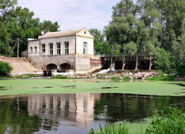
The picturesque landscape on the outskirts of the village is created by the Kuntsivska HPP, built in 1953.
Село Кунцеве на правому березі річки Ворскла розташоване в 10 кілометрах на північний схід від Нових Санжарів, поруч з трасою М-22 "Полтава - Кропивницький".
Засноване в 1859 році.
Мальовничий ландшафт на околиці села створює побудована в 1953 році Кунцівська ГЕС.
Сплануй своє перебування у Kuntseve
What to see and where to go in Kuntseve
Tourist attractions and museums of Kuntseve

Kuntseve HPP
Architecture
The Kuntseve hydroelectric power station on the Vorskla River was built in 1953 on the outskirts of the Kuntseve village.
In 2007, reconstruction was carried out and permanent work was resumed. The capacity of Kuntseve HPP is 400 kilowatts.
A good place for recreation and fishing.
Reviews Kuntseve
Geographical information about Kuntseve
| {{itemKey}} | {{itemValue}} |
|---|---|
| Region |
Poltava |


