Functional temporarily unavailable
General information about Ustia
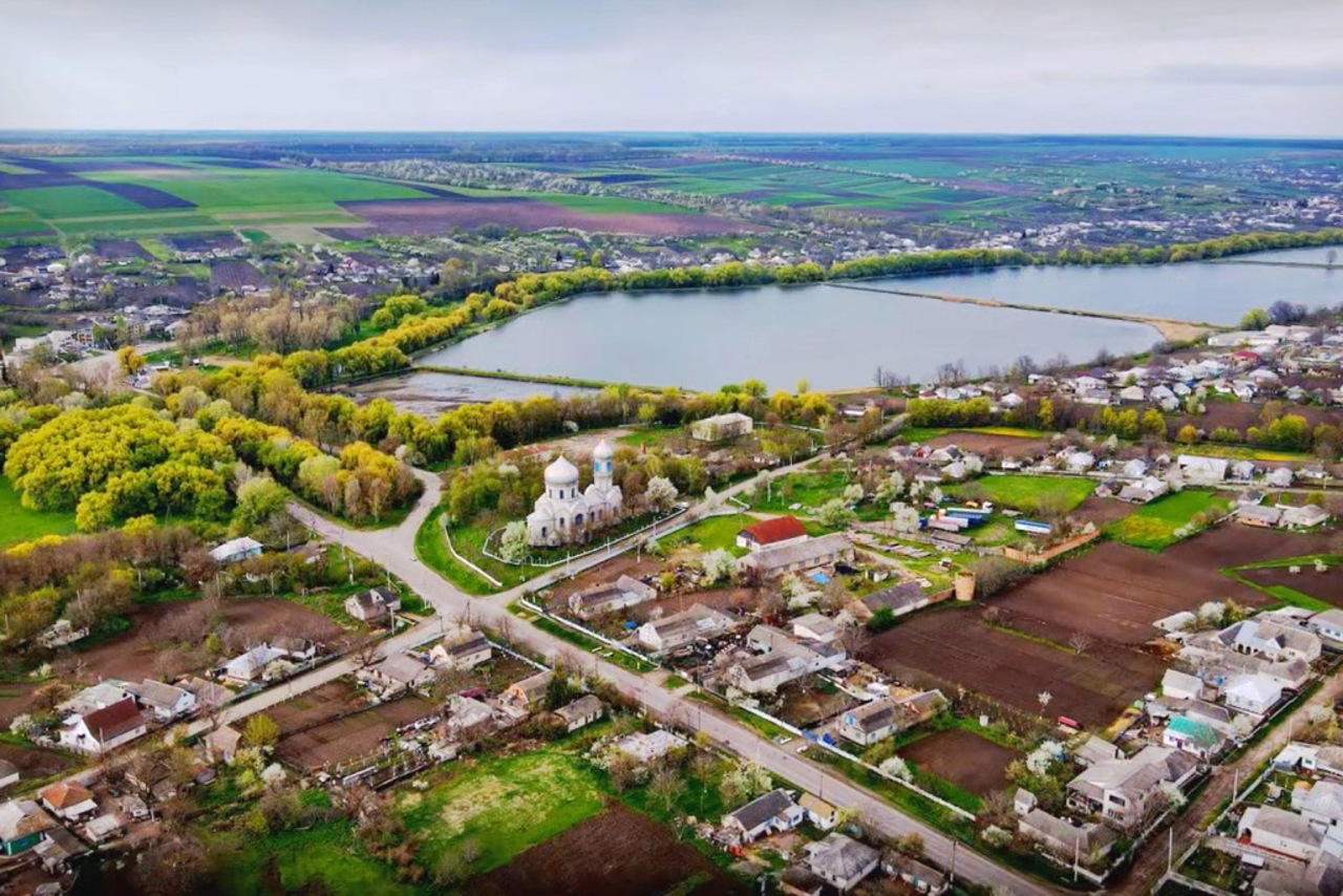
The village Ustia is located at the confluence of the Dokhna River into the Pivdennyi Buh between Bershad and Haivoron. Administratively, it is part of the Bershad hromada of Haisyn district of Vinnytsia region.
The official date of foundation is considered to be 1651, although as early as 1552, Ustia is mentioned in the audit of the Bratslav Castle as a fortified settlement on the banks of the Dokhna River. The name most likely comes from the location of the village at the river mouth, although some ...
The village Ustia is located at the confluence of the Dokhna River into the Pivdennyi Buh between Bershad and Haivoron. Administratively, it is part of the Bershad hromada of Haisyn district of Vinnytsia region.
The official date of foundation is considered to be 1651, although as early as 1552, Ustia is mentioned in the audit of the Bratslav Castle as a fortified settlement on the banks of the Dokhna River. The name most likely comes from the location of the village at the river mouth, although some sources associate it with the name of the possible founder of Ustyna Lubomyrska.
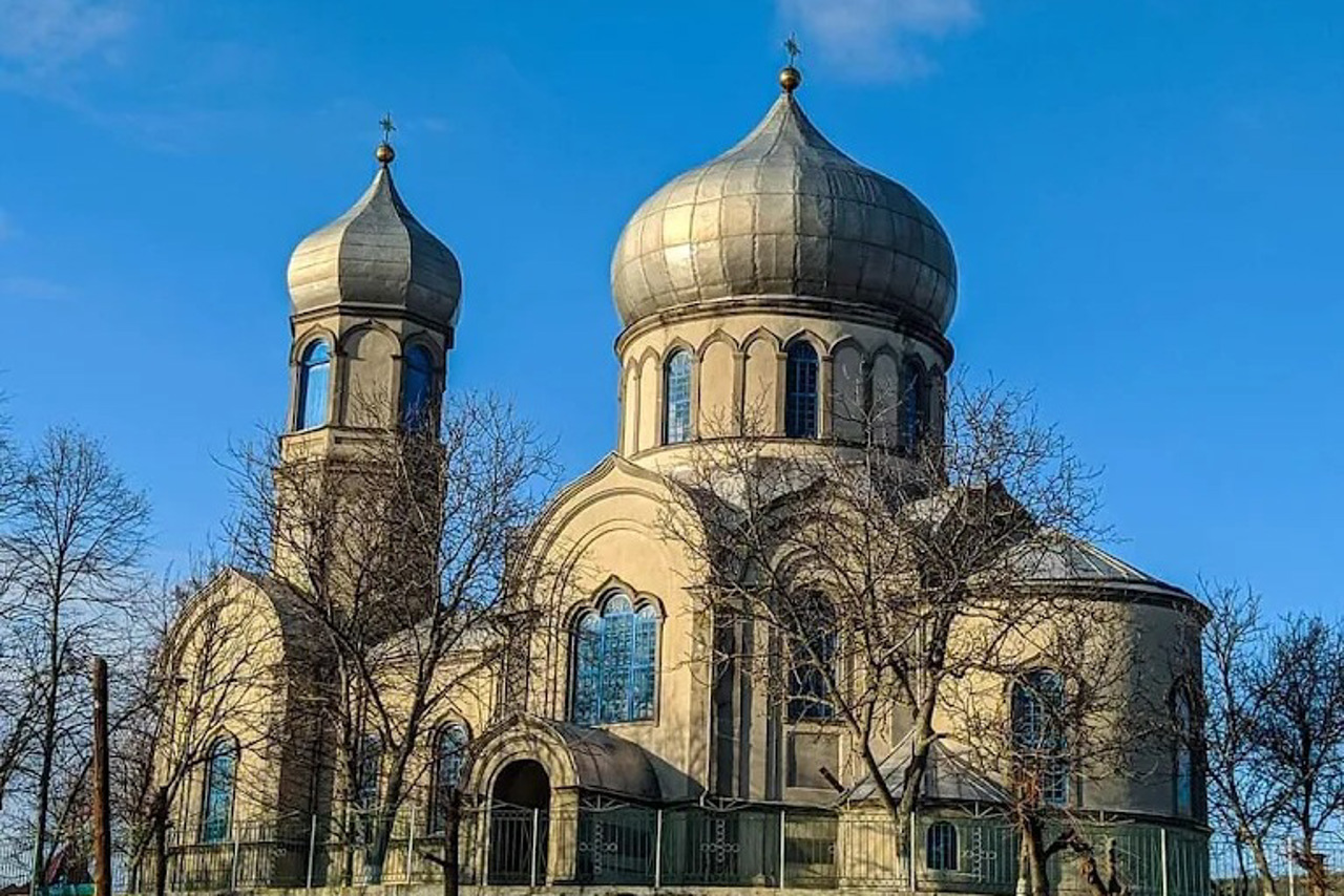
The main architectural monument of the village is the St. George Church, built in 1873 on the site of an older church. In 1886, a sugar refinery was built in Ustia. The remains of the estate of the landowner Hlynsky have been preserved, as well as the building of the railway station "Ustia" 2 kilometers southeast of the village.
In 1920, the Cavalry Regiment of the Black Zaporozhians of the UNR Army entered Ustia during the Winter Campaign. During the Holodomor of 1932–1933, carried out by the Soviet authorities, 1,100 residents of the village died.
Not far from the village is the Ustianska Dacha, a botanical reserve of national importance.
Село Устя розташоване при впадінні річки Дохна в Південний Буг між Бершаддю та Гайвороном. Адміністративно входить до складу Бершадської громади Гайсинського району Вінницької області.
Офіційною датою заснування вважається 1651 рік, хоча ще у 1552 Устя згадується в ревізії Брацлавського замку як укріплений населений пункт на березі річки Дохна. Назва найімовірніше походить від розташуванням села в річковому усті, хоча деякі джерела пов'язують його з іменем можливої засновниці Устини Любомирської.< ...
Село Устя розташоване при впадінні річки Дохна в Південний Буг між Бершаддю та Гайвороном. Адміністративно входить до складу Бершадської громади Гайсинського району Вінницької області.
Офіційною датою заснування вважається 1651 рік, хоча ще у 1552 Устя згадується в ревізії Брацлавського замку як укріплений населений пункт на березі річки Дохна. Назва найімовірніше походить від розташуванням села в річковому усті, хоча деякі джерела пов'язують його з іменем можливої засновниці Устини Любомирської.
Головною пам'яткою архітектури села є Свято-Георгіївська церква, збудована 1873 року на місці давнішого храму. 1886 року в Усті спорудили цукровий завод. Збереглися залишки маєтку поміщика Глинського, а також будівля залізничної станції "Устя" за 2 кілометри на південний схід від села.
У 1920 році до Устя під час Зимового походу заходив Кінний полк Чорних Запорожців Армії УНР. Під час Голодомору 1932–1933 років, проведеного радянською владою, загинуло 1100 мешканців села.
Неподалік від села розташовано ботанічний заказник загальнодержавного значення Устянська дача.
Сплануй своє перебування у Ustia
What to see and where to go in Ustia
Tourist attractions and museums of Ustia
Ustia Village History Museum
Museum / gallery
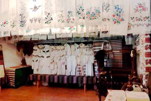
The Public Museum of the Ustia Village History was founded in 1984 on the initiative of journalist and local historian Petro Shvets. Initially, the exhibition was located in the former estate of the landowner Hlynsky.
Since 2018, the museum has opened an updated exhibition in a new building next to the village council. Over 3,000 exhibits are exhibited in five exhibition rooms. All of them are collected on the territory of the village and reflect its culture, everyday life and history.
The museum is decorated with an ethnographic collection: carpets, towels, shirts, folk clothes, pottery. Traditional folk crafts are told about by tools of labor, such as a loom, a potter's wheel, and various working tools.
The ancient history of the region is represented by objects of Trypillia and Cherniakhiv culture. And the events of the last century are told by old photographs, letters from the front, fragments of weapons, awards, and exhibits of the post-war period.
Visitors are offered master classes in weaving on an old wooden loom.
Reviews Ustia
Geographical information about Ustia
| {{itemKey}} | {{itemValue}} |
|---|---|
| Region |
Vinnytsia |
