Functional temporarily unavailable
Olenivka
Travel guide online Olenivka
General information about Olenivka
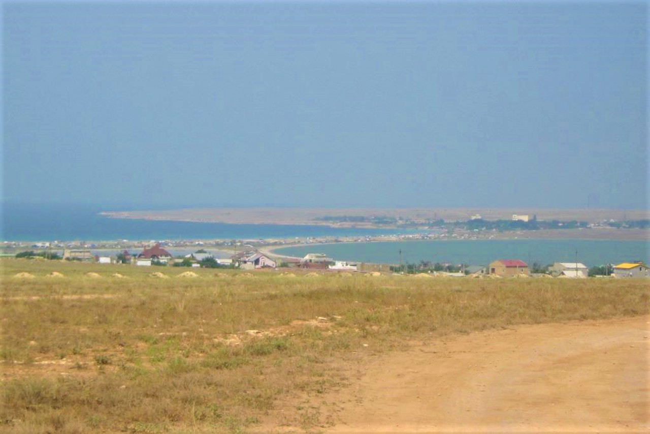
The village Olenivka is located on the western edge of the Tarkhankut peninsula, known among lovers of diving and "wild" recreation in Crimea. In ancient times, there was a Greek settlement and a Scythian settlement here. During the Crimean Khanate, there was a Nogai-Tatar village of Qara-Adzhi (in Turkic - "kosulya").
After the annexation of Crimea to Russia, the personal secretary of the Novorossian Governor-General Potemkin, Vasil Popov, received these lands, who built his estate here (now it is the territory of the "Sunny Valley" boarding house). Since the 19th century, the village has changed its name several times: Stepanivka, Tarkhankut, Qaragadzhi, Qaradzhi. The former Tatar village of Qara-Adzhi received the name Olenivka in 1945 after t ...
The village Olenivka is located on the western edge of the Tarkhankut peninsula, known among lovers of diving and "wild" recreation in Crimea. In ancient times, there was a Greek settlement and a Scythian settlement here. During the Crimean Khanate, there was a Nogai-Tatar village of Qara-Adzhi (in Turkic - "kosulya").
After the annexation of Crimea to Russia, the personal secretary of the Novorossian Governor-General Potemkin, Vasil Popov, received these lands, who built his estate here (now it is the territory of the "Sunny Valley" boarding house). Since the 19th century, the village has changed its name several times: Stepanivka, Tarkhankut, Qaragadzhi, Qaradzhi. The former Tatar village of Qara-Adzhi received the name Olenivka in 1945 after the forced deportation of Crimean Tatars by the Soviet occupiers from Crimea to Central Asia.
In Soviet times, the settlement was closed, a lighthouse, a border outpost, an air defense unit and other military forces were stationed here.
After the collapse of the USSR, the village was opened to vacationers, it quickly turned into a transshipment base for divers and "savages" of all stripes, who rest on Tarkhankut amid the picturesque nature of the Atlesh and Jangul tracts.
Село Оленівка розташоване на західній околиці півострова Тарханкут, відоме серед любителів дайвінгу та "дикого" відпочинку в Криму. В античні часи тут було грецьке городище і скіфське поселення. Під час Кримського ханства існувало ногайсько-татарське село Кара-Аджи (тюркською - "косуля").
Після приєднання Криму до Росії ці землі отримав особистий секретар новоросійського генерал-губернатора Потьомкіна Василій Попов, який побудував тут свою садибу (зараз це територія пансіонату "Сонячна долина"). З XIX століття село кілька разів змінювало назву: Степанівка, Тарханкут, Карагаджі, Караджі. Назву Оленівка колишнє татарське село Кара-Аджи отримало в 1945 році після примусової депортації кримських татар радянськими окупантами із Криму до Середньої Азії.
...Село Оленівка розташоване на західній околиці півострова Тарханкут, відоме серед любителів дайвінгу та "дикого" відпочинку в Криму. В античні часи тут було грецьке городище і скіфське поселення. Під час Кримського ханства існувало ногайсько-татарське село Кара-Аджи (тюркською - "косуля").
Після приєднання Криму до Росії ці землі отримав особистий секретар новоросійського генерал-губернатора Потьомкіна Василій Попов, який побудував тут свою садибу (зараз це територія пансіонату "Сонячна долина"). З XIX століття село кілька разів змінювало назву: Степанівка, Тарханкут, Карагаджі, Караджі. Назву Оленівка колишнє татарське село Кара-Аджи отримало в 1945 році після примусової депортації кримських татар радянськими окупантами із Криму до Середньої Азії.
За радянських часів населений пункт був закритим, тут був розміщений маяк, прикордонна застава, підрозділ ППО й інші військові сили.
Після розвалу СРСР село відкрили для курортників, воно швидко перетворилося на перевалочну базу дайверів і "дикунів" всіх мастей, які відпочивають на Тарханкуті серед мальовничої природи урочищ Атлеш і Джангуль.
Сплануй своє перебування у Olenivka
What to see and where to go in Olenivka
Tourist attractions and museums of Olenivka
"Dzhanhul" Tract
Natural object
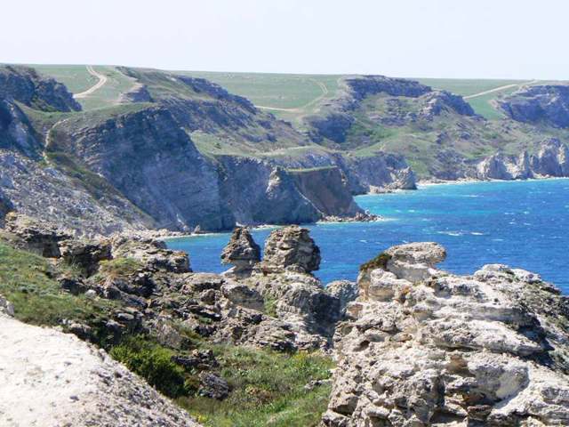
The Dzhanhul tract is a picturesque rock formation that stretches for 5 kilometers along the northwestern coast of Cape Tarkhankut.
The relief of the coast with clusters of characteristic layered rock chaos is formed by landslides, a large number of bizarre limestone figures are created by weathering and abrasion.
The largest landslide massif of Dzhanhul is located near Ternivska Balka: its length is about 500 meters, width - 200 meters. Cormorants, pelicans, starlings, partridges, flycatchers, nightingales and other birds nest among the stones, in the niches and crevices of the rocks.
The ruins of the ancient Greek customs house have been preserved in the Velykiy Kastel (Big Kastel) bay.
Since 1980, Dzhanhul has been a protected landscape reserve of local importance. In 2010, it became part of the "Charivna Havan" (Magic Harbor) nature park.
Its cozy terraces are popular among lovers of secluded relaxation in the company of nature.
Landscape Recreation Park "Atlesh"
Natural object
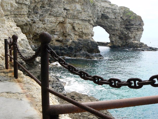
Landscape and recreation park "Atlesh" is a very picturesque rocky seashore in the southeastern part of Cape Tarkhankut.
The height of the rocks here reaches 30-40 meters, the coast is full of various bays and grottoes.
Cape Velykiy Atlesh (Big Atlesh) is a forty-meter arch with caves to which steps cut into the rock lead. Here is a fishing enterprise, which is now being repurposed into a modern diving center.
Cape Maliy Atlesh (Small Atlesh) is pierced by a through tunnel almost 100 meters long. Enthusiasts have created an underwater museum of Soviet sculpture "Alley of Leaders" here.
A little further away is the natural pool "Chasha kokhannya" (Cup of Love) - a popular swimming spot.
Due to the easy descent to the sea, there is the largest concentration of "savages" tents here, which in the high season fill the entire coast of the cape.
Thanks to the stunning "photogenic" terrain, Atlesh has repeatedly become a filming location - the films "Amphibian Man", "Pirates of the 20th Century", "People and Dolphins" and others were shot here.
A memorial sign has been installed on the shore in honor of the underwater house-laboratory "Ichthyandr-66", in which the Donetsk aquanauts from the Scorpena club lived and conducted experiments in 1966.
Tarkhankut Hillfort
Archaeological site
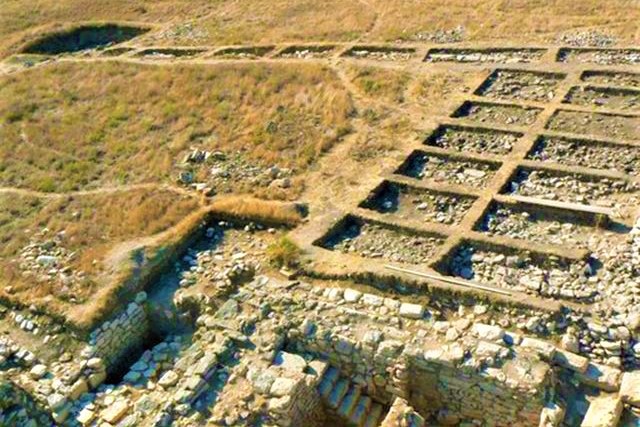
The Tarkhankut (Karadzhyn) Hillfort in Olenivka is located on the northern shore of the Tarkhankut estuary and is washed by water.
Presumably, in this place, in the 3rd century BC - 2nd century AD, there was a rich ancient settlement of Tamiraka, which in later times lost its polis self-government and later turned into an ordinary coastal fortification.
The area of the Tarkhankut Hillfort is 5 hectares.
Tarkhankut Lighthouse
Architecture
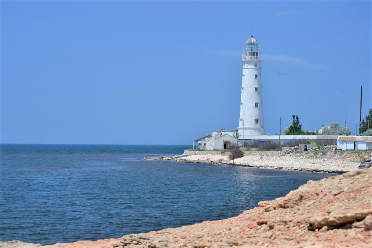
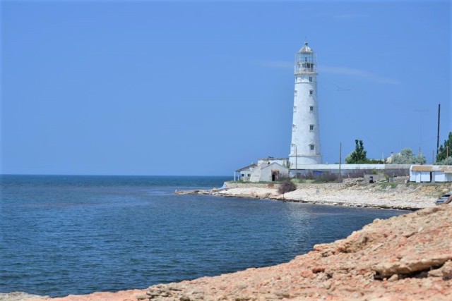
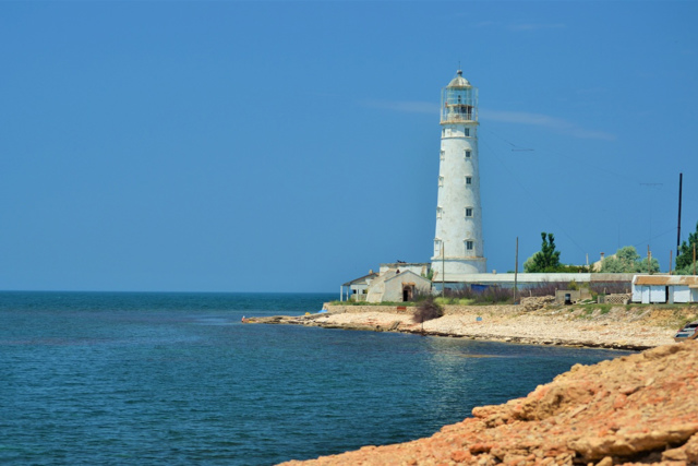
The Tarkhankut lighthouse is a well-preserved 200-year-old lighthouse that is still functioning and is located on the western edge of the Crimean peninsula, Cape Tarkhankut.
Presumably, the lighthouse at this dangerous place from the point of view of navigation existed even in ancient times. The current 42-meter-high tower was built of white Inkerman limestone in 1816. Due to the excellent quality of the construction, the building required only cosmetic repairs until now.
In 1851, the Tarkhankut lighthouse had 13 lamps with reflectors, in 1862 the lighting was improved and spread over 12.4 miles. During the fog, the sound of a pneumatic siren was heard or the bell was struck.
All buildings have been preserved. With the permission of the administration, you can climb the tower by climbing 142 steps of a cast iron spiral staircase.
Reviews Olenivka
Geographical information about Olenivka
| {{itemKey}} | {{itemValue}} |
|---|---|
| Region |
Autonomous Republic of Crimea |
