Functional temporarily unavailable
Vysoke
Travel guide online Vysoke
General information about Vysoke
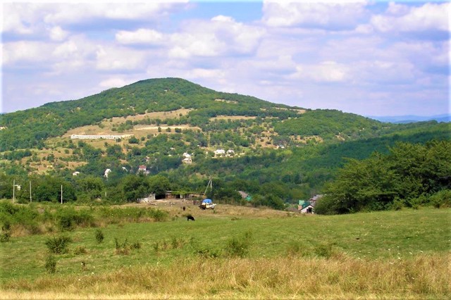
The village of Vysoke is located in the middle of the Second Ridge of the Crimean Mountains, 10 kilometers east of Albat, 30 kilometers from Bakhchysarai.
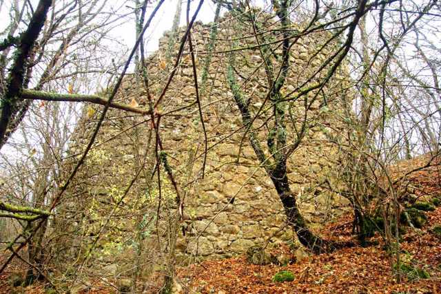
It is known since the 13th century, when the fortress of the Principality of Feodoro was built on Fortetsia Mountain on the western edge of the village (the ruins have been preserved). The Crimean Tatar name of the village Kremanchyk (small fortress) comes from it.
The Church of the Holy Trinity, known since 1310, has not been preserved, but in the village you can see the ruins of another one of the 14 ancient churches of Kermenchyk - the Dormition of the Virgin.
Before the conquest of Crimea by Russia, t ...
The village of Vysoke is located in the middle of the Second Ridge of the Crimean Mountains, 10 kilometers east of Albat, 30 kilometers from Bakhchysarai.
It is known since the 13th century, when the fortress of the Principality of Feodoro was built on Fortetsia Mountain on the western edge of the village (the ruins have been preserved). The Crimean Tatar name of the village Kremanchyk (small fortress) comes from it.
The Church of the Holy Trinity, known since 1310, has not been preserved, but in the village you can see the ruins of another one of the 14 ancient churches of Kermenchyk - the Dormition of the Virgin.
Before the conquest of Crimea by Russia, the village was divided into two parts - Greek and Tatar, but the Greeks were evicted to the Azov region. In 1944, all Crimean Tatars were forcibly evicted by the Soviet occupiers to Central Asia, the empty houses were filled with displaced persons from Ukraine, and the village was renamed Vysoke.
Село Високе розташоване посеред Другої гряди Кримських гір в 10 кілометрах на схід від Албата, в 30 кілометрах від Бахчисарая.
Відоме з XIII сторіччя, коли на горі Фортеця на західній околиці села була побудована фортеця князівства Феодоро (збереглися руїни). Від неї походить кримськотатарська назва села Креманчик (маленька фортеця).
Відома з 1310 року церква Святої Трійці не збереглася, але в селі можна побачити руїни ще одного з 14 стародавніх храмів Керменчика - Успіння Богородиці.
До моменту завоювання Криму Росією село ділилося на дві частини - грецьку та татарську, однак греки були виселені до Приазов'я. В 1944 році всі кримські татари були примус ...
Село Високе розташоване посеред Другої гряди Кримських гір в 10 кілометрах на схід від Албата, в 30 кілометрах від Бахчисарая.
Відоме з XIII сторіччя, коли на горі Фортеця на західній околиці села була побудована фортеця князівства Феодоро (збереглися руїни). Від неї походить кримськотатарська назва села Креманчик (маленька фортеця).
Відома з 1310 року церква Святої Трійці не збереглася, але в селі можна побачити руїни ще одного з 14 стародавніх храмів Керменчика - Успіння Богородиці.
До моменту завоювання Криму Росією село ділилося на дві частини - грецьку та татарську, однак греки були виселені до Приазов'я. В 1944 році всі кримські татари були примусово виселені радянськими окупантами в Середню Азію, в порожні будинки заселили переселенців з України, а село було перейменоване на Високе.
Сплануй своє перебування у Vysoke
What to see and where to go in Vysoke
Tourist attractions and museums of Vysoke

Kermenchyk Fortress Ruins
Castle / fortress
The Kermenchyk fortress in Vysokye has been known since the 13th century. The stone fortification on Mount Fortetsya (700 meters above sea level) is located 0.5 kilometers west of the village, which until 1945 was also called Kermenchyk (small fortress).
The length of the defensive wall was more than 230 meters, from the south there was a donjon tower. A fragment of the fortress wall with a height of 4.2 meters and a width of 7 meters has been preserved.
The Kermenchyk fortress was built during the time of the Feodoro principality and served to shelter the local population in case of danger, and was also a connecting signal post, clearly visible from the fortifications of Mahgup, Syuren fortress, Tepe-Kermen and Kiz-Kermen.
Reviews Vysoke
Geographical information about Vysoke
| {{itemKey}} | {{itemValue}} |
|---|---|
| Region |
Autonomous Republic of Crimea |


