Functional temporarily unavailable
Peredove
Travel guide online Peredove
General information about Peredove
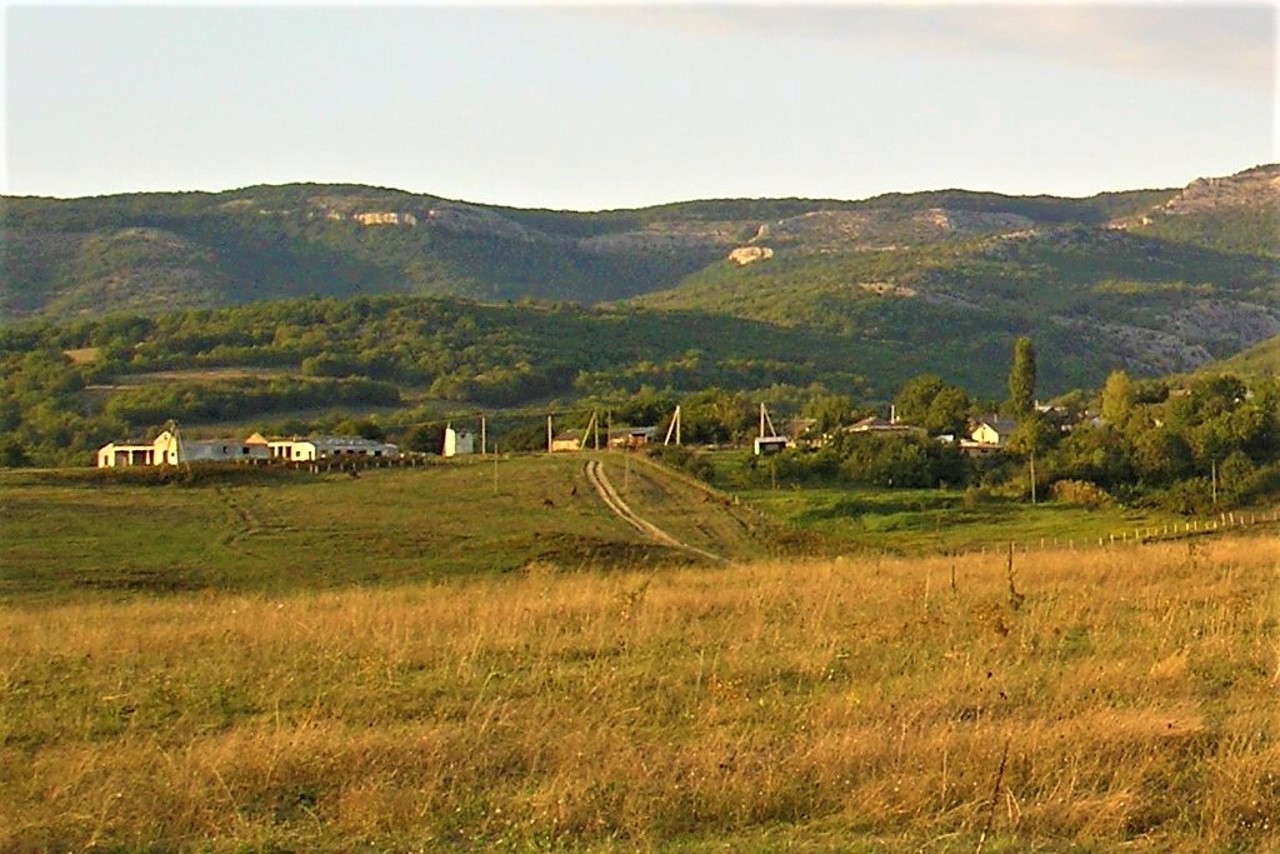
The village Peredove is located in the northern part of the Baydar Valley. It is located at an altitude of 400 meters above sea level among picturesque mountains, juniper and pine groves. Before the forced deportation of Crimean Tatars by Soviet occupiers from Crimea to Central Asia in 1944, the village was called Urkusta.
The first settlements appeared here in the time of Ancient Rome, as evidenced by archaeological findings. The name Urkusta has no Turkic roots and probably originates from ancient times (translated as "Bear's Ford"). In the 17th and 18th centuries, it was a small Tatar settlement. The old part of the village has preserved its original layout, and the village houses have a colorful "medieval" appearance.
There are many lakes in the v ...
The village Peredove is located in the northern part of the Baydar Valley. It is located at an altitude of 400 meters above sea level among picturesque mountains, juniper and pine groves. Before the forced deportation of Crimean Tatars by Soviet occupiers from Crimea to Central Asia in 1944, the village was called Urkusta.
The first settlements appeared here in the time of Ancient Rome, as evidenced by archaeological findings. The name Urkusta has no Turkic roots and probably originates from ancient times (translated as "Bear's Ford"). In the 17th and 18th centuries, it was a small Tatar settlement. The old part of the village has preserved its original layout, and the village houses have a colorful "medieval" appearance.
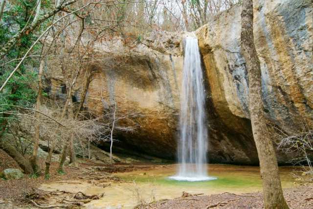
There are many lakes in the vicinity of Peredove, as well as the Kobolar (Kozyrok) waterfall, which dries up in summer.
Село Передове розташоване в північній частині Байдарської долини. Знаходиться на висоті 400 метрів над рівнем моря серед мальовничих гір, ялівцевих і соснових гаїв. До примусової депортації кримських татар радянськими окупантами із Криму в Середню Азію в 1944 році село мало назву Уркуста.
Перші поселення з'явилися тут ще за часів Стародавнього Риму, про що свідчать археологічні знахідки. Назва Уркуста не має тюркського коріння і, ймовірно, походить ще з античних часів (перекладається як "Ведмежий Брод"). В XVII-XVIII століттях це було невелике татарське поселення. Стара частина села зберегла первинне планування, а сільські будинки мають колоритний "середньовічний" вид.
В околицях Передового є багато озер, а також водоспад Коболар (Козирок), що пересих ...
Село Передове розташоване в північній частині Байдарської долини. Знаходиться на висоті 400 метрів над рівнем моря серед мальовничих гір, ялівцевих і соснових гаїв. До примусової депортації кримських татар радянськими окупантами із Криму в Середню Азію в 1944 році село мало назву Уркуста.
Перші поселення з'явилися тут ще за часів Стародавнього Риму, про що свідчать археологічні знахідки. Назва Уркуста не має тюркського коріння і, ймовірно, походить ще з античних часів (перекладається як "Ведмежий Брод"). В XVII-XVIII століттях це було невелике татарське поселення. Стара частина села зберегла первинне планування, а сільські будинки мають колоритний "середньовічний" вид.
В околицях Передового є багато озер, а також водоспад Коболар (Козирок), що пересихає влітку.
Сплануй своє перебування у Peredove
What to see and where to go in Peredove
Tourist attractions and museums of Peredove

Kobalar Waterfall
Natural object
The Kobalar stream flows through the Kobalar-Dere stream and flows into Nizhne Lake in the northern part of the Baydary valley.
Water falls from a height of about 14 meters to a small clear lake, creating a water curtain under the rock.
The Kobalar waterfall (Kozyrok) belongs to the so-called ephemeral waterfalls. You can admire the amazing sight of the rapidly falling stream only in spring and winter. In summer, both the stream and the waterfall are usually exhausted. Their occurrence is associated with the rapid melting of snow on the mountains.
The Kobalar waterfall is known among tourists under the name Kozyrok. This name was given to it by the unusual shape of the ledge from which the water falls. As for the toponym "Kobalar", the name of the stream translated from Turkic means "cave ravine", which is true.
The Kozyrok waterfall is almost unknown among vacationers on the Southern coast of Crimea, but it is popular among residents of Baydary Valley and Sevastopol. There is a rest area with indoor tables. Visiting the waterfall is paid.
Reviews Peredove
Geographical information about Peredove
| {{itemKey}} | {{itemValue}} |
|---|---|
| Region |
Autonomous Republic of Crimea |


