Functional temporarily unavailable
Murovani Kurylivtsi
Travel guide online Murovani Kurylivtsi
General information about Murovani Kurylivtsi
The town Murovani Kurylivtsi is located on the steep banks of the Zhvan River, 45 kilometers northwest of Mohyliv-Podilskyi. Administratively, it is part of the Vinnytsia region.
The settlement was first mentioned in 1453 as Churylivtsi - after the surname of the founders from the Polish Churyli family of the Korchak coat of arms (according to another version, the Cossack Churyla). They began to be called "walled" in the 16th century, after the tycoon Polyanovsky built a stone castle ("walls").
From the middle of the 17th century, Murovani Kurylivtsi became the property of the Kossakis, but after the accession o ...
The town Murovani Kurylivtsi is located on the steep banks of the Zhvan River, 45 kilometers northwest of Mohyliv-Podilskyi. Administratively, it is part of the Vinnytsia region.
The settlement was first mentioned in 1453 as Churylivtsi - after the surname of the founders from the Polish Churyli family of the Korchak coat of arms (according to another version, the Cossack Churyla). They began to be called "walled" in the 16th century, after the tycoon Polyanovsky built a stone castle ("walls").
From the middle of the 17th century, Murovani Kurylivtsi became the property of the Kossakis, but after the accession of Right-Bank Ukraine to the Russian Empire, when Katarzyna Kosakivska supported the Bar Confederation, her estate was confiscated and given to the loyal nobleman Stanislav Komar, the future marshal of Podillia. In 1805, Count Komar built the existing palace, incorporating parts of the castle buildings into its composition.
The landscape park laid out in the 18th century and reconstructed in 1814 under the leadership of Dionysius Makler is also partially preserved.
In 1842, a sugar factory was launched, the town soon became the center of the parish. In 1867, Rear Admiral Mykola Chikhachov became the owner of Murovani Kurylivts. The Church of the Nativity of the Virgin was built under him in 1885.
In 1931-38, along the banks of the Zhvan River, the 12th Mohyli-Yampilsky Fortification District (part of the "Stalin Line") were erected toll towers, which can still be seen today. Next to one of them, a heavy IS-2 tank is installed on a pedestal.
Селище Муровані Курилівці розташоване на крутих берегах річки Жван в 45 кілометрах на північний захід від Могилева-Подільського. Адміністративно входить до складу Вінницької області.
Вперше поселення згадується в 1453 році як Чурилівці - по прізвищу засновників з польського роду Чурилів гербу Корчак (за іншою версією, козака Чурила). "Мурованими" їх стали називати в XVI сторіччі, після того як магнат Поляновський звів тут кам'яний замок ( "мури").
З середини XVII століття Муровані Курилівці перейшли у власність Коссаківських, однак після приєднання Правобережної України до Російської імперії, коли Катажина К ...
Селище Муровані Курилівці розташоване на крутих берегах річки Жван в 45 кілометрах на північний захід від Могилева-Подільського. Адміністративно входить до складу Вінницької області.
Вперше поселення згадується в 1453 році як Чурилівці - по прізвищу засновників з польського роду Чурилів гербу Корчак (за іншою версією, козака Чурила). "Мурованими" їх стали називати в XVI сторіччі, після того як магнат Поляновський звів тут кам'яний замок ( "мури").
З середини XVII століття Муровані Курилівці перейшли у власність Коссаківських, однак після приєднання Правобережної України до Російської імперії, коли Катажина Косаківська підтримала Барську конфедерацію, маєток у неї було конфісковано й передано лояльному шляхтичу Станіславові Комарові, майбутньому подільському маршалку. В 1805 році граф Комар побудував існуючий нині палац, включивши в його композицію частини замкових споруд.
Також частково зберігся пейзажний парк, закладений в XVIII столітті та реконструйований в 1814 році під керівництвом Діонісія Маклера.
В 1842 році було запущено цукровий завод, містечко незабаром стало волосним центром. В 1867 році власником Мурованих Курилівців став контр-адмірал Микола Чихачов. При ньому в 1885 році була побудована церква Різдва Богородиці.
В 1931-1938 роках уздовж берега річки Жван були зведені ДОТи 12-го Могилів-Ямпільського укріпрайону (частина "Лінії Сталіна"), які можна побачити і зараз. Поруч з одним з них на постаменті встановлено важкий танк ІС-2.
Сплануй своє перебування у Murovani Kurylivtsi
What to see and where to go in Murovani Kurylivtsi
Tourist attractions and museums of Murovani Kurylivtsi
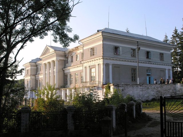
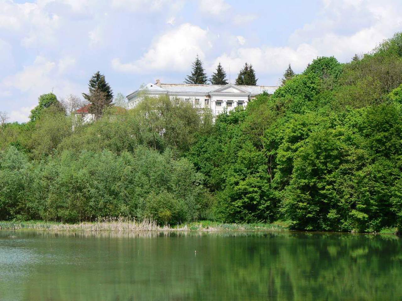
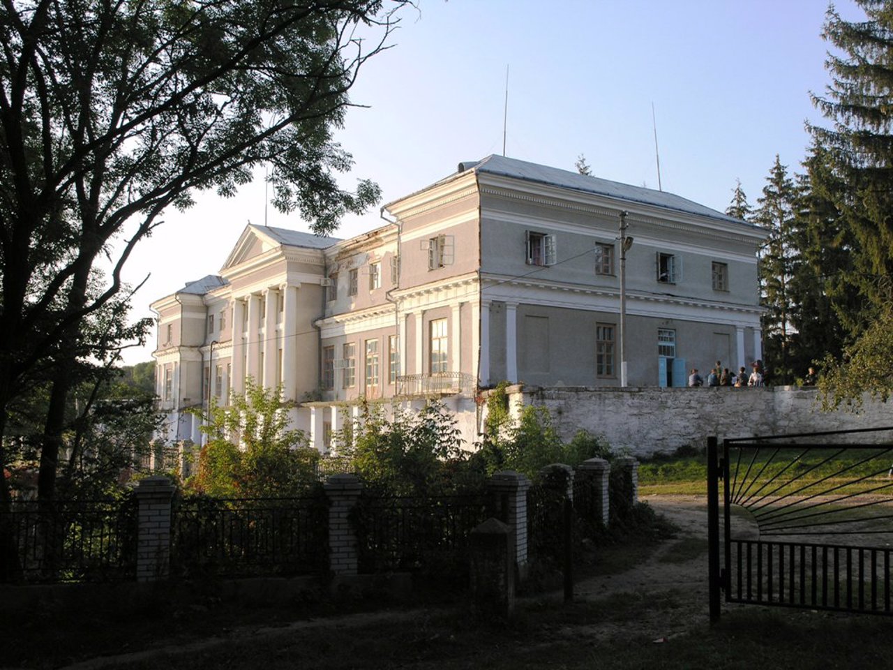
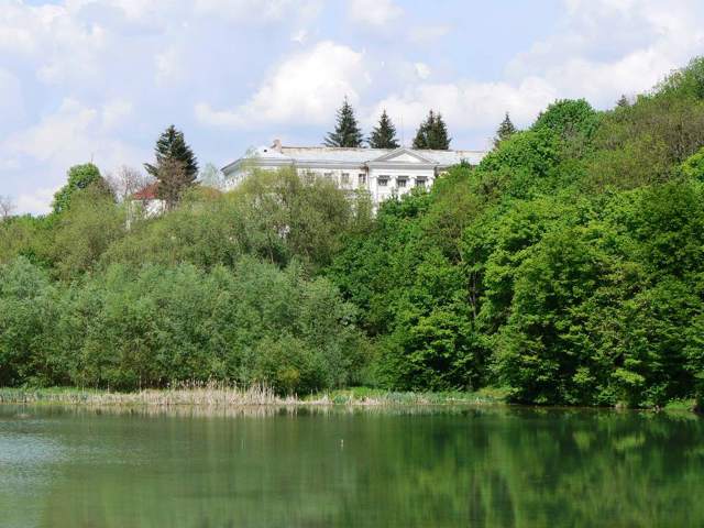
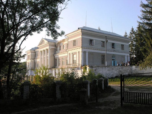
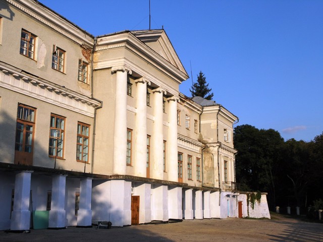
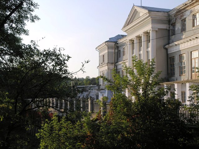
Komar Palace
Palace / manor , Architecture
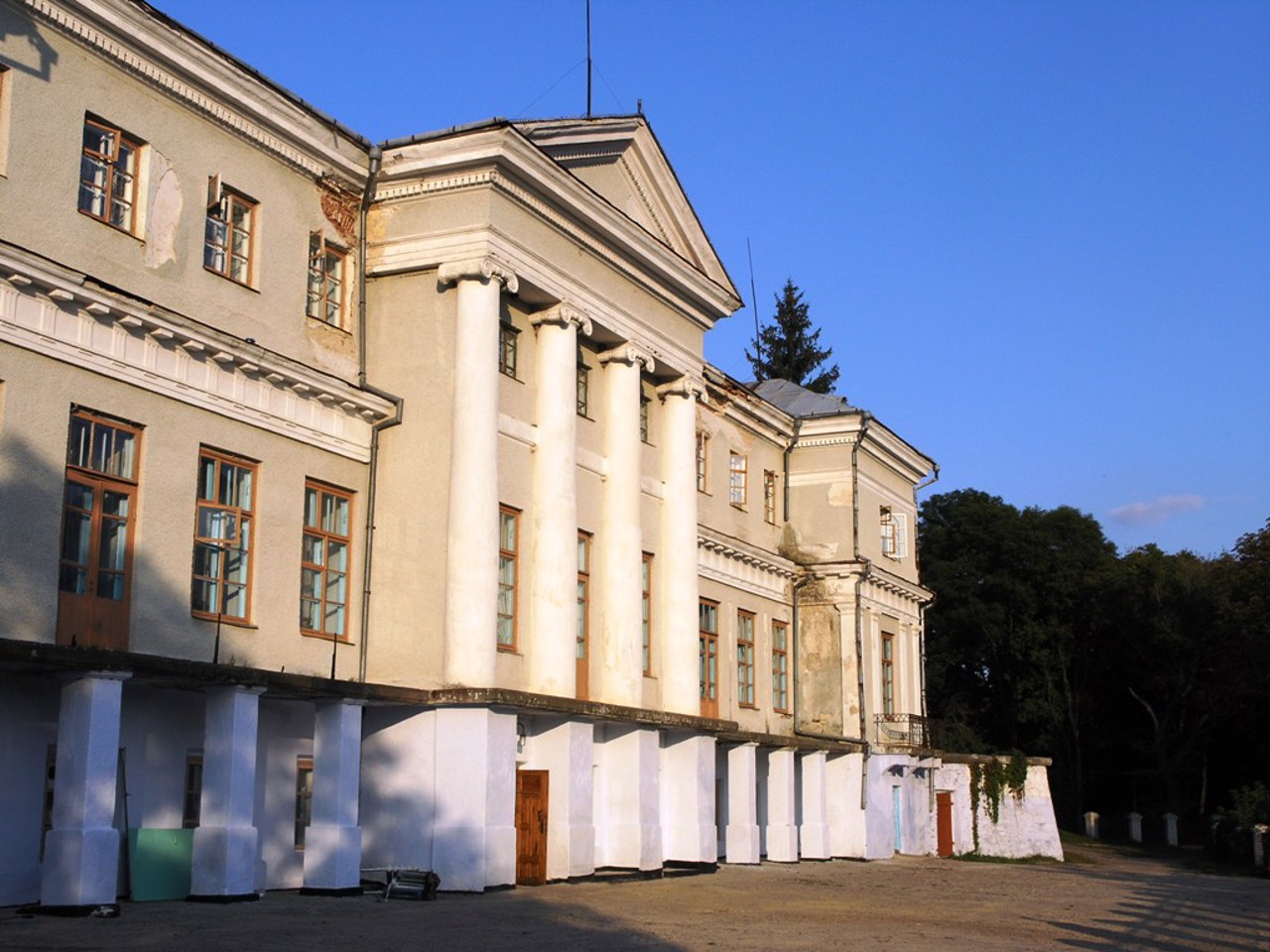
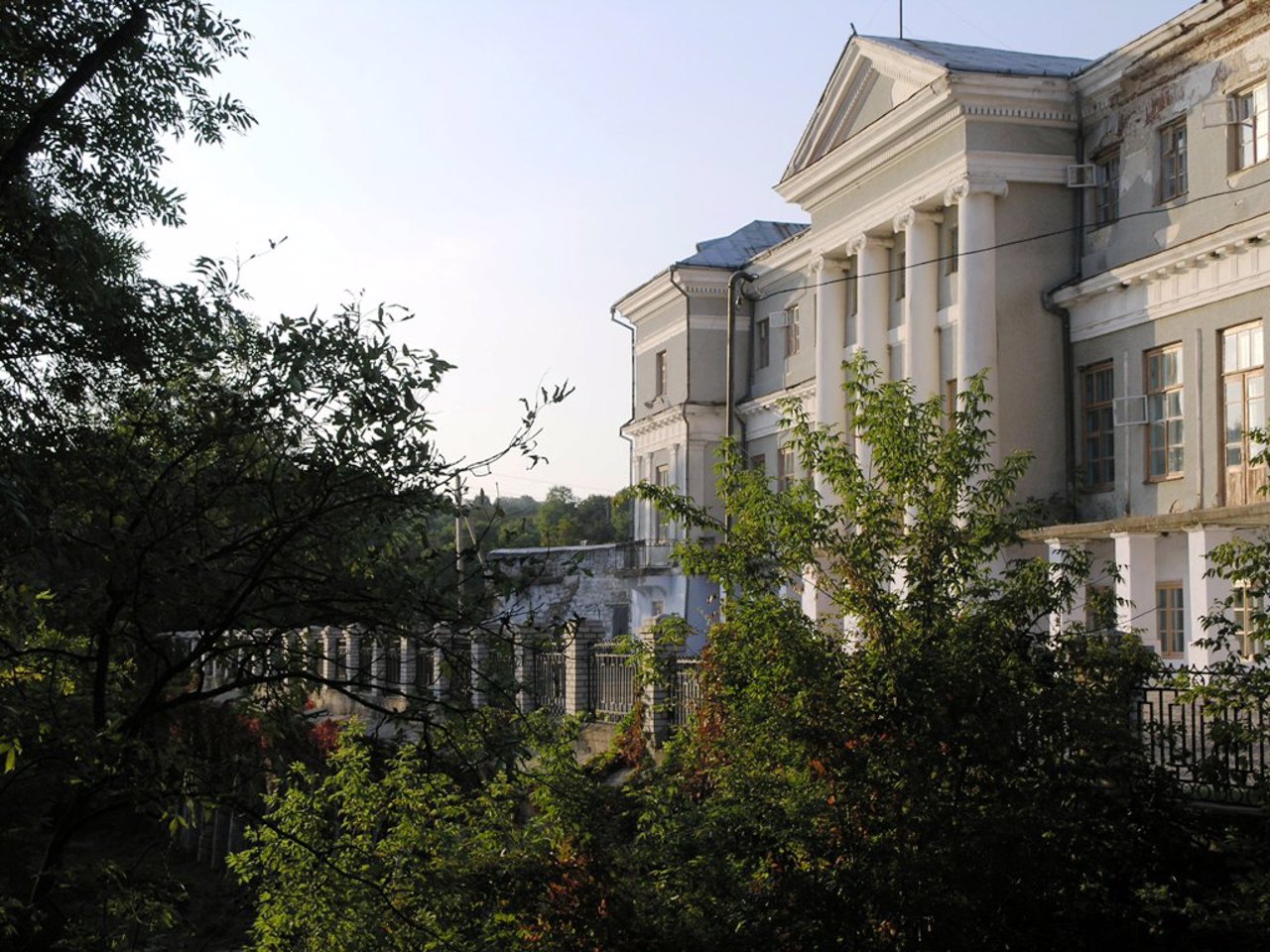
The palace of Podillya marshal Stanislav Komar in Murovani Kurylivtsi was built in 1805 on the basis of fortress buildings of the 16th century.
In the architectural composition of the manor, the architect included parts of the castle buildings: the stone escarpment of the bastion castle on the northern, eastern and southern sides (which includes underground vaulted casemates), and on the western, floor side - the foundations and ruins of the former castle wall. This part of the palace looks very majestic, while on the other side it is an ordinary two-story building in the style of classicism.
A landscape park, the construction of which was managed in 1814 by the famous Irish park builder Dionisiy Mikler (Makkler), who created many wonderful parks in Podillya, is partially preserved.
Among other buildings of the manor that have survived: an arsenal (stable), a wing in the Neo-Gothic style, a stone three-span arched bridge over the Zhvan River.
In the 1960s, the palace underwent a major reconstruction (the lobby was redesigned, the sizes and levels of the windows on the second floor were changed). Now the estate houses a sanatorium-boarding school for children with diseases of the cardiovascular system.
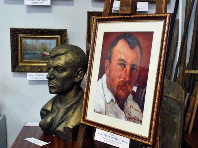
Murovani Kurylivtsi Local Lore Museum
Museum / gallery
The local lore museum in Murovani Kurylivtsi was opened in 1992 in the cultural center on the initiative of the family of the famous Ukrainian artist Fedir Konovalyuk, a native of the village of Yahidne near Murovani Kurylivtsi.
As a gift to the museum, the family donated a collection of Konovalyuk's canvases: portraits, landscapes, illustrations to the works of Ukrainian writers. In 2010, on the occasion of the 120th anniversary of the artist's birth, his museum room was opened.
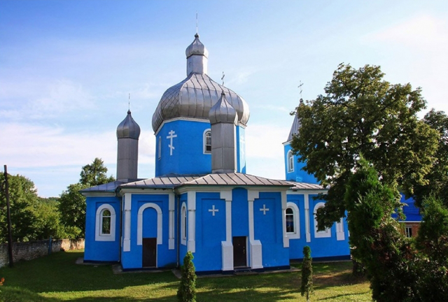
Nativity of Holy Virgin Church
Temple , Architecture
The Church of the Nativity of the Holy Virgin in Murovani Kurylivtsi was founded in 1781. Later, it was dismantled, and the materials were used for a new five-domed church, the construction of which was completed in 1889 at the expense of parishioners, the treasury, and landowners Komar and Lykhachev.
The church had a one-tier gilded iconostasis with a valuable icon of the Tikhvin Mother of God, which was purchased on Mount Athos and donated by the landowner Chykhachova.
In 1934, the Church of the Nativity of the Virgin was closed by the Soviet authorities, then briefly revived during the German occupation, but in the 1950s it was closed again and stripped of its domes. The premises were used as a library, a gym, a bakery and even a warehouse for glass containers.
Since 1991, the Nativity of Holy Virgin Church is active again.
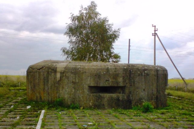
Pillboxs Stalin's Line
Castle / fortress
About ten Pillboxs (DOTs) from the Second World War have been preserved in the area of Murovani Kurylivtsi.
Not far from here was the northwestern edge of the 12th Mohyliv-Yampil District (MYUR), established in the 1930s on the then southwestern border of the USSR. It was part of the gigantic system of defensive structures of the "Stalin Line", which stretched from the Baltic to the Black Sea.
In July 1941, the MIAUR became the defense border of the 18th Army of the Southern Front. Divisions of the 17th Rifle Corps fought in the area of Murovani Kurylivtsi. After the Germans broke through the defenses to the north, the Soviet troops disarmed the DOTs and retreated to the east.
One of the DOTs is located at the entrance to the village from the Vinnytsia side next to the monument to the liberating soldiers - an IS-2 tank on a pedestal. Another DOT is located in front of the bridge over the Zhvan River, and the third is on the territory of the Komar estate.
Reviews Murovani Kurylivtsi
Geographical information about Murovani Kurylivtsi
| {{itemKey}} | {{itemValue}} |
|---|---|
| Region |
Vinnytsia |
