Functional temporarily unavailable
General information about Vytachiv
The ancient village of Vytachiv is located on the high right bank of the Dnieper, next to Trypillia, 60 kilometers southeast of Kyiv. Administratively, it is a part of the Ukrayinka urban hromada of Obukhiv district, Kyiv region.
Vytachiv is one of the oldest villages of Kyiv region. For the first time it is mentioned in the work "On the management of the empire" of the Byzantine Emperor Constantine VII Porphyrogenitus in 957 as Vytychiv (Vitichiv), in other historical chronicles it appears as Uvetychi.
According to one of the versions, the name of Vytachiv may come from the name of the king of the Ostrogoths, Vithimiris. In the central part of the village is Krasukha mountain of artificial origin, which is considered a burial mound from the times of the Ant kingdo ...
The ancient village of Vytachiv is located on the high right bank of the Dnieper, next to Trypillia, 60 kilometers southeast of Kyiv. Administratively, it is a part of the Ukrayinka urban hromada of Obukhiv district, Kyiv region.
Vytachiv is one of the oldest villages of Kyiv region. For the first time it is mentioned in the work "On the management of the empire" of the Byzantine Emperor Constantine VII Porphyrogenitus in 957 as Vytychiv (Vitichiv), in other historical chronicles it appears as Uvetychi.
According to one of the versions, the name of Vytachiv may come from the name of the king of the Ostrogoths, Vithimiris. In the central part of the village is Krasukha mountain of artificial origin, which is considered a burial mound from the times of the Ant kingdom. Some researchers believe that the barrow was built in 375 at the place of death of the famous Gothic king Ermanaric by order of his successor Vithimiris, which gave rise to the settlement.
During the times of Kyivan Rus, the city of Vytychiv was an important port on the Dnipro, where merchant caravans stopped on the trade route "from the Varangians to the Greeks" (the settlement is located on Mount Okip in the northern part of the village, partially built up).
Near Vytachiv, in 1096, Prince of Kyiv Svyatopolk Izyaslavych founded the city of Svyatopolch (Novhorod Svyatopolchyi), where he resettled the inhabitants of the city of Yuryiv, destroyed by the Polovtsy (the hillfort is located 1.5 kilometers south of the village, traces of old ramparts have been preserved). After the Mongol-Tatar invasion, life in Vytachiv resumed in the 15th century.
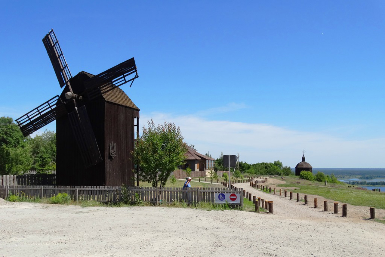
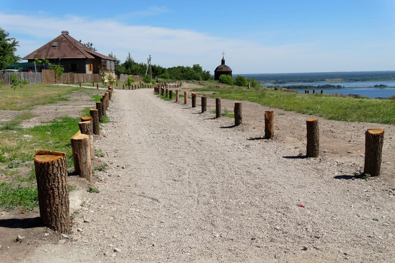
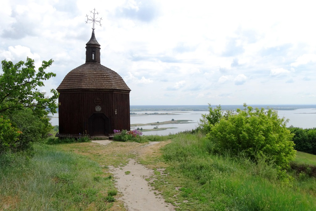
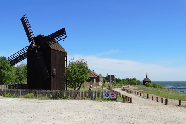
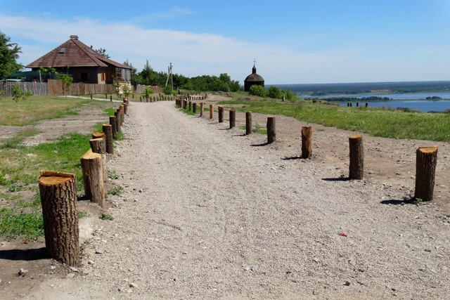
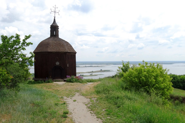
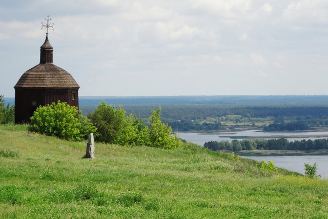
The most visited place in Vytachiv is Mohyla Mountain or Prince's Spire. According to legend, it was here in 1100 that the Vytychiv princes' conference took place, at which peace was concluded between Svyatopolk Izyaslavych, Volodymyr Monomakh, Davyd and Oleh Svyatoslavych. In 1991, a wooden chapel designed by Taras Shevchenko was built on the mountain under the leadership of the Ukrainian Spiritual Republic, headed by Oles Berdnyk. At the same time, a wooden mill was built. This is one of the best panoramic sites on the right bank of Kyiv region.
Vytachiv Village Day is celebrated on the last Saturday of September or on the Feast of the Exaltation of the Holy Cross.
Старовинне село Витачів розташоване на високому правому березі Дніпра, поруч із Трипіллям, за 60 кілометрів на південний схід від Києва. Адміністративно входить до складу Української міської громади Обухівського району Київської області.
Витачів є одним із найдавніших сіл Київщини. Вперше воно згадується у творі "Про управління імперією" імператора Візантії Костянтина VII Багрянородного у 957 році як Витичів, в інших історичних хроніках фігурує як Уветичі.
За однією з версій, назва Витачева може походити від імені короля остготів Витимира. В центральній частині села знаходиться гора Красуха штучного походження, яка вважається курганом часів Антського царства. Деякі дослідники вважають, що курган був насипаний у 375 році на місці загибелі відомого готського короля Г ...
Старовинне село Витачів розташоване на високому правому березі Дніпра, поруч із Трипіллям, за 60 кілометрів на південний схід від Києва. Адміністративно входить до складу Української міської громади Обухівського району Київської області.
Витачів є одним із найдавніших сіл Київщини. Вперше воно згадується у творі "Про управління імперією" імператора Візантії Костянтина VII Багрянородного у 957 році як Витичів, в інших історичних хроніках фігурує як Уветичі.
За однією з версій, назва Витачева може походити від імені короля остготів Витимира. В центральній частині села знаходиться гора Красуха штучного походження, яка вважається курганом часів Антського царства. Деякі дослідники вважають, що курган був насипаний у 375 році на місці загибелі відомого готського короля Германаріха за наказом його наступника Витимира, що і дало початок поселенню.
За часів Київської Русі місто Витичів було важливим портом на Дніпрі, де зупинялися купецькі каравани, що рухалися торговим шляхом "із варягів у греки" (городище знаходиться на горі Окіп у північній частині села, частково забудоване).
Поблизу Витачева у 1096 році князь Київський Святополк Ізяславич заснував місто Святополч (Новгород Святополчий), куди переселив мешканців зруйнованого половцями міста Юр'їва (городище знаходиця за 1,5 кілометри південніше села, збереглися сліди старих валів). Після монголо-татарської навали життя у Витачеві відновилося у XV столітті.
Найвідвідуванішим місцем Витачева є гора Могила або Княжий шпиль. За легендою, саме тут у 1100 році відбувся Витичівський з'ззд князів, на якому було укладено мир між Святополком Ізяславичем, Володимиром Мономахом, Давидом і Олегом Святославичами. В 1991 році під проводом Української Духовної Республіки на чолі з Олесем Бердником на горі було споруджено дерев'яну каплицю за власноручним проєктом Тараса Шевченка. Тоді ж було збудовано дерев'яний млин. Це один із найкращих панорамних майданчиків на правобережжі Київщини.
День села Витачева святкується в останню суботу вересня або на свято Воздвиження Хреста Господнього.
Сплануй своє перебування у Vytachiv
What to see and where to go in Vytachiv
Tourist attractions and museums of Vytachiv
Mohyla Mountain (Knyazhyi Shpyl)
Historic area , Archaeological site
The most famous and most visited tourist object of Vytachiv is Mohyla Mountain, better known recently as Knyazhyi Shpyl (Prince's Spire) or Horodyshche. It is located in the south-eastern part of the village. This is one of the highest Dnipro cliffs (190 meters above sea level), which has become the hallmark of the village of Vytachiv thanks to stunning panoramas, modern legends and developed tourist infrastructure.
Data from archeological researches indicate that a 12th century barrow gravedigger is located at this place. Some local historians believe that it was at this place that the historic Vytychiv snem (congress of ancient Rus princes) took place, at which peace was concluded between Svyatopolk Izyaslavych, Volodymyr Monomakh, David and Oleh Svyatoslavych.
Mohyla Mountain does not have a protected status, although in some sources this place is mistakenly called the National Scientific and Cultural Reserve "Novhorod Svyatopolchyi Settlement" or "Vytych Settlement".
In 1991, Ukrainian writer and philosopher Oles Berdnyk laid the cornerstone of the future Church of Ukraine-Mother at this place during the Second Congress of the Ukrainian Spiritual Republic. Before the third congress held in Vytachiv the following year, a wooden windmill and a chapel designed by Taras Shevchenko were erected. The Berdnyk chapel appears in the film "Bohdan Zynoviy Khmelnytskyi" (2004). On the lower terrace of the mountain, the remains of the scenery of Orysya's hut from the film "The Guide" (2014) have been preserved.
The "Vytach" wood-fired craft bakery offers sourdough bread near the windmill. There is a car parking lot, places for rest with tables and barbecues, a public toilet. A stylized private estate also attracts attention.
Krasukha Mountain
Archaeological site
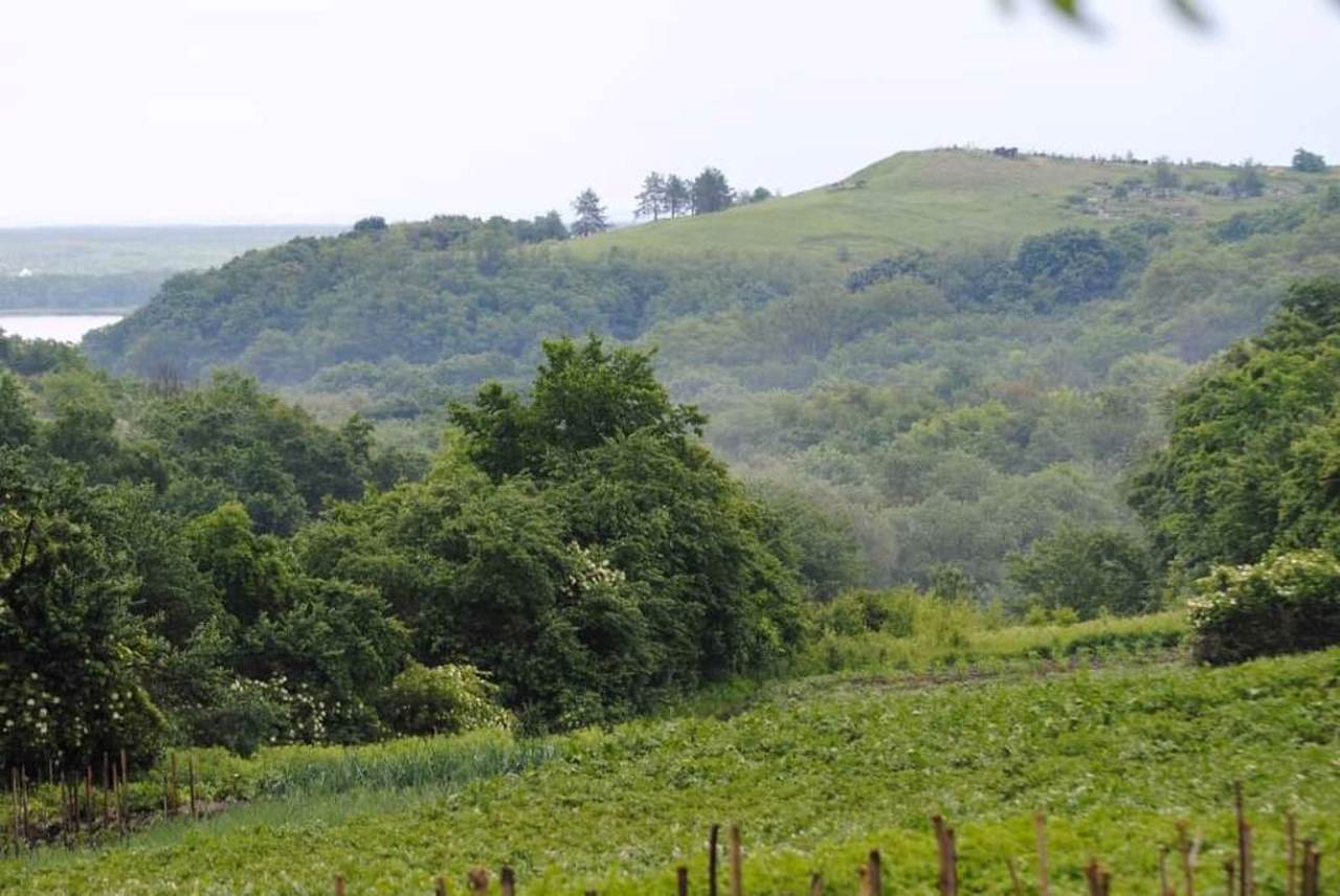
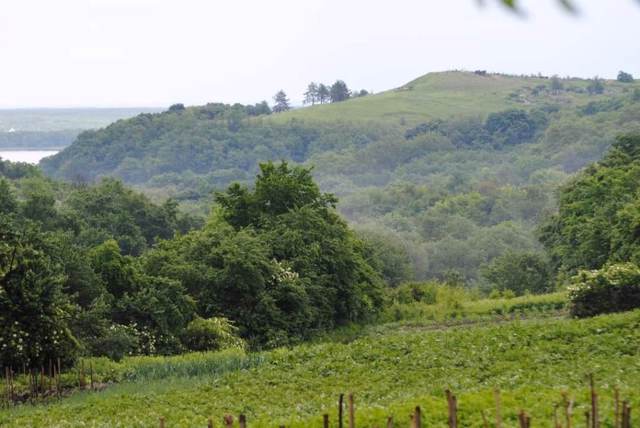
Mountain Krasukha rises 189 meters above sea level in the northeastern part of the Vytachiv village. Archaeological studies indicate that the top of the mountain is an artificial mound of the 2nd-4th centuries, probably from the times of the Ant kingdom.
There is a popular version that the barrow was built in 375 at the place of death of the famous Gothic king Ermanaric by order of his successor Vithimiris, which gave rise to the village of Vytachiv.
Archeological research discovered objects of the Chernyakhiv culture of the 2nd-3rd centuries, artifacts from the time of the Huns (5th century) and the remains of a pagan temple from the 6th-8th centuries on the mountain. The mountain was probably used as a burial place at all times.
Now there is also a village cemetery on Krasukha Mountain, so it is considered the oldest active necropolis in Kyiv region. Adherents of esoteric teachings consider the mountain a "place of power".
To the west of the mountain is the historical area of Okip, where there is a settlement of the ancient Rus city of Vytychiv of the 10th-13th centuries. Remains of ramparts and ditches can still be seen among private estates there.
Svyatopolch Hillfort
Museum / gallery
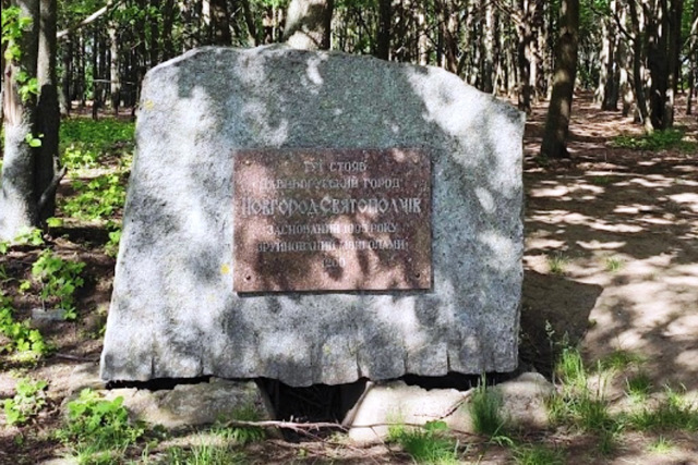
The historic town of Svyatopolch (Novhorod Svyatopolchyi) was founded in 1095 by the Kyiv prince Svyatopolk II Izyaslavych on the Vytachiv hill. Here the prince will resettle the inhabitants of the city of Yuryiv, destroyed by the Polovtsy.
Chronicles show that after the defeat of the army of the Rus princes in the battle of Kalka in 1223, the Mongols marched into Rus, but only reached Svyatopolch, from where they turned back. After that, Svyatopolch is no longer mentioned in the annals.
According to archaeological research, the remains of historical Svyatopolch are located in the Horodyshche tract between the villages of Vytachiv and Staiky. Hillfort occupied a triangular cape with an area of about 0.5 hectares. Fragments of earthen defensive ramparts with three towers have been preserved, and the remains of settlements have been investigated. Remains of a post with a pottery workshop can be traced on the ground side and on the slopes.
In 2009, the monument of archeology "The settlement of the historical city of Svyatopolch of the IX-XIII centuries" was entered into the State Register of Immovable Monuments of Ukraine under the number 100014-Н. A memorial sign has been installed.
Vytachiv Local Lore Museum
Museum / gallery
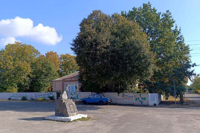
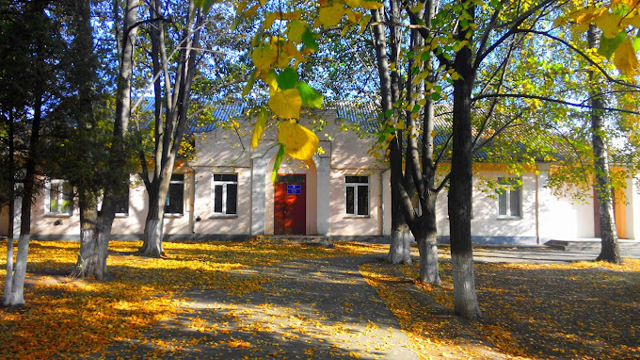
The Vytachiv Museum of Local Lore was opened in 2008. It is located in the premises of the Vytachiv village club.
A small ethnographic collection and works of local masters of folk art are presented.
Reviews Vytachiv
Geographical information about Vytachiv
| {{itemKey}} | {{itemValue}} |
|---|---|
| Region |
Kyiv |
