Functional temporarily unavailable
Turkish Shaft, Novovidradne
Castle / fortress
General information about Turkish Shaft (Novovidradne)
Turkish Shaft is the name of one of the oldest defensive structures on the territory of Ukraine.
According to the legend described by Herodotus, the earthen Shaft crossing the entire eastern edge of the Crimea was built by Scythian slaves who went on a long military campaign, fearing retribution for cohabiting with Scythian wives. The rampart was probably built by the Cimmerians, which is why experts call it the Cimmerian rampart (also Akkosiv or Uzunlarsky).
The length of the Turkish wall reached 32 kilometers, at the base was a stone embankment. It runs from the northwestern edge of the village of Novovidradne past the Kerch ...
Turkish Shaft is the name of one of the oldest defensive structures on the territory of Ukraine.
According to the legend described by Herodotus, the earthen Shaft crossing the entire eastern edge of the Crimea was built by Scythian slaves who went on a long military campaign, fearing retribution for cohabiting with Scythian wives. The rampart was probably built by the Cimmerians, which is why experts call it the Cimmerian rampart (also Akkosiv or Uzunlarsky).
The length of the Turkish wall reached 32 kilometers, at the base was a stone embankment. It runs from the northwestern edge of the village of Novovidradne past the Kerch Reservoir, crosses the E-97 highway 3 kilometers from the village of Hornostaivka, descends past Lake Marfivske to Lake Uzunlarske.
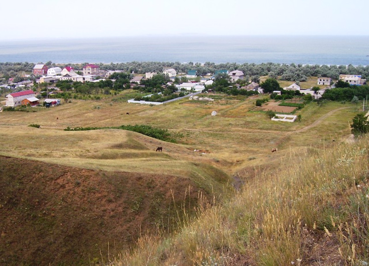
From the northern edge of the Turkish Wall, a wonderful view of the village of Novovidradne and the coast of the Sea of Azov opens up.
Турецький вал - назва однієї з найдавніших оборонних споруд на території України.
За легендою, описаною Геродотом, земляний вал, що перетинає весь східний край Криму, насипали раби скіфів, що пішли в тривалий військовий похід, побоюючись відплати за співжиття зі скіфськими дружинами. Ймовірно, вал збудований кіммерійцями, тому фахівці називають його Кіммерійським валом (також Аккосовим чи Узунларським).
У довжину Турецький вал досягав 32 кілометрів, в основі був кам'яний насип. Проходить від північно-західного краю села Нововідрадне повз Керчинське водосховище, перетинає трасу Е-97 за 3 кілометри від села Горностаївка, о ...
Турецький вал - назва однієї з найдавніших оборонних споруд на території України.
За легендою, описаною Геродотом, земляний вал, що перетинає весь східний край Криму, насипали раби скіфів, що пішли в тривалий військовий похід, побоюючись відплати за співжиття зі скіфськими дружинами. Ймовірно, вал збудований кіммерійцями, тому фахівці називають його Кіммерійським валом (також Аккосовим чи Узунларським).
У довжину Турецький вал досягав 32 кілометрів, в основі був кам'яний насип. Проходить від північно-західного краю села Нововідрадне повз Керчинське водосховище, перетинає трасу Е-97 за 3 кілометри від села Горностаївка, опускається повз озеро Марфівське до озера Узунларське.
З північного краю Турецького валу відкривається чудовий краєвид на село Нововідрадне та берег Азовського моря.
Practical information about Turkish Shaft (Novovidradne)
Last update
1/30/2025
| Categories | Castle / fortress |
|---|---|
| Date of foundation | 1st millennium BC |
| Address |
Novovidradne |
| Coordinates |
45.3846921° N, 36.0604548° E
|
| Additional services |
Аccessibility information
Have you visited Turkish Shaft in Novovidradne?
Add practical or descriptive information, photos, links
What to see, where to go next?


