Functional temporarily unavailable
Burty Hillfort, Chaplynka
Archaeological site
General information about Burty Hillfort (Chaplynka)
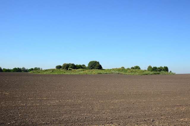
Burty Hillfort is located 1 kilometer north of Chaplynka village. Earthen ramparts 10-12 meters high surround the territory of 1.9 hectares.
Traditionally, "Burty" is attributed to Scythian times (VI-VII centuries BC), however, recent research has revealed burials of the Bronze Age (2-3 millennia BC) in the center of the settlement.
In Cossack times, the ramparts were used as fortifications by the troops of Hetman Bohdan Khmelnytskyi, then Colonel Semen Paliy. The "Black Path" of Tatar raids passed 8 kilometers to the northeast of "Burtiv". During the Korsun-Shevchenkskyi battle (World War II), German troops placed an artillery battery here, but they did not last long. At that time, the settlement occupied up to 12 hectares.
In the 1960s a ...
Burty Hillfort is located 1 kilometer north of Chaplynka village. Earthen ramparts 10-12 meters high surround the territory of 1.9 hectares.
Traditionally, "Burty" is attributed to Scythian times (VI-VII centuries BC), however, recent research has revealed burials of the Bronze Age (2-3 millennia BC) in the center of the settlement.
In Cossack times, the ramparts were used as fortifications by the troops of Hetman Bohdan Khmelnytskyi, then Colonel Semen Paliy. The "Black Path" of Tatar raids passed 8 kilometers to the northeast of "Burtiv". During the Korsun-Shevchenkskyi battle (World War II), German troops placed an artillery battery here, but they did not last long. At that time, the settlement occupied up to 12 hectares.
In the 1960s and 1970s, Burty Hillfort was intensively plowed. Today, it is a monument not only of archeology, but also of nature, as representatives of the "Red Book of Ukraine" can be found among the local vegetation.
Городище "Бурти" розташоване за 1 кілометр на північ від села Чаплинка. Земляні вали заввишки 10-12 метрів оточують територію площею 1,9 гектари.
Традиційно "Бурти" відносять до скіфських часів (VI-VII сторіччя до нашої ери), проте недавні дослідження виявили в центрі городища поховання епохи бронзи (2-3 тисячоліття до нашої ери).
У козацькі часи вали використовувалися як укріплення військами гетьмана Богдана Хмельницького, потім полковника Семена Палія. У 8 кіорметрах на північний схід від "Буртів" проходив "Чорний шлях" набігів татар. Під час Корсунь-Шевченківської битви (Друга світова війна) німецькі війська розмістили тут артилерійську батарею, проте протрималися недовго. Тоді городище займало ще до 12 гектарів.
У 1960-1970-х ...
Городище "Бурти" розташоване за 1 кілометр на північ від села Чаплинка. Земляні вали заввишки 10-12 метрів оточують територію площею 1,9 гектари.
Традиційно "Бурти" відносять до скіфських часів (VI-VII сторіччя до нашої ери), проте недавні дослідження виявили в центрі городища поховання епохи бронзи (2-3 тисячоліття до нашої ери).
У козацькі часи вали використовувалися як укріплення військами гетьмана Богдана Хмельницького, потім полковника Семена Палія. У 8 кіорметрах на північний схід від "Буртів" проходив "Чорний шлях" набігів татар. Під час Корсунь-Шевченківської битви (Друга світова війна) німецькі війська розмістили тут артилерійську батарею, проте протрималися недовго. Тоді городище займало ще до 12 гектарів.
У 1960-1970-х роках городище "Бурти" інтенсивно розорювали. Нині це пам'ятник не лише археології, а й природи, оскільки серед місцевої рослинності трапляються представники "Червоної книги України".
Practical information about Burty Hillfort (Chaplynka)
Last update
5/28/2025
| Categories | Archaeological site |
|---|---|
| Date of foundation | VI-VII centuries BC |
| Address |
Chaplynka |
| Coordinates |
49.3567118° N, 30.6328171° E
|
| Additional services |
Аccessibility information
Have you visited Burty Hillfort in Chaplynka?
Add practical or descriptive information, photos, links
What to see, where to go next?


