Functional temporarily unavailable
Perekop Shaft, Armiansk
Historic area
Castle / fortress
General information about Perekop Shaft (Armiansk)
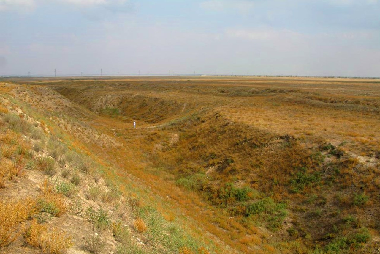
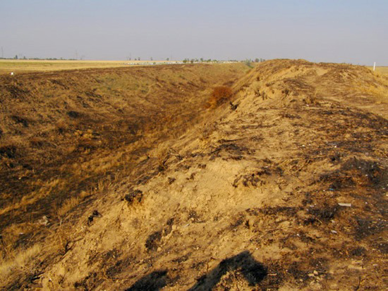
The Perekop Shaft is a powerful earthen fortification that crosses the Perekop Isthmus in its narrowest part.
The height of the embankment reached 10 meters, along it ran a canal connecting Perekop Bay with Lake Sivash.
The exact date of construction of the Perekop Shaft is unknown, but already in the 1st century Greek sources mention the Tafros fortress with a defensive rampart and a canal laid along it.
During the Crimean Khanate, Perekop defended Crimea from the continent. The earthen embankment was fortified with stone towers, the ruins of one of which still rise 15 meters above the waters of the Karkinit Bay of the Bl ...
The Perekop Shaft is a powerful earthen fortification that crosses the Perekop Isthmus in its narrowest part.
The height of the embankment reached 10 meters, along it ran a canal connecting Perekop Bay with Lake Sivash.
The exact date of construction of the Perekop Shaft is unknown, but already in the 1st century Greek sources mention the Tafros fortress with a defensive rampart and a canal laid along it.
During the Crimean Khanate, Perekop defended Crimea from the continent. The earthen embankment was fortified with stone towers, the ruins of one of which still rise 15 meters above the waters of the Karkinit Bay of the Black Sea on the western side of the embankment. In the center was the Turkish fortress of Or-Kapu, of which only the ramparts now remain. Since then, Perekop is often called the Turkish rampart.
In 1736, it was stormed by Russian troops, and in 1920, Wrangel's army stubbornly defended itself here during the Red Army attack (the city of Perekop was completely destroyed), battles were fought during the Second World War. Monuments and obelisks remind us of this.
Перекопський вал - потужне земляне укріплення, що перетинає Перекопський перешийок у найвужчій частині.
Висота валу досягала 10 метрів, уздовж нього проходив канал, що сполучав Перекопську затоку з озером Сиваш.
Точна дата побудови Перекопського валу невідома, але вже у І сторіччі у грецьких джерелах згадується фортеця Тафрос із оборонним валом і прокладеним уздовж нього каналом.
За часів Кримського Ханства Перекоп захищав Крим із боку континенту. Земляний насип був укріплений кам'яними вежами, руїни однієї з яких і зараз на 15 метрів височіють над водами Каркінітської затоки Чорного моря із західного боку валу. У цент ...
Перекопський вал - потужне земляне укріплення, що перетинає Перекопський перешийок у найвужчій частині.
Висота валу досягала 10 метрів, уздовж нього проходив канал, що сполучав Перекопську затоку з озером Сиваш.
Точна дата побудови Перекопського валу невідома, але вже у І сторіччі у грецьких джерелах згадується фортеця Тафрос із оборонним валом і прокладеним уздовж нього каналом.
За часів Кримського Ханства Перекоп захищав Крим із боку континенту. Земляний насип був укріплений кам'яними вежами, руїни однієї з яких і зараз на 15 метрів височіють над водами Каркінітської затоки Чорного моря із західного боку валу. У центрі була турецька фортеця Ор-Капу, від якої тепер залишилися лише вали. З того часу Перекоп часто називають Турецьким валом.
У 1736 році його штурмували російські війська, а в 1920 році тут уперто оборонялася армія Врангеля при наступі Червоної Армії (місто Перекоп було знищено повністю), велися бої у роки Другої світової війни. Про це нагадують пам'ятники та обеліски.
Practical information about Perekop Shaft (Armiansk)
Last update
1/30/2025
| Categories | Historic area, Castle / fortress |
|---|---|
| Date of foundation | I |
| Address |
Khersonske highway
Armiansk |
| Coordinates |
46.12944444° N, 33.61694444° E
|
| Additional services |
Аccessibility information
Have you visited Perekop Shaft in Armiansk?
Add practical or descriptive information, photos, links
Perekop Shaft (Armiansk) in photos and videos
What to see, where to go next?


