Functional temporarily unavailable
Abandoned Village, Sokilets
Historic area
General information about Abandoned Village (Sokilets)
On the site of the ancient Podillya village of Sokilets, there were two ancient Rus fortresses back in the 13th century.
In 1973, the village was included in the list of settlements that were subject to flooding in connection with the commissioning of the Dniester HPP. This is exactly what happened to the villages of Bakota, Kalyus and others. Local residents were urgently relocated to the heights of the Ushytsky Canyon. However, the level of rising water turned out to be significantly lower than the erroneous calculation of engineers. In this way, it was possible to preserve the historical part of the village.
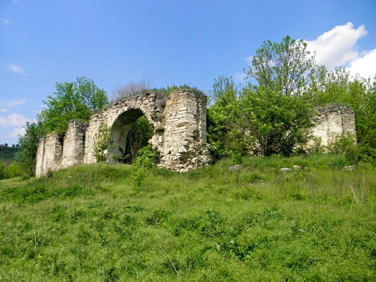
Among the ruins are the remains of the Church of the Nativity of the Virgin (1723), the remains of an ancient cave monastery, a part of the ancient defensive wall of ...
On the site of the ancient Podillya village of Sokilets, there were two ancient Rus fortresses back in the 13th century.
In 1973, the village was included in the list of settlements that were subject to flooding in connection with the commissioning of the Dniester HPP. This is exactly what happened to the villages of Bakota, Kalyus and others. Local residents were urgently relocated to the heights of the Ushytsky Canyon. However, the level of rising water turned out to be significantly lower than the erroneous calculation of engineers. In this way, it was possible to preserve the historical part of the village.
Among the ruins are the remains of the Church of the Nativity of the Virgin (1723), the remains of an ancient cave monastery, a part of the ancient defensive wall of the 18th century, a settlement of the 12th-13th centuries, an old village cemetery, a burial mound of the 12th-13th centuries, and the only active object - the Orthodox Church of the Intercession of the Holy Mother of God (1840).
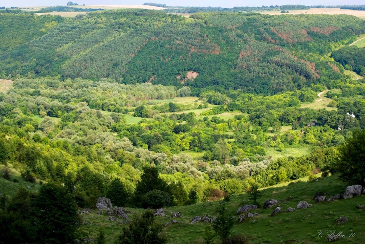
From the territory of modern Sokilets, a wonderful view of the abandoned valley of the village opens.
На місці старовинного подільського села Сокілець ще в XIII сторіччі існували дві давньоруські фортеці.
У 1973 році село потрапило до переліку населених пунктів, які підлягали затопленню у зв'язку із введенням в експлуатацію Дністровської ГЕС. Саме так сталося з селами Бакота, Калюс та іншими. Місцевих мешканців терміново переселили на височину Ушицького каньйону. Однак рівень підйому вод виявився суттєво нижчим від помилкового розрахунку інженерів. У такий спосіб вдалося зберегти історичну частину села.
Серед руїн знаходяться залишки костелу Різдва Богородиці (1723 рік), залишки стародавнього печерного монастиря, частина старовинної оборонної стіни XVIII століття, городище ХІІ-ХІІІ сторічь, старий сільський цвинтар, курганний могильник ХІІ-ХІІІ сторічь та єдиний діючий о ...
На місці старовинного подільського села Сокілець ще в XIII сторіччі існували дві давньоруські фортеці.
У 1973 році село потрапило до переліку населених пунктів, які підлягали затопленню у зв'язку із введенням в експлуатацію Дністровської ГЕС. Саме так сталося з селами Бакота, Калюс та іншими. Місцевих мешканців терміново переселили на височину Ушицького каньйону. Однак рівень підйому вод виявився суттєво нижчим від помилкового розрахунку інженерів. У такий спосіб вдалося зберегти історичну частину села.
Серед руїн знаходяться залишки костелу Різдва Богородиці (1723 рік), залишки стародавнього печерного монастиря, частина старовинної оборонної стіни XVIII століття, городище ХІІ-ХІІІ сторічь, старий сільський цвинтар, курганний могильник ХІІ-ХІІІ сторічь та єдиний діючий об'єкт – православна церква Покрови Пресвятої Богородиці (1840 рік).
З території сучасного Сокільця відкривається чудовий краєвид на покинуту долину села.
Practical information about Abandoned Village (Sokilets)
Last update
7/17/2025
| Categories | Historic area |
|---|---|
| Date of foundation | XIII-XIX centuries |
| Address |
Sokilets |
| Coordinates |
48.749738° N, 27.053157° E
|
| Additional services |
Аccessibility information
Have you visited Abandoned Village in Sokilets?
Add practical or descriptive information, photos, links
Abandoned Village (Sokilets) in photos and videos
What to see, where to go next?


