Functional temporarily unavailable
General information about Myhiia
The ancient Cossack village of Myhiia is located on the banks of the Pivdenniy Buh, on the highway Mykolaiv - Holovanivsk, near Pervomaisk.
At the end of the 18th century, it was the center of the Haydamak movement. According to legend, the legendary Cossack Mamay came from here, whose image with a bandura in his hands, sitting under an oak tree, became a visual symbol of Ukrainian Cossacks.
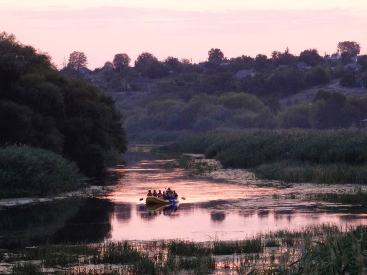
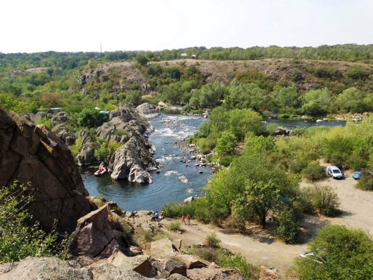
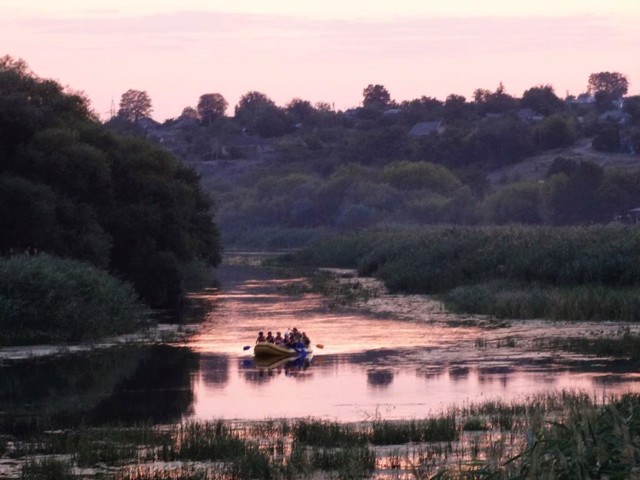
Myhiia is the center of the National Nature Park "Buzky Gard". The picturesque canyon of the Pivdenniy Buh forms 12 rapids in this place (the most famous is Integral, or the Red Gate), which are popular among rafting enthusiasts.
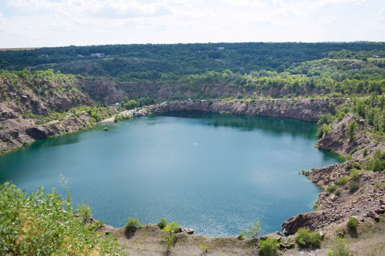
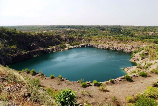
The flooded granite quarry nearby is nicknamed the "Black Sea" because of the characteristic color of the water. The Gard tract, which ...
The ancient Cossack village of Myhiia is located on the banks of the Pivdenniy Buh, on the highway Mykolaiv - Holovanivsk, near Pervomaisk.
At the end of the 18th century, it was the center of the Haydamak movement. According to legend, the legendary Cossack Mamay came from here, whose image with a bandura in his hands, sitting under an oak tree, became a visual symbol of Ukrainian Cossacks.
Myhiia is the center of the National Nature Park "Buzky Gard". The picturesque canyon of the Pivdenniy Buh forms 12 rapids in this place (the most famous is Integral, or the Red Gate), which are popular among rafting enthusiasts.
The flooded granite quarry nearby is nicknamed the "Black Sea" because of the characteristic color of the water. The Gard tract, which gave the name to the national park, is located downstream of the Buh, on the outskirts of Pivdennoukrainsk.
Старовинне козацьке село Мигія розташоване на березі Південного Бугу, на трасі Миколаїв - Голованівськ, біля Первомайська.
В кінці ХVІІІ століття було центром руху гайдамаків. За переказами, звідси родом легендарний козак Мамай, зображення якого з бандурою в руках, що сидить під дубом, стало візуальним символом українського козацтва.
Мигія є центром Національного природного парку "Бузький Гард". Мальовничий каньйон Південного Бугу утворює в цьому місці 12 порогів (найвідоміший - Інтеграл, або Червоні ворота), які популярні серед любителів рафтингу.
Затоплений гранітний кар'єр поруч прозваний "Чорним морем" за характерний колір води. Урочище Гард, що дало назву національному парку, знаходиться нижче за течією Бугу, на околиці ...
Старовинне козацьке село Мигія розташоване на березі Південного Бугу, на трасі Миколаїв - Голованівськ, біля Первомайська.
В кінці ХVІІІ століття було центром руху гайдамаків. За переказами, звідси родом легендарний козак Мамай, зображення якого з бандурою в руках, що сидить під дубом, стало візуальним символом українського козацтва.
Мигія є центром Національного природного парку "Бузький Гард". Мальовничий каньйон Південного Бугу утворює в цьому місці 12 порогів (найвідоміший - Інтеграл, або Червоні ворота), які популярні серед любителів рафтингу.
Затоплений гранітний кар'єр поруч прозваний "Чорним морем" за характерний колір води. Урочище Гард, що дало назву національному парку, знаходиться нижче за течією Бугу, на околиці Південноукраїнська.
Сплануй своє перебування у Myhiia
What to see and where to go in Myhiia
Tourist attractions and museums of Myhiia
Myhiia Rapids
Natural object
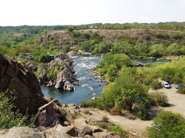
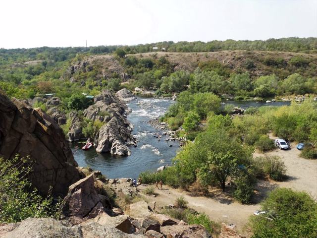
Myhiia Rapids on Pivdenniy Buh are the most famous part of the National Nature Park "Buzhkiy Gard" and the Regional Landscape Park "Granite-Steppe Pobuzhzhia".
The Pivdenniy Buh and its tributaries flow here through a narrow canyon-like valley with majestic granite rocks, a hollow channel, islands and eddies.
Myhiia rapids on Pivdenniy Buh, especially the "Integral" rapid, are popular among water tourists and athletes - this is one of the best water slalom tracks in Ukraine.
A beautiful view of them opens from Mount Vysoka, which is next to the highway at the exit from Myhiia in the direction of Mykolaiv.
The administration of the national park is also located in Myhiia.
National Nature Park "Buzkyi Gard"
Natural object , Reserve
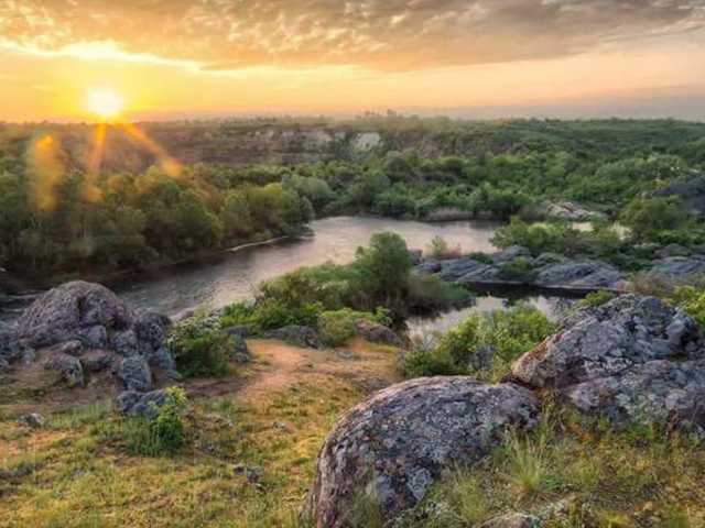
The national nature park "Buzkyi Gard" stretches from the outskirts of the village of Myhiia for 40 kilometers along the Pivdenniy Buh to the village of Oleksandrivka. Its area is 6,138 hectares within Voznesensk and Pervomaysk districts of Mykolaiv region.
The creation of a national nature park on the basis of the regional landscape park "Granite-Steppe Pobuzhzhya" began in 2004 as part of the implementation of the World Environmental Fund - International Bank for Reconstruction and Development project "Biodiversity Conservation in the Azov-Black Sea Corridor".
The local flora includes 900 plant species, 26 of which are included in the Red Book of Ukraine, 4 - in the European Red List.
The territory of the national nature park "Buzkyi Gard" coincides with the border of 1658 between the Ottoman Porte (Turkey) and the liberties of the Zaporizhzhia Nizove Army. In fact, the left bank of the Granitno-steppe Pobuzhzhya coincides with the boundary of the Buho-Hardova palanka of the Zaporizhzhia Army as of 1734. For more than three hundred years, the territory where the National Nature Park "Buzkyi Gard" was created was controlled by the Zaporozhzhians. Their administrative and economic center was located near the confluence of the Tashlyk River with the Pivdenniy Buh, on Gard Island, where a military camp with Cossack huts of up to 500 people was located. The facilities for catching fish were called gardas on Pivdenniy Buh. Such guards existed both in the Guard tract itself and in other areas on the Buh, where Zaporozhzhian winterers were located. Gards, as a method of fishing, existed in this area until 1945. Accordingly, this name first spread to the surrounding areas: Gardovy Island, Gardova Balka, the village of Gardove (now the village of Bohdanivka), Stariy Gard, Gardovy Shlyach.
Aktove Canyon on the Mertvovod River and the adjacent Arbuzynsky (Maly Aktove) canyon on the Arbuzinka River are a separate part of the "Buzkiy Gard" National Nature Park.
Radon Lake
Natural object , Active rest , Rest on the water
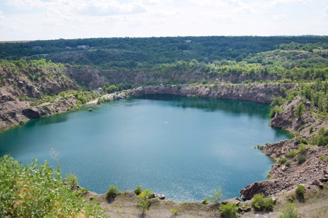
The radon lake near the village of Myhiia, also known as the "Black Sea", arose on the site of an old granite quarry in the territory of the regional landscape park "Granite-Steppe Pobuzhzhya" near the rapids of the Pivdenniy Buh.
The lake, more than 40 meters deep with steep banks, is fed by underground radon sources. The water in it is very clean, has an extremely bright blue color. According to legend, you can see a submerged excavator at the bottom.
There is a convenient viewing platform above the lake.
Skarzhynsky's Mill
Architecture
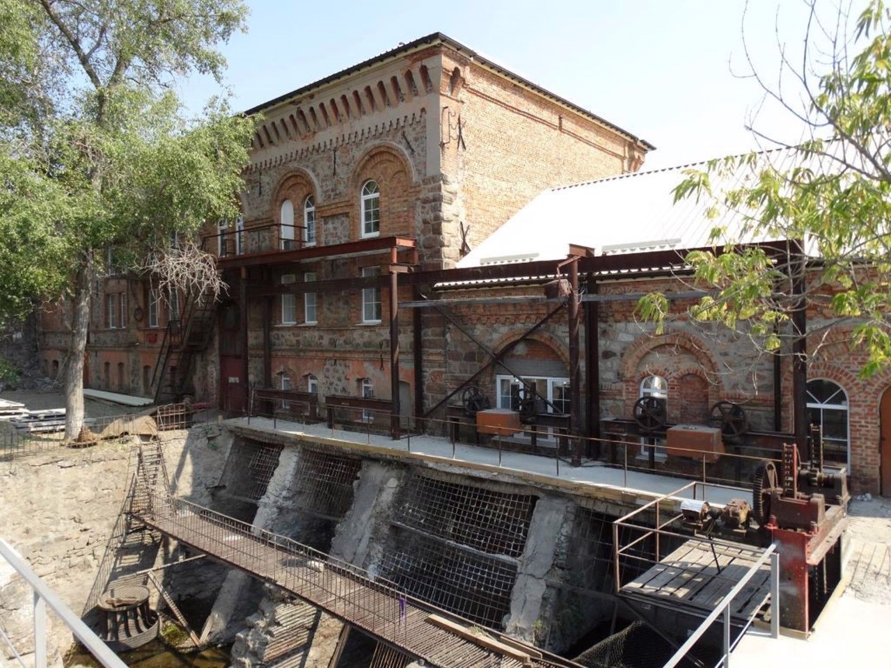
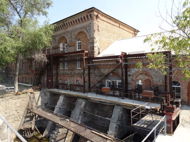
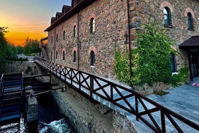
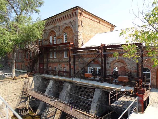
The water mill on the Pivdennyi BuhRiver in Myhiia was built in 1888 by the local landowner Yosyp Skarzhynskyi according to the project of the engineer Vladyslav Yaskulskyi.
The five-story building resembles a medieval castle. Previously, up to 3,000 poods of flour per day were milled here, and in Soviet times the mill was converted into a hydroelectric power station.
Nearby you can see Buh rapids.
Reviews Myhiia
Geographical information about Myhiia
| {{itemKey}} | {{itemValue}} |
|---|---|
| Region |
Mykolaiv |
