Functional temporarily unavailable
General information about Myropillia
The village of Myropillia on the Psel River is located 40 kilometers northeast of Sumy, near the Russian border.
Founded in the middle of the 17th century by emigrants from the Volyn village of Myropillia, it was the hundredth town of the Sumy regiment. Since 1670, Myropillia had the status of a city, later it received its coat of arms.
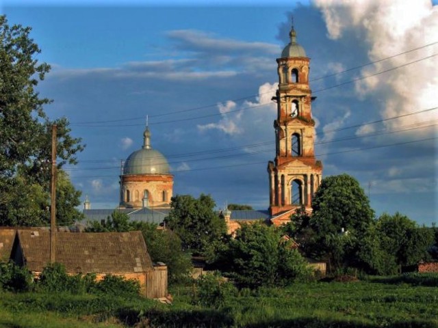
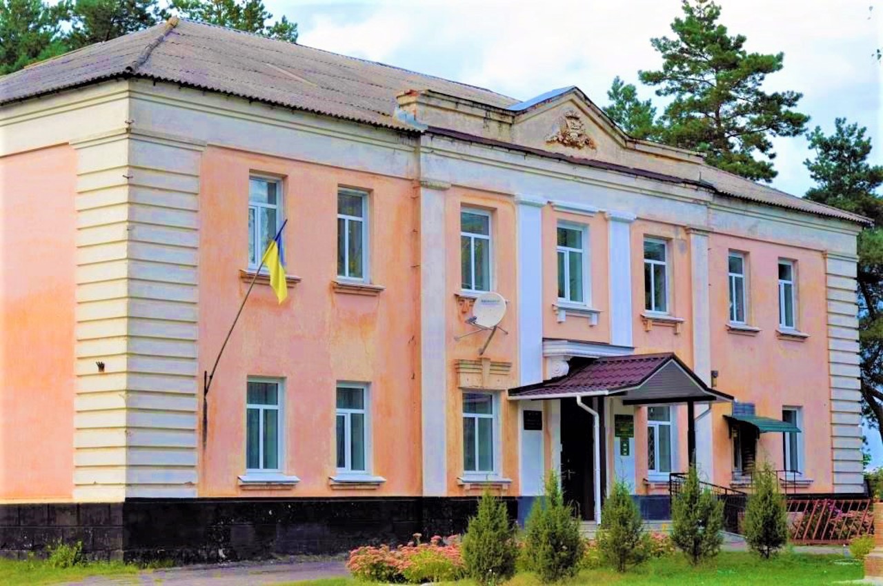
The main attraction of the village is the five-story, 56-meter bell tower of the Saint Nicholas Monastery (1885) - the highest bell tower in Sumy Region. Many other examples of provincial architecture of the late 19th and early 20th centuries have been preserved in the village: the house of the merchant Slitin (1905), the Hlukhovtsev estate (19th century), the Zemstvo sch ...
The village of Myropillia on the Psel River is located 40 kilometers northeast of Sumy, near the Russian border.
Founded in the middle of the 17th century by emigrants from the Volyn village of Myropillia, it was the hundredth town of the Sumy regiment. Since 1670, Myropillia had the status of a city, later it received its coat of arms.
The main attraction of the village is the five-story, 56-meter bell tower of the Saint Nicholas Monastery (1885) - the highest bell tower in Sumy Region. Many other examples of provincial architecture of the late 19th and early 20th centuries have been preserved in the village: the house of the merchant Slitin (1905), the Hlukhovtsev estate (19th century), the Zemstvo school, the Zemstvo hospital, the bell tower of the Transfiguration Church, and others. It is planned to create a historical and cultural complex.
Село Миропілля на річці Псел розташоване в 40 кілометрах на північний схід від Сум, поряд з російським кордоном.
Засноване в середині XVII сторіччя переселенцями з волинського села Миропілля, було сотенним містечком Сумського полку. З 1670 року Миропілля мало статус міста, пізніше отримало свій герб.
Головною визначною пам'яткою села є п'ятиярусна 56-метрова дзвінниця Свято-Миколаївського монастиря (1885 рік) - найвища дзвіниця на Сумщині. В селі збереглося і багато інших зразків провінційної архітектури кінця XIX - початку XX століття: будинок купця Слітіна (1905 рік), садиба Глуховцева (XIX століття), земська школа, земська лікарня, дзвіниця Преображенської церкви та інші. Планується створення ...
Село Миропілля на річці Псел розташоване в 40 кілометрах на північний схід від Сум, поряд з російським кордоном.
Засноване в середині XVII сторіччя переселенцями з волинського села Миропілля, було сотенним містечком Сумського полку. З 1670 року Миропілля мало статус міста, пізніше отримало свій герб.
Головною визначною пам'яткою села є п'ятиярусна 56-метрова дзвінниця Свято-Миколаївського монастиря (1885 рік) - найвища дзвіниця на Сумщині. В селі збереглося і багато інших зразків провінційної архітектури кінця XIX - початку XX століття: будинок купця Слітіна (1905 рік), садиба Глуховцева (XIX століття), земська школа, земська лікарня, дзвіниця Преображенської церкви та інші. Планується створення історико-культурного комплексу.
Сплануй своє перебування у Myropillia
What to see and where to go in Myropillia
Tourist attractions and museums of Myropillia

Saint Nicholas Monastery
Temple , Architecture
Saint Nicholas Monastery in Myropillia is one of the most striking architectural monuments of Sumy Region of the 19th century.
The five-tiered, 56-meter bell tower of the Saint Nicholas Church, which is the tallest in the region, attracts attention. The five-apsed brick temple in the style of classicism has a complex structure and an unusual shape.
Currently, the Saint Nicholas Monastery is active, restoration is in progress.
Reviews Myropillia
Geographical information about Myropillia
| {{itemKey}} | {{itemValue}} |
|---|---|
| Region |
Sumy |


