Functional temporarily unavailable
Hard Tract, Pivdennoukrainsk
Historic area
Natural object
General information about Hard Tract (Pivdennoukrainsk)
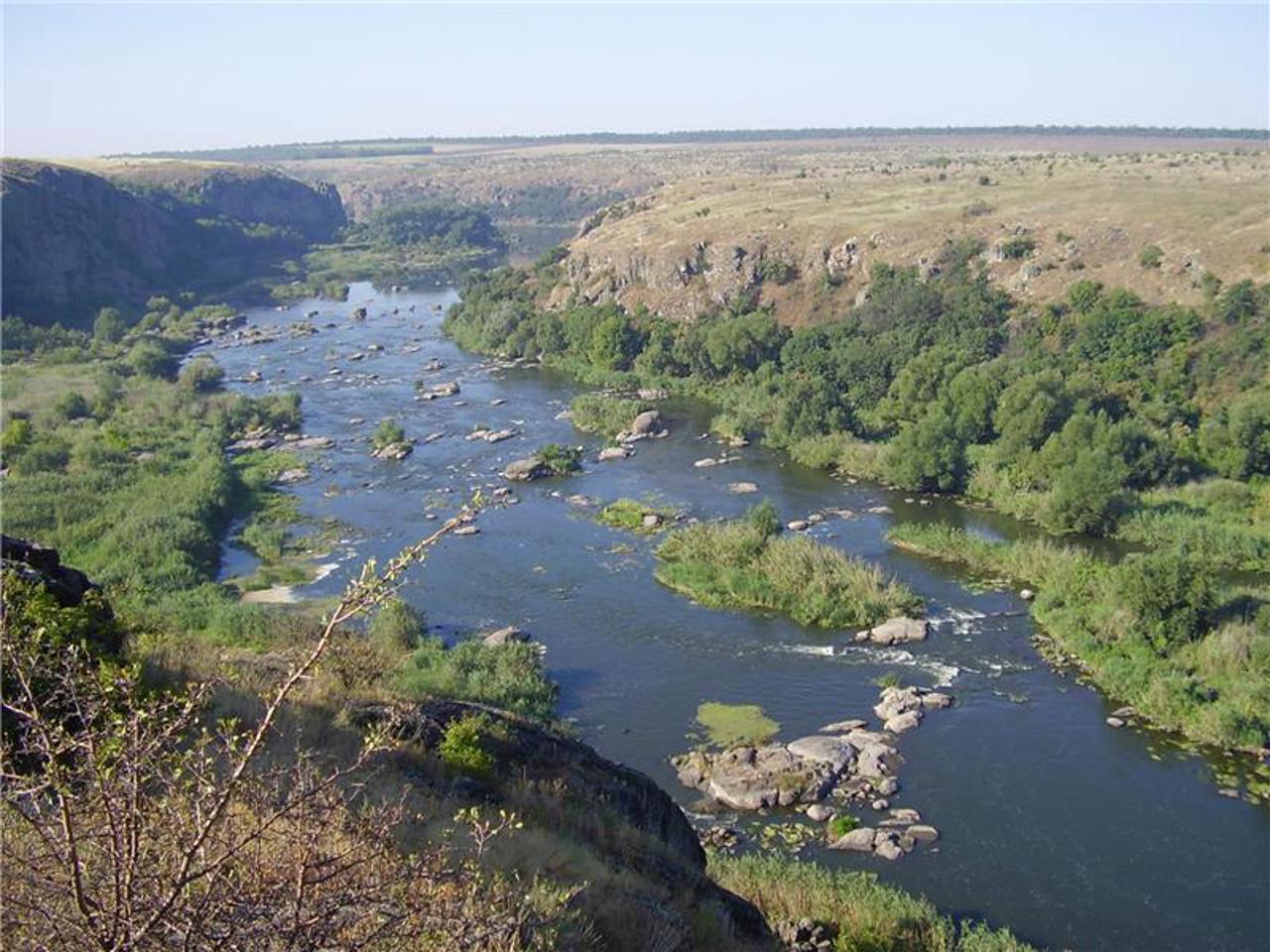
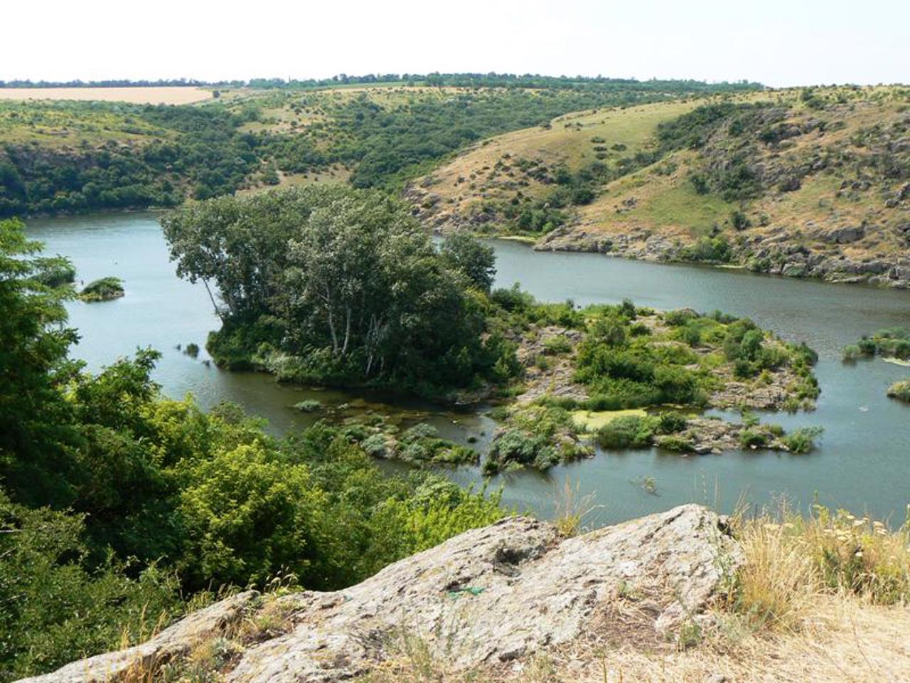
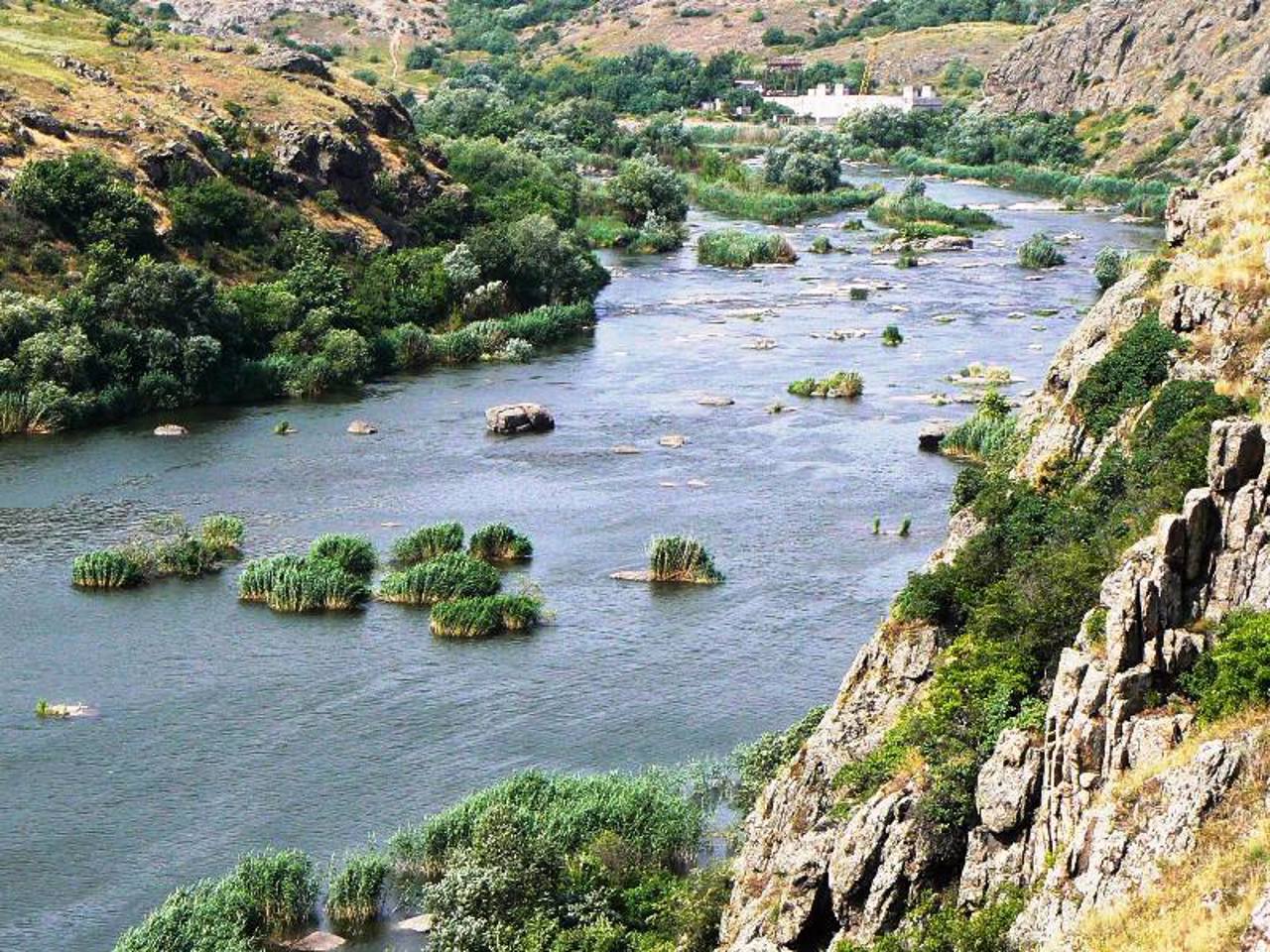
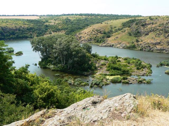
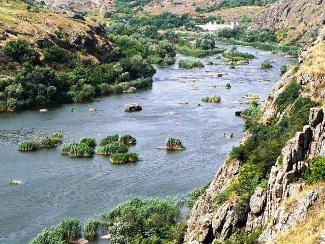
The Hard tract in the granite canyon of the Pivdennyi Buh River is one of the most picturesque places of the Buzkyi Hard National Nature Park (formerly the Regional Landscape Park "Granite-Steppe Pobuzhzhya").
"Hard" was the name of a special structure for catching fish, built by Zaporizhzhia Cossacks back in the 16th century. After the creation of Nova Sich in 1740, the Buho-Hard palanque of the Zaporizhzhia Nizove Army was formed on these lands, the military-administrative center of which was the settlement of Hard (present-day Bohdanivka opposite Pivdennoukrainsk). There was a ferry crossing across the Pivdennyi Buh on Hard Island, for the protection of which the Buho-Hard armed border pos ...
The Hard tract in the granite canyon of the Pivdennyi Buh River is one of the most picturesque places of the Buzkyi Hard National Nature Park (formerly the Regional Landscape Park "Granite-Steppe Pobuzhzhya").
"Hard" was the name of a special structure for catching fish, built by Zaporizhzhia Cossacks back in the 16th century. After the creation of Nova Sich in 1740, the Buho-Hard palanque of the Zaporizhzhia Nizove Army was formed on these lands, the military-administrative center of which was the settlement of Hard (present-day Bohdanivka opposite Pivdennoukrainsk). There was a ferry crossing across the Pivdennyi Buh on Hard Island, for the protection of which the Buho-Hard armed border post was built.
The remains of the Cossack fortress and the wooden church on Hard Island were preserved until the middle of the 20th century. In the 1970s, the Yuzhnoukrainsk NPP was built at the confluence of the Pivdennyi Buh and its left tributary Velikiy Tashlyk, a Cossack church was destroyed on Hard Island, and granite rocks were blown up. In 2006, during the construction of the Tashlytska HPP, the Hard threshold was flooded.
The remains of the island itself still exist, but are divided into two parts. The hanging rocks of the canyon are a favorite place for climbing competitions. Porig Hard is one of the most difficult sections of rafting on the Pivdennyi Buh.
Урочище Гард у гранітному каньйоні річки Південний Буг - одне з наймальовничіших місць Національного природного парку "Бузький Гард" (колишній Регіональний ланшафтний парк "Гранітно-степове Побужжя").
"Гардом" називалася спеціальна споруда для лову риби, збудована запорозькими козаками ще у XVI сторіччі. Після створення у 1740 році Нової Січі ці на цих землях було утворено Буго-Гардівську паланку Війська Запорозького Низового, військово-адміністративним центром якої було поселення Гард (нинішня Богданівка навпроти Південноукраїнська). По острову Гард проходила поромна переправа через Південний Буг, для охорони якої було збудовано прикордонний озброєний Буго-Гардський пост.
Зал ...
Урочище Гард у гранітному каньйоні річки Південний Буг - одне з наймальовничіших місць Національного природного парку "Бузький Гард" (колишній Регіональний ланшафтний парк "Гранітно-степове Побужжя").
"Гардом" називалася спеціальна споруда для лову риби, збудована запорозькими козаками ще у XVI сторіччі. Після створення у 1740 році Нової Січі ці на цих землях було утворено Буго-Гардівську паланку Війська Запорозького Низового, військово-адміністративним центром якої було поселення Гард (нинішня Богданівка навпроти Південноукраїнська). По острову Гард проходила поромна переправа через Південний Буг, для охорони якої було збудовано прикордонний озброєний Буго-Гардський пост.
Залишки козацької фортеці та дерев'яна церква на острові Гард зберігалися до середини XX століття. У 1970-і роки в місці злиття Південного Бугу та його лівого притоку Великий Ташлик було збудовано Південноукраїнську АЕС, на острові Гард було знищено козацьку церкву, підірвано гранітні скелі. У 2006 році під час спорудження Ташлицької ГАЕС було затоплено поріг Гард.
Залишки самого острова ще існують, але поділені на дві частини. Висячі скелі каньйону - улюблене місце змагань скелелазів. Поріг Гард - одна з найскладніших ділянок сплаву Південним Бугом.
Practical information about Hard Tract (Pivdennoukrainsk)
Last update
5/22/2025
| Categories | Historic area, Natural object |
|---|---|
| Address |
Hard tract
Pivdennoukrainsk |
| Coordinates |
47.80305556° N, 31.17777778° E
|
| Additional services |
Аccessibility information
Have you visited Hard Tract in Pivdennoukrainsk?
Add practical or descriptive information, photos, links
What to see, where to go next?

