Functional temporarily unavailable
Cities and villages of Samar district
Online travel guide to the settlements of Samar district
General information about Samar district
Samar district (Samarivskyi) is located in the northern part of Dnipropetrovsk region, in the historical and ethnographic territory of the Middle Dnipro. The Samara River flows within the district.
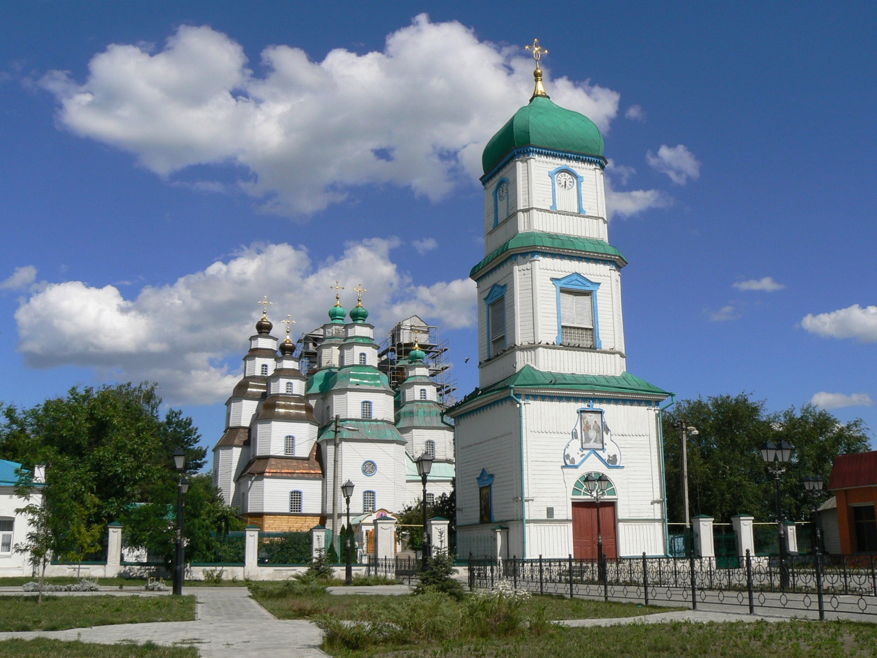
In Cossack times, the Samarska palanquin of the Zaporizhzhia Army was located here. Historical and cultural monuments such as the wooden Holy Trinity Cathedral in Samar and the Samara Desert-Nicolas Monastery have been preserved.
The administrative center of the Samar district is the city of Samar. The area of the district is 3483 square kilometers. The population of the district reaches 262 thousand people.
The Samar district consists of 130 settlements, which are united into 8 territorial hromadas: Samar and Pereshchepynska city hromadas, Lychkivska, Pishchanska, Chernechc ...
Samar district (Samarivskyi) is located in the northern part of Dnipropetrovsk region, in the historical and ethnographic territory of the Middle Dnipro. The Samara River flows within the district.
In Cossack times, the Samarska palanquin of the Zaporizhzhia Army was located here. Historical and cultural monuments such as the wooden Holy Trinity Cathedral in Samar and the Samara Desert-Nicolas Monastery have been preserved.
The administrative center of the Samar district is the city of Samar. The area of the district is 3483 square kilometers. The population of the district reaches 262 thousand people.
The Samar district consists of 130 settlements, which are united into 8 territorial hromadas: Samar and Pereshchepynska city hromadas, Lychkivska, Pishchanska, Chernechchynska village hromadas, Cherkaska, Hubynyska, Mahdalynivska settlement territorial hromadas.
Самарівський район розташований у північній частині Дніпропетровської області, на історико-етнографічній території Середнього Подніпров'я. У межах району протікає річка Самара.
За козацьких часів тут розташовувалася Самарська паланка Війська Запорозького. Збереглися такі історико-культурні пам'ятки, як дерев'яний Свято-Троїцький собор у Самару та Самарський Пустинно-Миколаївський монастир.
Адміністративним центром Самарівського району є місто Самар. Площа території району становить 3483 квадратних кілометри. Чисельність населення району сягає 262 тисяч осіб.
До складу Самарівського району входять 130 населених пунктів, які об'єднані у 8 територіальних громад: Самарівська та Перещепинська міські, Личківська, Піщанська, Чернеччинська сільські, Черкаська, ...
Самарівський район розташований у північній частині Дніпропетровської області, на історико-етнографічній території Середнього Подніпров'я. У межах району протікає річка Самара.
За козацьких часів тут розташовувалася Самарська паланка Війська Запорозького. Збереглися такі історико-культурні пам'ятки, як дерев'яний Свято-Троїцький собор у Самару та Самарський Пустинно-Миколаївський монастир.
Адміністративним центром Самарівського району є місто Самар. Площа території району становить 3483 квадратних кілометри. Чисельність населення району сягає 262 тисяч осіб.
До складу Самарівського району входять 130 населених пунктів, які об'єднані у 8 територіальних громад: Самарівська та Перещепинська міські, Личківська, Піщанська, Чернеччинська сільські, Черкаська, Губиниська, Магдалинівська селищні територіальні громади.


